
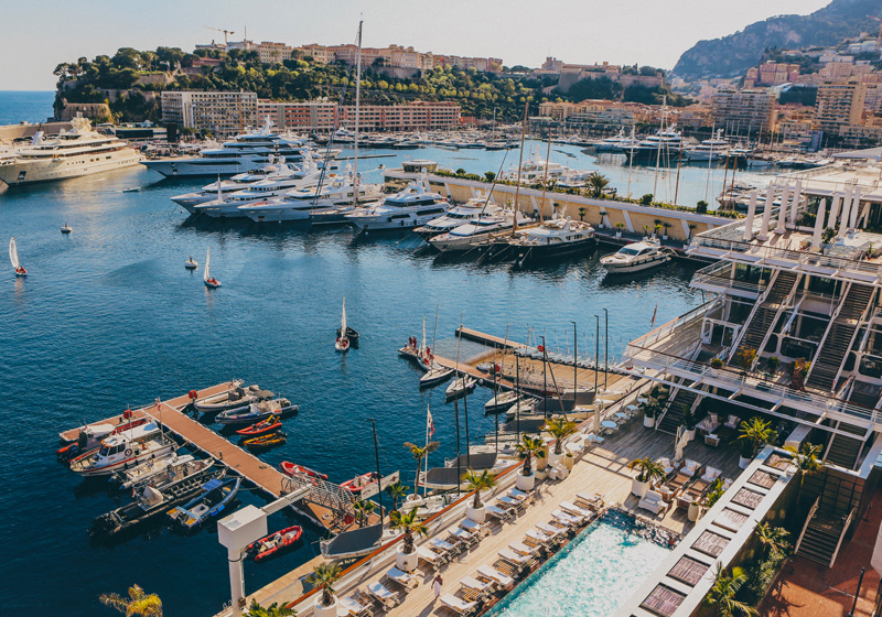
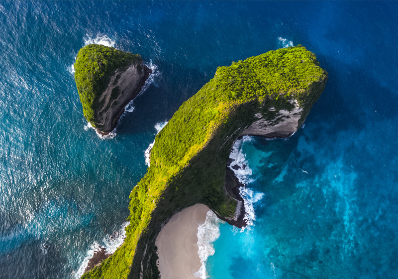
Aerial Photography
Aerial Photography
Find the perfect port!
Aerial Photography give a better sense of the surroundings so you can evaluate your options.
What you can do
Marinas
Heading into a new marina can be less stressful when you have an understanding of the layout that only a picture can provide.
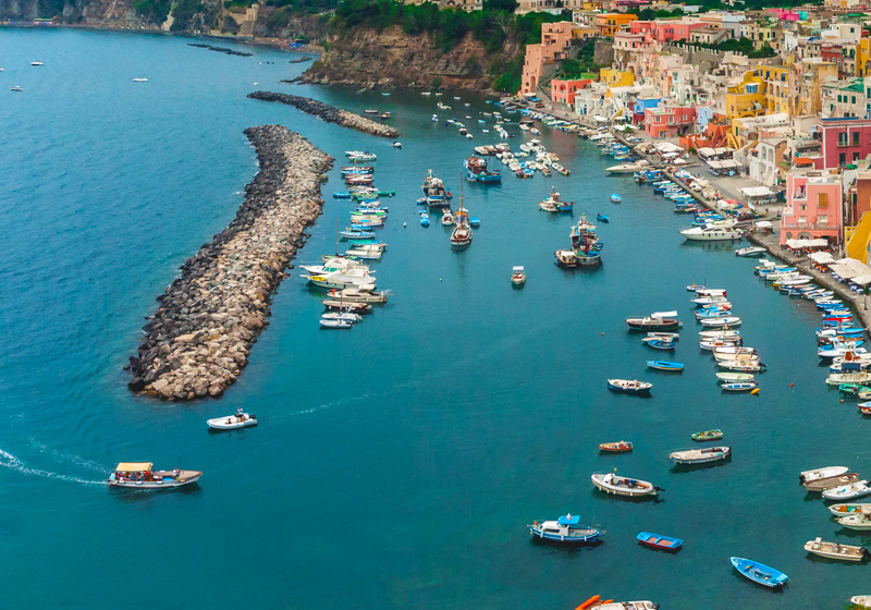
Dock layouts and boat ramps
Whether large or small, don't just find your destination, recognize it!
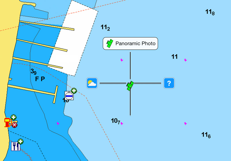
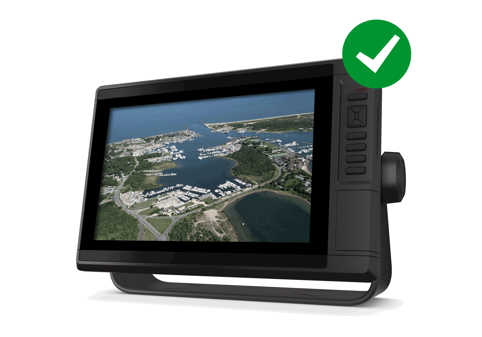
View on your device
Plotter
Select the camera icon with your cursor to display the photo on your GPS plotter screen.
Mobile
Target the green camera icon using the cross-hair then tap to view the photo.
Discover Our Other Additional Viewing Options
3D
View
Customize your chart to highlight key features for a better awareness of your surroundings.
Satellite Overlay with SonarChart™ Shading
A combined overlay unveiling hidden features that might hold fish.

Get Aerial Photography
Aerial photography are available with Platinum cards when used with compatible models from many brands. Check our Compatibility Guide.
The Navionics Subscription
When you purchase any new product, a one year subscription to daily updates and many advanced features is included. The subscription needs to be activated.
GPS Plotter Cards
What you get:
- Download of chart layers
- Daily Updates
- Dock-to-dock Route Guidance1
- Advanced Map Options
- Plotter Sync
- Satellite Overlay with SonarChart Shading
- Relief Shading
Check if your GPS plotter model is compatible with advanced features and make sure it is running the latest software.
Like our features?
Create an account to receive news, tips and promotions.
Your overall experience with Navionics will greatly improve.
Create account¹ Dock-to-dock Route Guidance is for planning purposes only and does not replace safe navigation operations.