
At Navionics, we continuously enhance our products and technology with the most complete details and relevant content available to provide our customers with the best possible experience. As part of these ongoing efforts, we recently updated our charts of Sweden.
Every year, Hydrographica, a private company produces large-scale special charts of parts of the Swedish archipelago, releases new charts with important updates for waters that can be highly challenging, such as they are in Scandinavia. Our proprietary software and unique chart editing processes, enable us to quickly integrate these updates into our product.
This year, we acquired 150 updated charts, mostly covering the Stockholm and Gothenburg areas, plus Vänern, and the waters of the Mellan Asken archipelago--a newly mapped area located north of Stockholm.
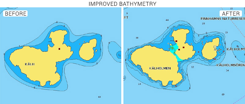
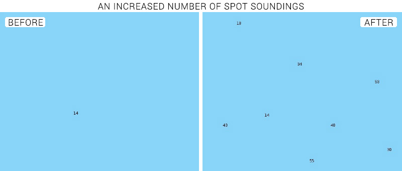
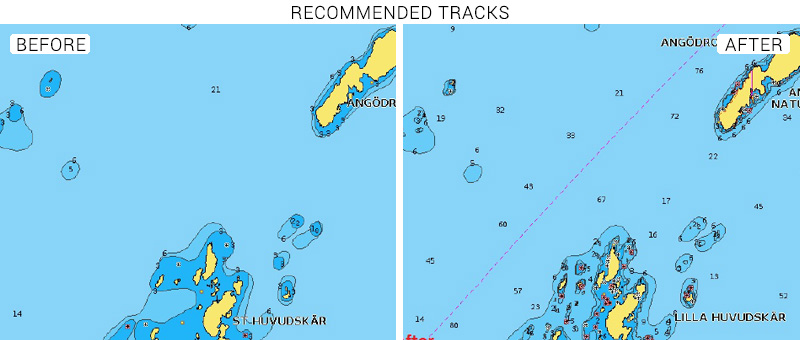
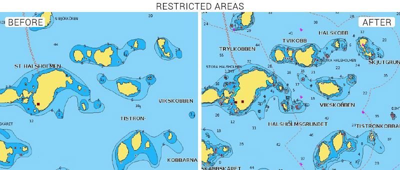
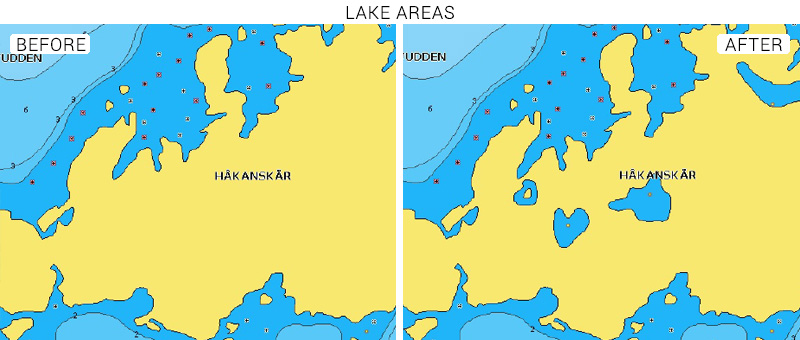
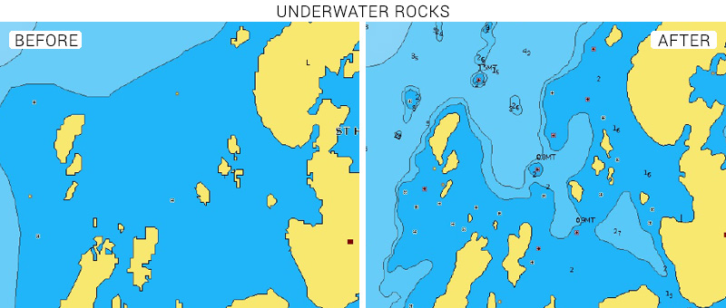
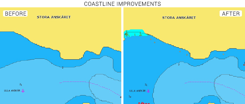
The updates include bathymetry improvements, lake areas, an increased number of spot soundings, new recommended tracks and restricted areas marked on the map, underwater rocks, coastlines improvements, and more.
Browse your areas of interest on our Chart Viewer, check out some examples below:
Learn more about chart updates and discover our latest changes!
GET UPDATED CHARTS!
With an active subscription
- Have a plotter card? Plug your card into a PC and download. Or, if you also have our Boating app, do it wirelessly with Plotter Sync. Download
- Have the Boating app? Open the app and tap Menu > Update All.
With an expired subscription
- Have a plotter card? Choose one of the available options to easily renew. Renew
- Have the Boating app? Open the app, tap Menu > Charts & Upgrades.
IF YOU DON’T HAVE NAVIONICS YET
- Have a plotter? choose Navionics+ 45XG, or Platinum+ 17P. Shop Now
- Have a mobile? Download the free Boating Marine & Lakes app that provides a 2-week free trial or the paid apps for US & Canada or Caribbean & South America! DIscover


