
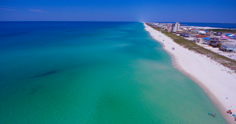
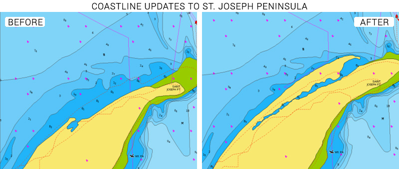
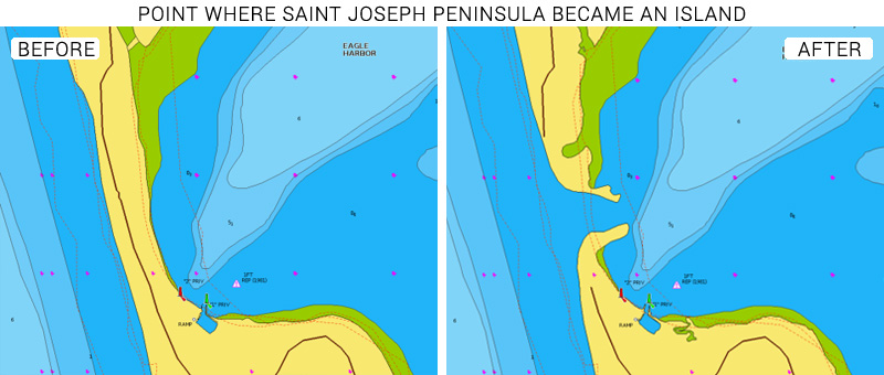
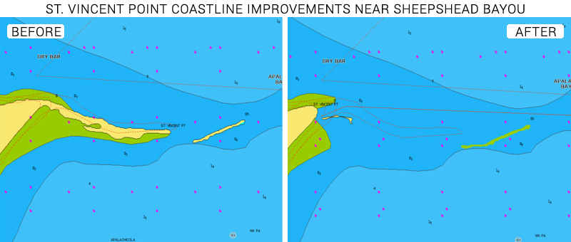
Hurricanes change coastal and marine landscapes significantly, impacting the chart accuracy of shorelines and bottom contours. Our cartography team has prioritized and completed coastline improvements to the area surrounding Port St. Joe following the category 5 hurricane, Michael, which made landfall on the Florida panhandle on October 10, 2018.
Updates were made on the coastline from Laguna Beach near Panama City on the westernmost coast of Bay County to the west coast of St. Teresa near the Florida State University Coastal and Marine Laboratory.
Boaters affected by hurricane Michael can now benefit from updated coastline data that better reflects the devastating changes made to much of the coastline of and near Port St. Joe.
See the improvements now
Browse your areas of interest on our Chart Viewer, check out some examples here below and judge for yourself:
Learn more about chart updates and discover our latest changes
GET UPDATED CHARTS!
With an active subscription
- Have a plotter card? Plug your card into a PC and download. Or, if you also have our Boating app, do it wirelessly with Plotter Sync. Download
- Have the Boating app? Open the app and tap Menu > Update All.
With an expired subscription
- Have a plotter card? Choose one of the available options to easily renew. Renew
- Have the Boating app? Open the app, tap Menu > Charts & Upgrades.
IF YOU DON’T HAVE NAVIONICS YET
- Have a plotter? choose Navionics+ South or US & Canada or Platinum+ East Gulf of Mexico or Gulf of Mexico. Shop Now
- Have a mobile? Download the free Boating Marine & Lakes app that provides a trial! Discover


