
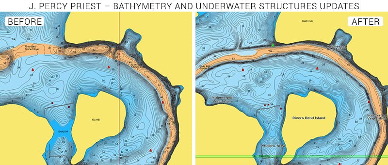
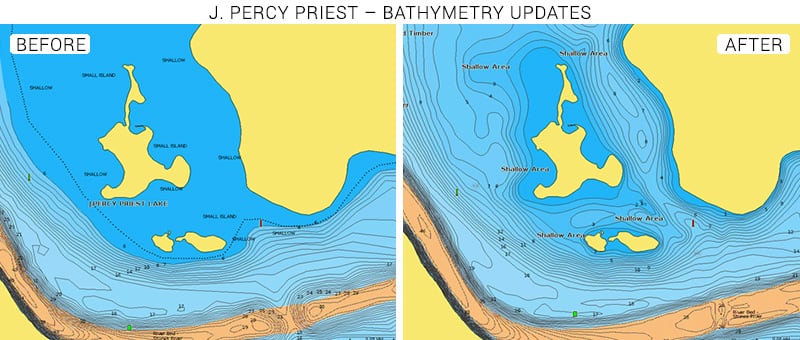
Driven by a passionate commitment to support our customers’ enjoyment on the water, Navionics continues enriching its chart coverage to include popular boating and fishing areas around the world. Our cartography team has updated Lake J. Percy Priest, located a few miles east of Nashville, TN, with brand-new high definition data.
The lake was created by the impoundment of the Stones River in 1968 and is named after Tennessee Congressman J. Percy Priest. The reservoir stretches for 42 miles and its shores have ramps, marinas, rowing clubs and a sailing club. Many services are available like fuel docks, fishing shops, boat or kayak rentals and restaurants.
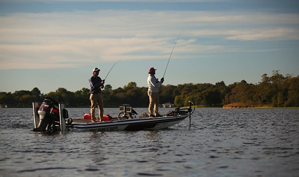
J. Percy Priest lake is the perfect place for anyone who loves the outdoors and all the water activities like sailing, kayaking, fishing and swimming.
Our latest updates have improved the data available for this fantastic area. This new information allowed us to refine our current charts by creating contours in previously unmapped areas, better define the edges of underwater rivers and add structures.
If you are an angler, you already know how important it is to know your contours to easily spot bars, humps and breaks on the map. By locating these structures quickly, you can spend time casting more and, above all, catching more. Oh, and remember that in our Boating app, with the Fishing Ranges feature you can also highlight up to 5 depth ranges with different colors to find your fishing spot even faster. Largemouth bass, striped bass, white bass, small mouth bass, sunfish, catfish crappie and bluegill that populate J. Percy Priest waters won’t stand a chance against your fishing skill powered by Navionics charts and features.
See the improvements now
Browse your areas of interest on our Chart Viewer, check out some examples below:

Learn more about chart updates and discover our latest changes!
GET UPDATED CHARTS!
With an active subscription
- Have a plotter card? Plug your card into a PC and download. Or, if you also have our Boating app, do it wirelessly with Plotter Sync. Download
- Have the Boating app? Open the app and tap Menu > Update All.
With an expired subscription
- Have a plotter card? Choose one of the available options to easily renew. Renew
- Have the Boating app? Log in on the website with the same account you use in the app. In the menu select Subscriptions and renew.
IF YOU DON’T HAVE NAVIONICS YET
- Have a plotter? Choose Navionics+ East or South or HotMaps Platinum East or South Shop Now
- Have a mobile? Download the free Boating Marine & Lakes app that provides a trial period. Discover


