
As part of our ongoing product enhancement, we recently added completely new cartography in Brasil for Lake Paranoá and Rio Tietê.
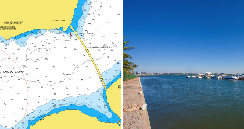
Located in Brasil’s capital, Brasilia, Lago Paranoá is an artificial lake created while building the city, by damming up the Paranoá River. It offers a wide variety of opportunities for recreation on the water, such as fishing and sailing, to the many residents and visitors of Brasilia.
Rio Tietê, is located in the southwestern part of the country, in the state of São Paulo. It flows in a northwesterly direction away from its source, Salesópolis in the Serra do Mar, for about 700 miles to the Paraná River. Although fairly narrow in many areas, the river widens at several places where damns have been constructed to allow navigation.
See the improvements now
Compare your current charts on our Chart Viewer! Boat Safer with the most detailed charts and always have up-to-date information with daily chart updates! If you are an angler, study detailed contours with SonarChart™, SonarChart™ Live and Advanced Map Options, then find your ideal fishing spots and, finally, Fish Smarter!
How to get these updates and enjoy Navionics advanced features
On plotter: choose Navionics+ or Platinum+. If you already have an active subscription, plug your card it into a PC to update your charts (learn more). If you have our Boating app, you can update your plotter card wirelessly with Plotter Sync.
On mobile: download any of the paid apps or the free version that provides a 2-week free trial! If you already have an active subscription, open the app and tap Menu > Update All.
Renew your subscription
On plotter: choose one of the available options to easily renew, by simply clicking here.
On mobile: open the app, tap Menu > Charts & Upgrades.


