
Driven by a passionate commitment to support our customers’ enjoyment on the water, Navionics continues enriching its chart coverage to include popular boating and fishing areas around the world.
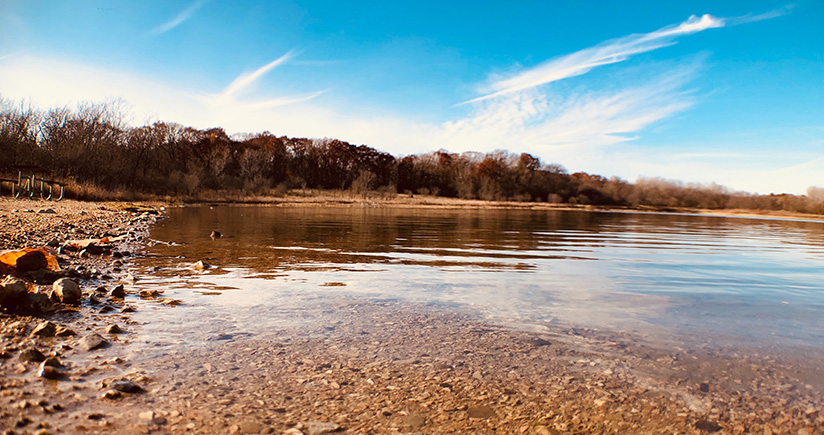
Hubbard Creek Reservoir, owned by the West Central Texas Municipal Water District for municipal, industrial and mining supplies is located about six miles northwest of Breckenridge in Stephens County, on Hubbard Creek. Recently, the mapping of the lake has been greatly improved.
The lake's surface area, about 15,000 acres, has been surveyed with high-resolution multi-beam technology. Survey results provided new and enhanced chart data that has been used to update our Nautical Chart and SonarChart™ layers.
A better understanding of the lake bottom is now available, thanks to the additional seabed information (underwater river beds and submerged culverts). HD contour details have more accuracy and density, especially near shorelines where shallow areas are. Navigational aids and points of interests, such as marina information, boat ramps and many others, are also included in the update.
For a closer look to the Hubbard Creek Reservoir updated chart details, use our free online Chart Viewer. Bathymetric information is available only at low levels of zoom and by selecting the SonarChart layer.
Have a look at the before and after pictures to get a better idea of the applied change:
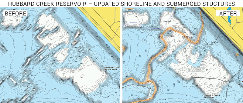
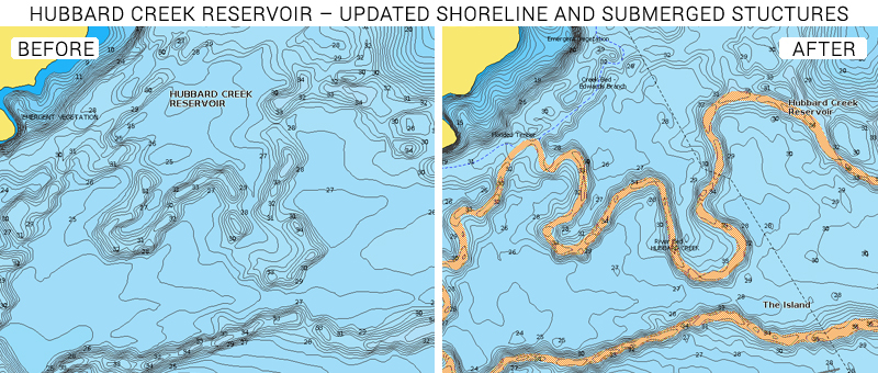
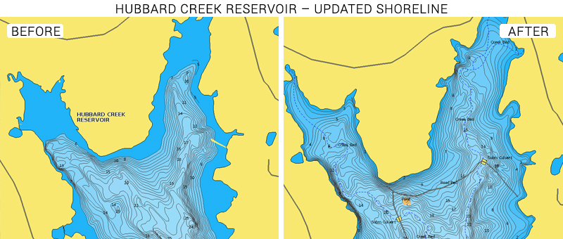
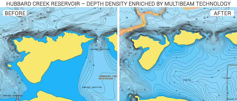
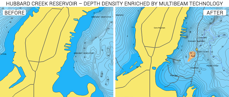
Bathymetric chart information is highly appreciated by all boaters, but especially by anglers, and it helps them identify perfect fishing spots where fish commonly feed or hide.
Hubbard Creek Reservoir is popular for many fishing activities. In late fall and winter, when the lake is full, excellent white crappie and white bass fishing is offered. During late summer and early fall, schools of largemouth and white bass will often feed on the surface around the Tanglewood Island area. Largemouth bass anglers frequently fish on the lake, especially during tournaments.
The lake’s surrounding park provides facilities for picnicking, swimming and rustic camping. There are several marinas and fishing piers and boat access is available from the four public boat ramps that can be found along the shoreline. Remember to clean your boat if you frequently change bodies of water to help prevent the spread of invasive plant and animal species.
GET UPDATED CHARTS!
With an active subscription
- Have a plotter card? Plug your card into a PC and download. Or, if you also have our Boating app, do it wirelessly with Plotter Sync. Download
- Have the Boating app? Open the app and tap Menu > Update All.
With an expired subscription
- Have a plotter card? Choose one of the available options to easily renew. Renew
- Have the Boating app? Open the app, tap Menu > Charts & Upgrades.
IF YOU DON’T HAVE NAVIONICS YET
- Have a plotter? Choose Navionics + US & Canada, or Central & South America or South. Ortherwise chose out HotMaps Platinum South.
- Have a mobile? Download the free Boating Marine & Lakes app that provides a 2-week free trial. Discover


