Navionics
Chart Layers
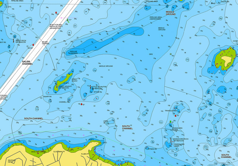
NAUTICAL CHART
Go boating with comprehensive charts derived from multiple official, government and private sources, displayed in a familiar look and feel.
Learn more
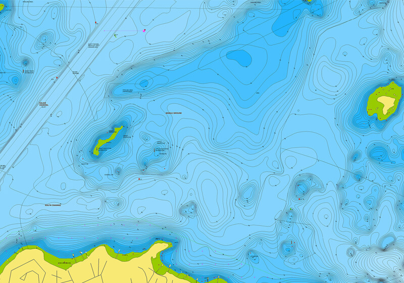
SONARCHART™ HD BATHYMETRY MAP
Understand depths and bottom detail with our innovative 1' bathymetry charts. They’re created by using Navionics proprietary systems that process sonar data contributed by boaters with existing content.
Learn more
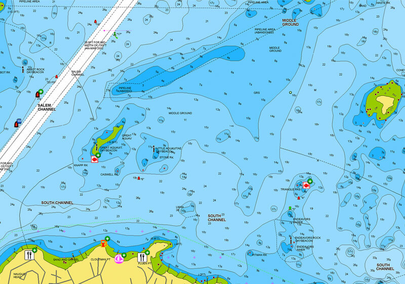
COMMUNITY EDITS
Get useful local knowledge from fellow boaters in this crowdsourced content layer packed with POIs, navigation aids and a variety of edits made by users of our Navionics Boating smart-device app.
Learn more
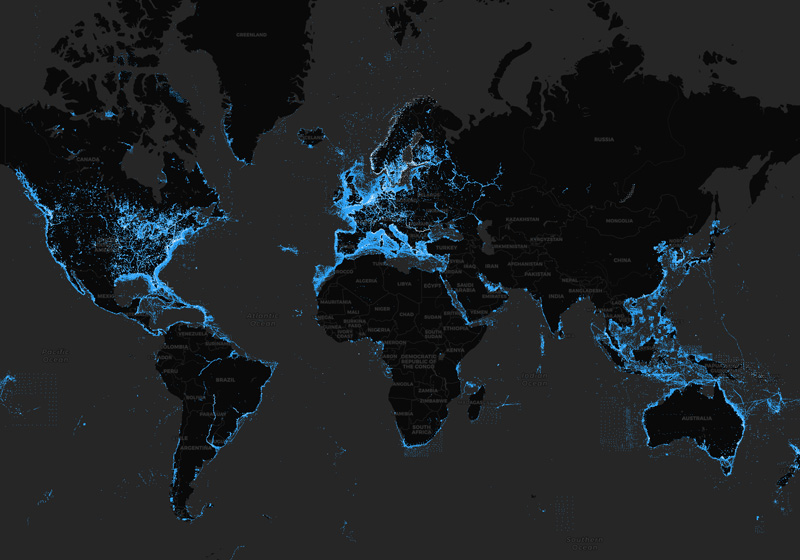
Daily Updates
We constantly enhance our charts with new and amended content from official hydrographic sources, public and private surveys, and millions of contributions from boaters.
We make up to 5,000 daily updates, which affect all our chart layers.
See our worldwide updates, and locate them on our Heatmap.
View our latest charts on the Chart Viewer.
The Navionics Subscription
When you purchase any new product, a one year subscription to daily updates and many advanced features is included. For charts purchased in-store, the subscription requires activation.
GPS Plotter Cards
What you get:
- Download of chart layers
- Daily Updates
- Dock-to-dock Route Guidance
- Advanced Map Options
- Plotter Sync
- Satellite Imagery
- Relief Shading
- Sonar Imagery
Check if your GPS plotter model is compatible with advanced features and make sure it is running the latest software.
Subscription expired? After one year, you can purchase a renewal. If you don’t, you can still use your chart layers and download the rest of your coverage area.
The above mentioned advanced features or the download of chart updates require an active subscription.

| Navionics+ | Platinum+ | |
|---|---|---|
| Coastal Content | • | • |
| Inland Content | 44,000+ lakes | 44,000+ lakes |
| Detailed Nautical Charts | • | • |
| SonarChart HD Bathymetry1 | • | • |
| Daily Updates1 | • | • |
| Dock-to-dock Route Guidance Technology1,2 | • | • |
| Plotter Sync1 | • | • |
| Community Edits | • | • |
| Advanced Map Options1 | • | • |
| SonarChart Live Mapping | • | • |
| High-resolution Relief Shading1 | Via Chart Installer | |
| Satellite Imagery1 | Via Chart Installer | |
| Sonar Imagery1 | Via Chart Installer | |
| Aerial Photography | • | |
| 3D View1 | • |
| Coastal Content | |
| Navionics+ | • |
| Platinum+ | • |
| Inland Content | |
| Navionics+ | 44,000+ lakes |
| Platinum+ | 44,000+ lakes |
| Detailed Nautical Charts | |
| Navionics+ | • |
| Platinum+ | • |
| SonarChart HD Bathymetry | |
| Navionics+ | • |
| Platinum+ | • |
| Daily Updates1 | |
| Navionics+ | • |
| Platinum+ | • |
| Dock-to-dock Route Guidance Technology1,2 | |
| Navionics+ | • |
| Platinum+ | • |
| Plotter Sync1 | |
| Navionics+ | • |
| Platinum+ | • |
| Community Edits | |
| Navionics+ | • |
| Platinum+ | • |
| Advanced Map Options1 | |
| Navionics+ | • |
| Platinum+ | • |
| SonarChart Live Mapping | |
| Navionics+ | • |
| Platinum+ | • |
| High-resolution Relief Shading1 | |
| Navionics+ | |
| Platinum+ | Via Chart Installer |
| Satellite Imagery1 | |
| Navionics+ | |
| Platinum+ | Via Chart Installer |
| Sonar Imagery1 | |
| Navionics+ | |
| Platinum+ | Via Chart Installer |
| Aerial Photography | |
| Navionics+ | |
| Platinum+ | • |
| 3D View1 | |
| Navionics+ | |
| Platinum+ | • |