
Go Fishing with Navionics
If Fishing Is Your Passion
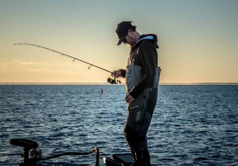
Anglers and fishing passionates, be they fresh or saltwater, have one thing on their mind: catching. Electronic charts can make a real difference with the many dedicated features that help locate fish holding structures, scrutinize the underwater topography and pinpoint fishing spots.
In general, your fishing life is improved because you have more knowledge and can focus on strategy.
Your passion counts for us. Create an account, and receive news on the latest features to take your fishing game to the next level.
Navionics for Fishing
Charts
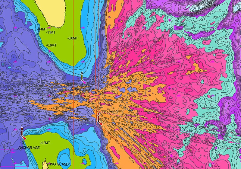
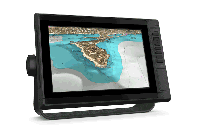
SonarChart™
SonarChart, our 1'ft contoured chart layer, gives you a detailed view of shallow waters, ledges, humps and more.
Discover the "Top Five Reasons" to use SonarChart in this video by our ProStaffer.
Fish Attractors
Fish seek out particular types of habitats where they prefer to nest. In many lakes and coastal waters, angling clubs and fisheries organizations will sink structures to attract fish and encourage a healthy fishery. Navionics charts include more than 10,000 fish attractors.
Functionalities
SonarChartTM Live
With SonarChart Live, you can count on the most up-to-date information because the bathymetry is drawn on the screen of your device in real time. When you create your own maps, you can feel confident that you're making decisions based on the most recent depth data.
Watch the video.
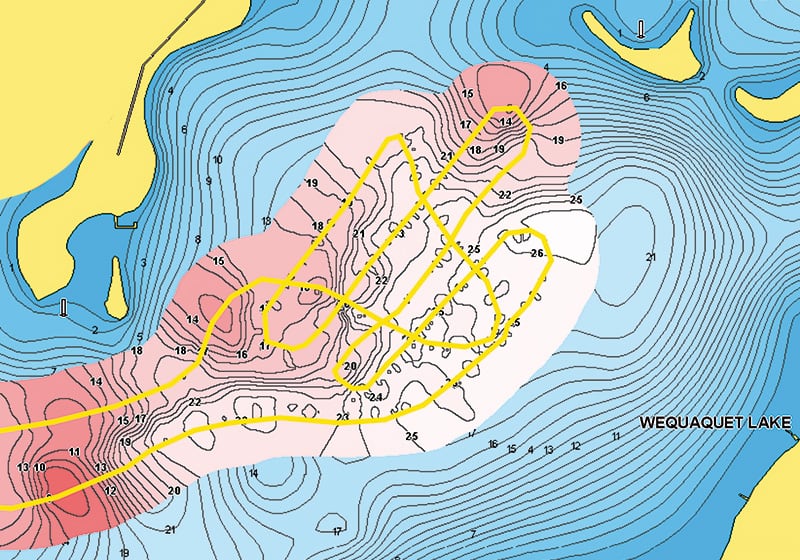
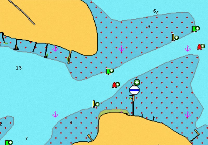
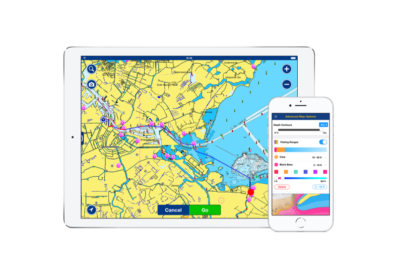
Fishing Ranges
Fishing Ranges will help you interpret the structure, identify patterns and focus on where to cast. Watch the video.
Advanced Map Options
Customize your view of Navionics charts to highlight shallow areas, adjust SonarChart™ contour density, and target a fishing range!
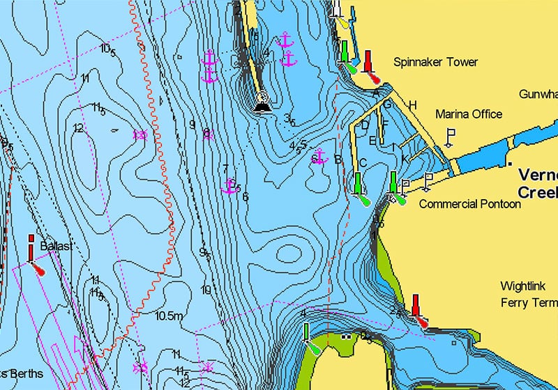
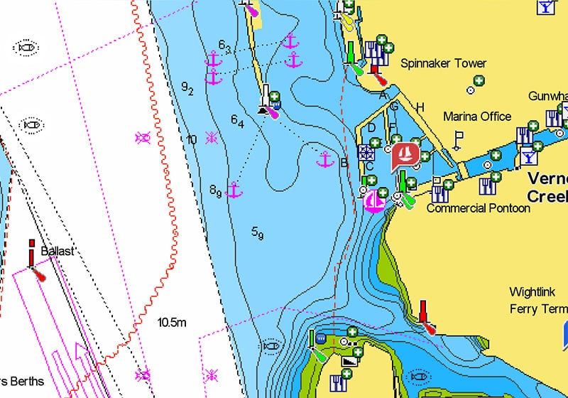
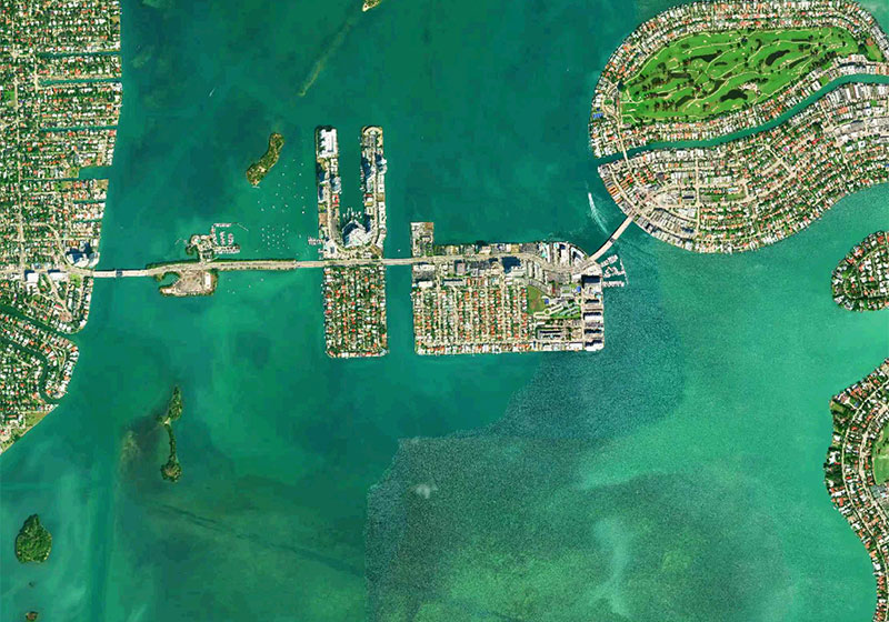
Satellite Imagery
Especially helpful in congested ports and marinas, crisp satellite overlay can also help you find hidden features such as backwater channels that might hold fish. Watch this video.
The Navionics Family of Products
Navionics+
Navionics+ cartography provides integrated offshore and inland marine mapping content with rivers, bays and more than 44,000 lakes around the world.
Shop Now
Platinum+
Navionics Platinum+™ charts include all the content of Navionics®+ cartography and additional viewing options for relief shading, satellite imagery with SonarChart shading and more.
Shop Now
Navionics Boating App
The same detailed charts and advanced features used on the best GPS plotters.
Shop Now