
Navionics
Boating App
Your Guide on the Water
The Navionics Boating app is a must-have for cruising, fishing, sailing, diving
and all your activities on the water offering a boatload of features on your Apple or Android mobile device, so they’re on hand wherever you go.
and all your activities on the water offering a boatload of features on your Apple or Android mobile device, so they’re on hand wherever you go.
Chart Layers
Up-to-date, detailed charts you can use offline.
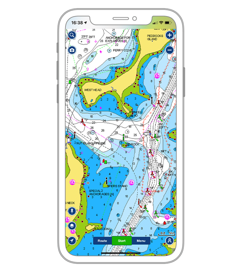
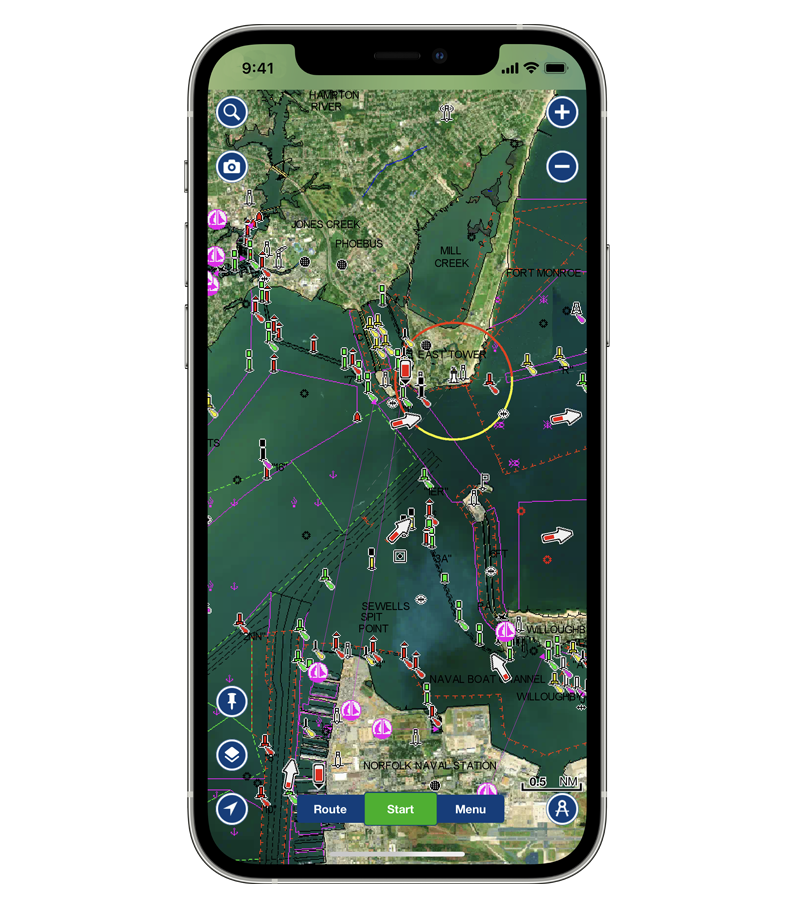
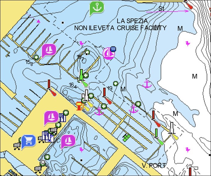
NAUTICAL CHART
Comprehensive charts displayed in a familiar look and feel.
LEARN MORE
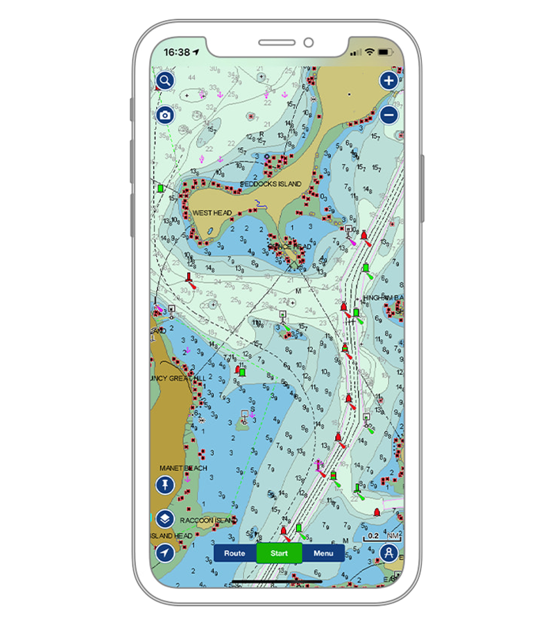
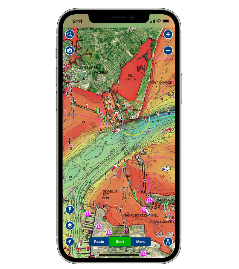
SONARCHART™
0,5 m bathymetry charts.
LEARN MORE
US GOVERNMENT CHARTS
Official unaltered NOAA Charts.
LEARN MORE
Overlays
Be more aware of what’s above and below the water.
SATELLITE IMAGERY
A top-down view of inland and coastal areas.
LEARN MORE
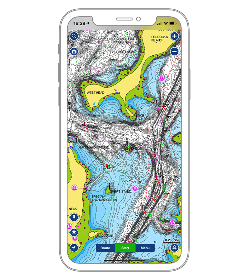
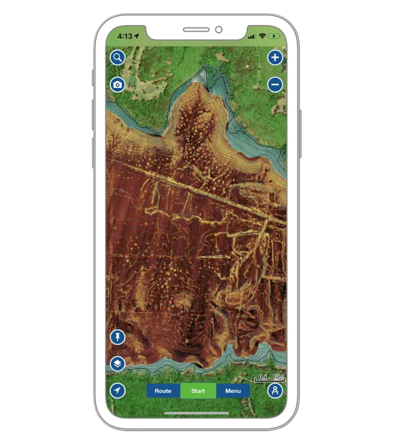
RELIEF SHADING
Get an easy-to-interpret, clearer view of bottom structure.
LEARN MORE
SONAR IMAGERY
View bottom hardness clearly and in contrasting color.
LEARN MORE
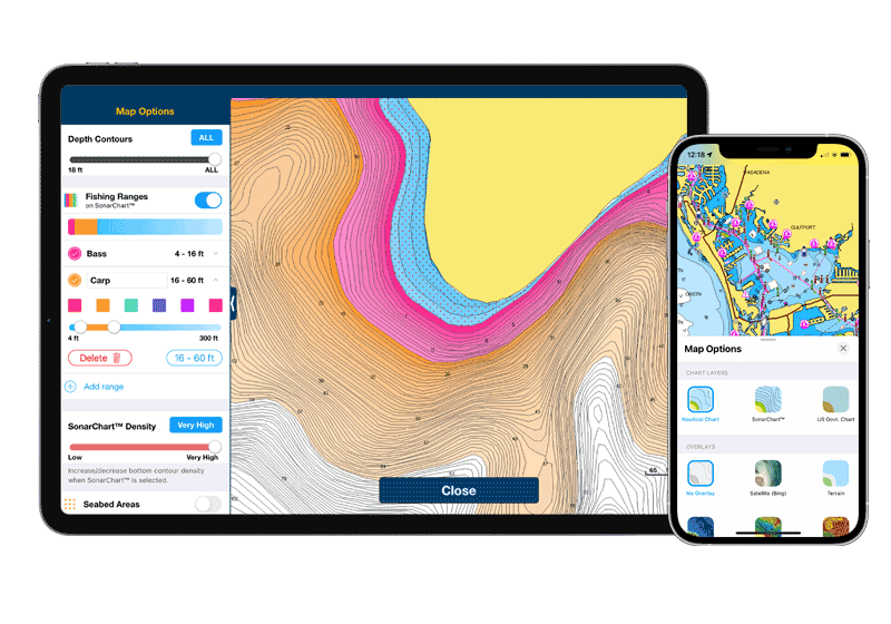
Map Options
Change chart-overlay combinations to customize chart views, highlight shallow areas, target multiple fishing ranges, and more.
TOOLS FOR PLANNING AND ENJOYING YOUR DAY

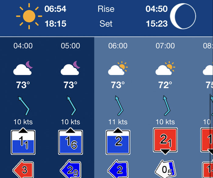
WEATHER AND TIDES
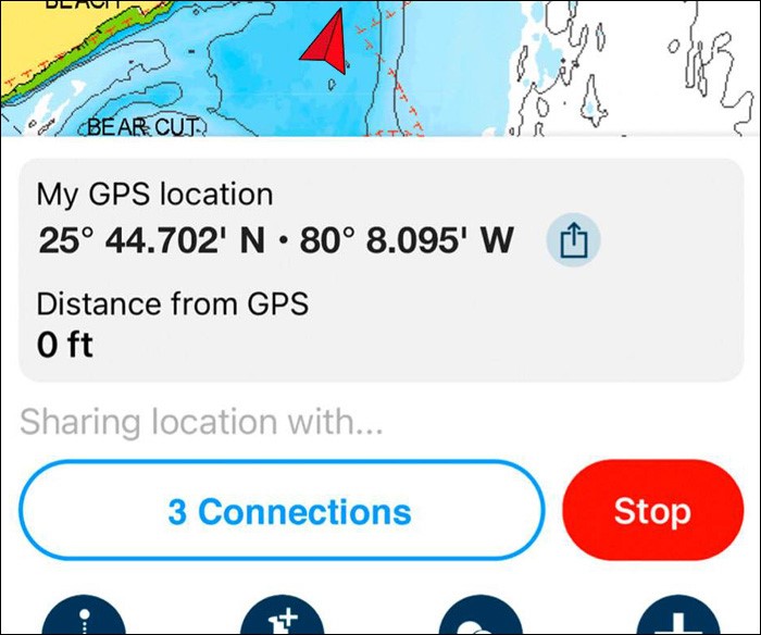
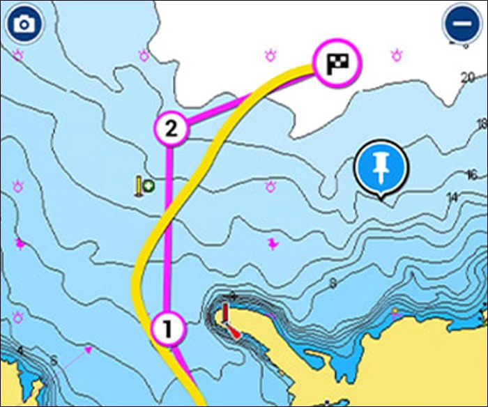
MARKERS, TRACKS, DISTANCE

Place a marker, record your track, and look back at your day.
AN ACTIVE AND HELPFUL COMMUNITY
COMMUNITY EDITS
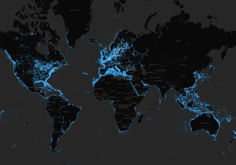
ACTIVECAPTAIN COMMUNITY
Useful local knowledge and valuable recommendations from people with firsthand experience.
EXTERNAL DEVICE
CONNECTION
FOR MORE FEATURES
PLOTTER SYNC
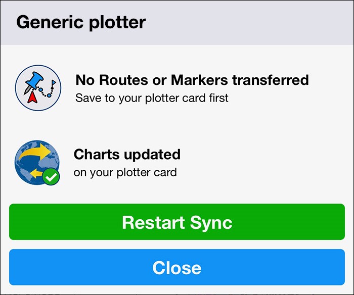
Sync compatible chartplotters with the app to transfer routes and markers, activate, update and more.
SONARCHART LIVE
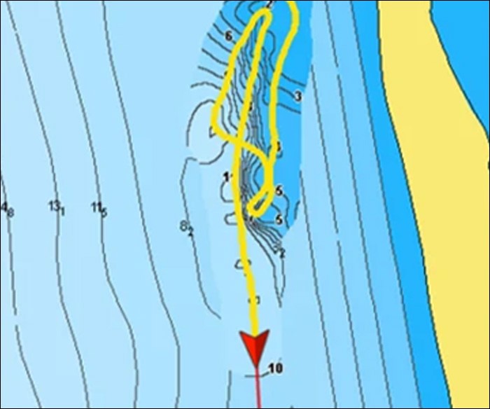
Connect with a compatible sonar/plotter and create your own maps in real time.
AIS
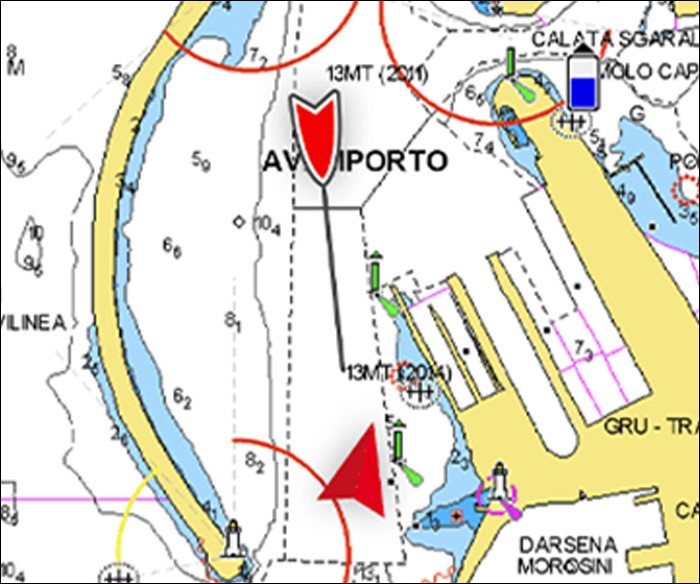
Connect to a compatible AIS receiver with Wi-Fi® connectivity to see nearby marine traffic.
| No Subscription | Active Subscription | |
|---|---|---|
| Wind forecasts, tides and currents, distance tool | • | |
| Your data: tracks, routes, markers, sync, share location, photos and videos, boat settings | • | |
| SonarChart™ Live1 mapping feature | • | |
| Connections feature | Connect with friends | Share/view live locations, Share/save shared tracks, routes and markers |
| Daily Updates | • | |
| Chart layers: nautical chart, HD bathymetry (for offline use) | • | |
| Overlays: high resolution relief shading, high-resolution satellite imagery, sonar imagery bottom hardness maps | • | |
| Auto Guidance+™ technology2 | • | |
| Weather forecasts | • | |
| Map options | • | |
| GPX import/export | • | |
| AIS display feature1 | • |
| Wind forecasts, tides and currents, distance tool | |
| No Subscription | |
| Active Subscription | • |
| Your data: tracks, routes, markers, sync, share location, photos and videos, boat settings | |
| No Subscription | |
| Active Subscription | • |
| SonarChart™ Live1 mapping feature | |
| No Subscription | |
| Active Subscription | • |
| Connections feature | |
| No Subscription | Connect with friends |
| Active Subscription | Share/view live locations, Share/save shared tracks, routes and markers |
| Daily Updates | |
| No Subscription | |
| Active Subscription | • |
| Chart layers: nautical chart, HD bathymetry (for offline use) | |
| No Subscription | |
| Active Subscription | • |
| Overlays: high resolution relief shading, high-resolution satellite imagery, sonar imagery bottom hardness maps | |
| No Subscription | |
| Active Subscription | • |
| Auto Guidance+™ technology2 | |
| No Subscription | |
| Active Subscription | • |
| Weather forecasts | |
| No Subscription | |
| Active Subscription | • |
| Map options | |
| No Subscription | |
| Active Subscription | • |
| GPX import/export | |
| No Subscription | |
| Active Subscription | • |
| AIS display feature11 | |
| No Subscription | |
| Active Subscription | • |
Quick Links


Like our features?
Create an account to receive news, tips and promotions.
Your overall experience with Navionics will greatly improve.
Create account¹ 1You can manage your subscription anytime, and you can turn auto-renewal off.
Charts, overlays, daily updates and advanced features are not accessible after the subscription expires.