
Latest Navionics mapping update delivers 120% more relief shading coverage of coastal and inland waters
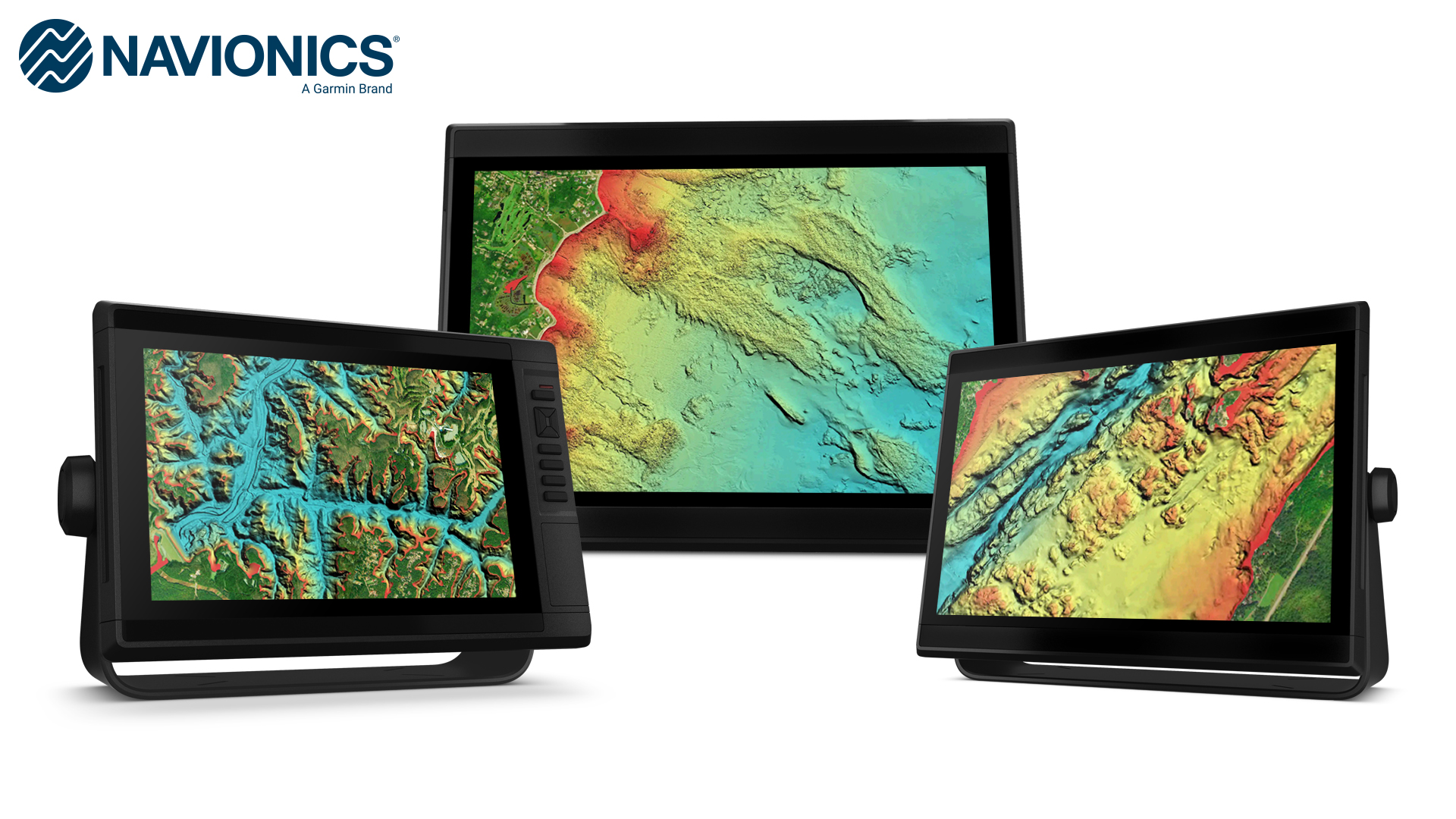
OLATHE, Kan./May 25, 2023/PR Newswire — Garmin (NYSE: GRMN), the world’s most innovative and recognized marine electronics manufacturer, today announced expanded and enhanced high-resolution relief shading coverage to Navionics® Platinum+™ premium marine charts for compatible chartplotters. The update from Navionics provides 120% more relief shading coverage for many new coastal and inland waters than previous charts. Combining color and shadow, relief shading gives boaters, anglers and divers an easy-to-interpret, clearer view of what’s below the surface than contour lines alone—and is now available on more than 40,000 additional lakes.
“Our team is continuously working to update our robust relief shading to provide combined inland and coastal content for our Navionics Platinum+ charts, simplifying mariners’ experience so they can focus on exploring the waters they enjoy most. Additionally, mariners can continue to utilize the same quality content and premium features, such as high-resolution relief shading chart overlays, to support a safer and more enjoyable navigation experience—whether on the lake or off the coast.
—Dan Bartel, Garmin Vice President of Global Consumer Sales
Platinum+ provides boaters, anglers and divers access to an exclusive relief shading overlay with availability in lakes and rivers in the U.S., Canada, Europe, Africa, Australia and New Zealand1. Platinum+ offers a variety of features — such as daily chart updates, chart overlays and advanced routing technology — that are designed to smoothly guide boaters on the water, or quickly lead anglers to where the fish may be hiding. The updated relief shading, which was recently made available in the Navionics Boating smart device app, reveals the shape of a lake, river and ocean seabeds in a vibrant new color palette that provides a better understanding of depth changes at a glance and makes it easier to identify sharp ledges, points or other changes in bottom structure.
A one-year subscription is included with the purchase of a Navionics Platinum+ chart card, offering a quick and easy way to access unlimited daily chart updates via the Navionics Chart Installer, or using the Plotter Sync feature in the Boating app. Charts also feature up to 1-foot depth contours, community edits, depth shading and shallow water shading options for insight into inland and coastal waters.
An even clearer picture
Platinum+ premium charts’ new color palette and image quality deliver a clear image of bottom detail that uncovers promising fishing spots, navigation channels and more. Multiple shading options aid in shallow water navigation, making it easier to choose depth ranges when searching for the best fishing spots. Additionally, numerous wrecks were targeted for enhancement to assist anglers and divers identify more precise spot-on-the-spot locations.
Daily map updates
With up to 5,000 updates to map content every day, Platinum+ mapping offers fresh insights about covered bodies of water for enhanced situational awareness and peace of mind while navigating. The mapping is revised daily from public and private sources which include proprietary surveys and Notice to Mariners to give mariners the most up-to-date information available from Navionics. With mapping coverage of coastal and inland waters worldwide, daily updates allow for immediate access to new content and chart data as it is updated. Once the year-long subscription is activated, customers can access unlimited daily map updates using the Navionics chart installer.
Platinum+ premium charts are available now starting at $249.99. The maps come on a microSD/SD card for simplified installation compatible with third-party chartplotters. To learn more, visit navionics.com.
1Level of detail will vary based on the location and sources used.
About Garmin International, Inc. Garmin International, Inc. is a subsidiary of Garmin Ltd. (NYSE: GRMN). Garmin Ltd. is incorporated in Switzerland, and its principal subsidiaries are located in the United States, Taiwan and the United Kingdom. Garmin and Navionics are registered trademarks, and Platinum+ is a trademark of Garmin Ltd. or its subsidiaries.
All other brands, product names, company names, trademarks and service marks are the properties of their respective owners. All rights reserved.
About Navionics. Navionics, a Garmin brand, is dedicated to creating marine cartography and integrated mapping solutions for boaters all over the world. This unique and valuable content is available to boaters for use in GPS chartplotters and through the Navionics Boating app. To learn more, visit navionics.com.
Notice on Forward-Looking Statements: This release includes forward-looking statements regarding Garmin Ltd. and its business. Such statements are based on management’s current expectations. The forward-looking events and circumstances discussed in this release may not occur and actual results could differ materially as a result of known and unknown risk factors and uncertainties affecting Garmin, including, but not limited to, the risk factors listed in the Annual Report on Form 10-K for the year ended December 31, 2022, filed by Garmin with the Securities and Exchange Commission (Commission file number 0001-411180). A copy of such Form 10-K is available at http://www.garmin.com/aboutGarmin/invRelations/finReports.html. No forward-looking statement can be guaranteed. Forward-looking statements speak only as of the date on which they are made and Garmin undertakes no obligation to publicly update or revise any forward-looking statement, whether as a result of new information, future events, or otherwise.
Media Contacts:
Carly Hysell or Adam Burns
913-397-8200
media.relations@garmin.com


