
AIS
AIS
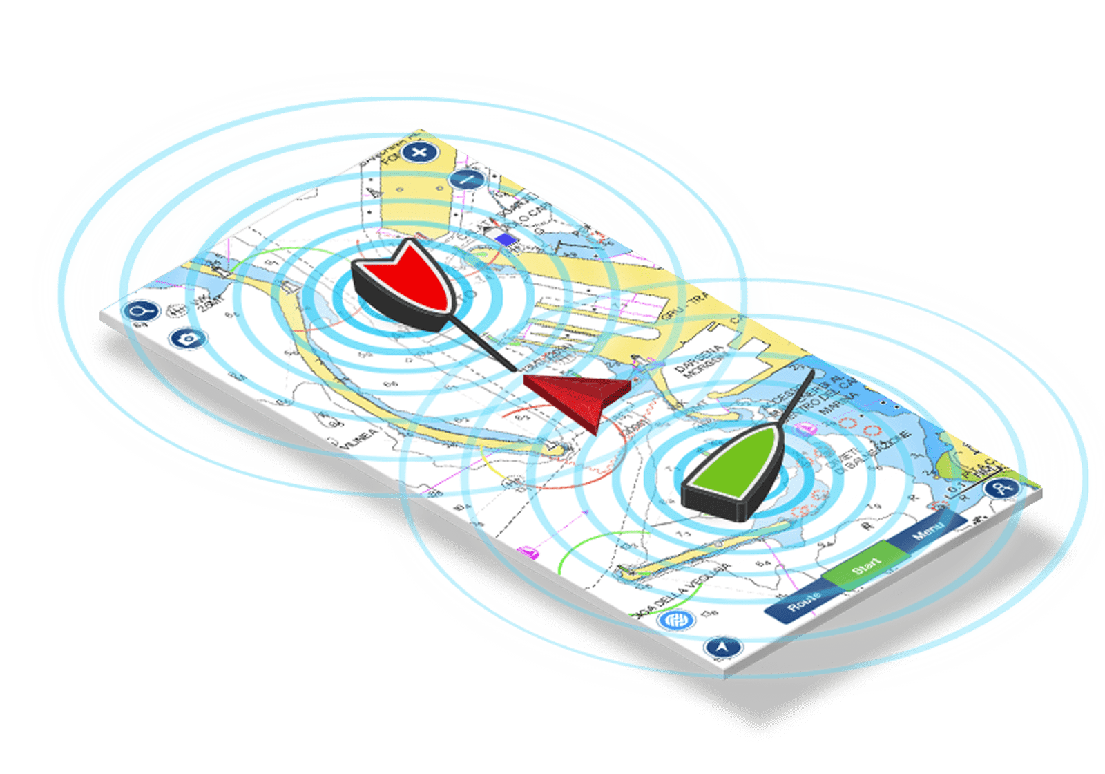
Your sixth sense on the water
AIS is a feature of the Navionics Boating app that will increase your situational awareness on the water, in heavy traffic areas and with low visibility since it displays vessels and navigational aids around you.
A Wi-Fi enabled feature
To use the AIS feature you need to connect the Navionics Boating app to a Wi-Fi® AIS compatible receiver.
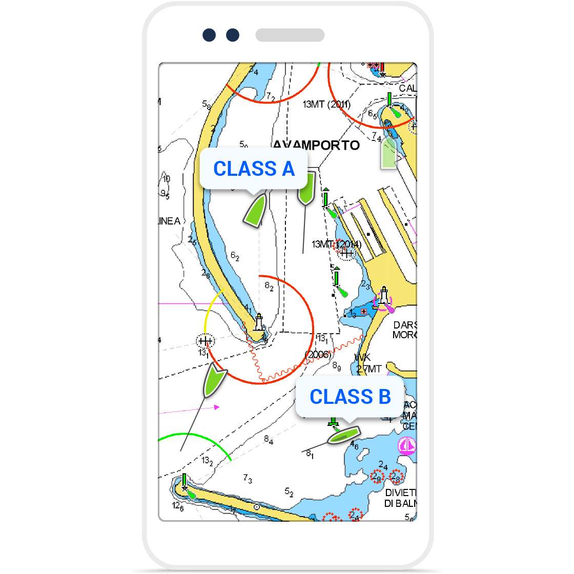
By doing so, you will be able to see Class A & B vessels and Aids-to-Navigation (ATON) overlaid on the chart in real time.
Target Information
You'll be able to distinguish moving (opaque) or still (transparent) vessels around you and specific categories.
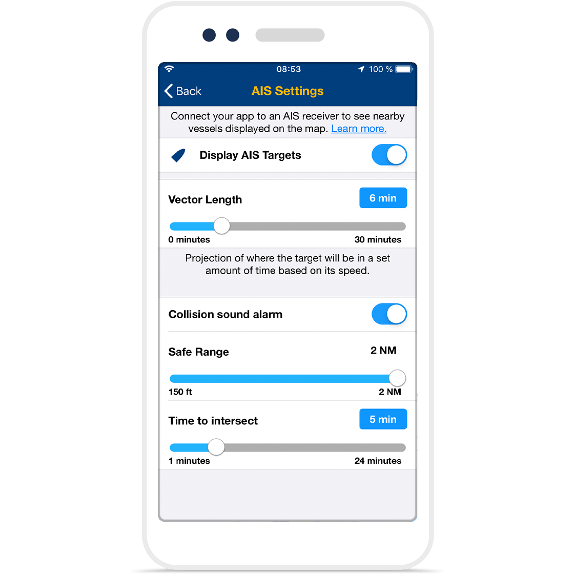
Select any target to see vessel details such as, name, MMSI, IMO,
Call sign, status, speed, heading, coordinates, distance from your GPS location, and more.
Collision Alarm
Don't miss targets approaching you.
The app provides the option to set a Safe Range and any target entering this range will turn red and a sound will go off to alert you of potential collisions.
The Navionics Mobile App Subscription
With an active marine chart subscription within the Navionics Boating app, you can download detailed charts and marine data that can be used offline, plus get suggested routes using Auto Guidance+ technology1, daily updates, chart overlays, HD bathymetry, crowdsourced local information and much more.
In addition to all the great chart content, the one-year renewable2 subscription offers daily updates and powerful advanced features accessible on or off the water.

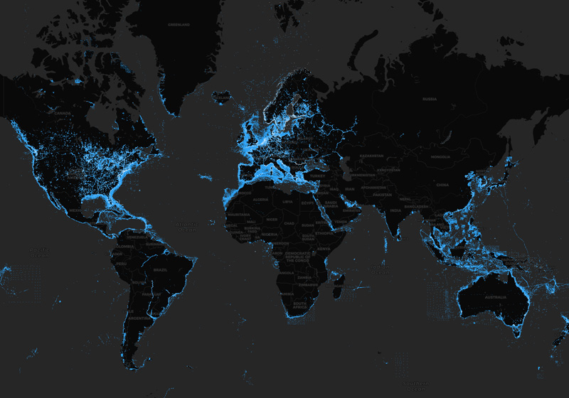
Daily Updates
Only Navionics customers enjoy the unique benefit of having the most current charts with every boating adventure.
See our worldwide updates instantly, and locate them on our Heatmap.
Advanced Features
Get the full Navionics experience!
- Auto Guidance+
- Advanced Map Options
- Plotter Sync
- ...and more
provide you with additional functionalities on your mobile device.

Like our products?
Create an account to receive news, tips and promotions.
Your overall experience with Navionics will greatly improve.
Create account¹ Puedes gestionar tu suscripción y desactivar la renovación automática en cualquier momento.
Cuando la suscripción caduque, no se podrá acceder a las cartas, superposiciones, actualizaciones diarias y funciones avanzadas.
un comportamiento responsable en las operaciones de navegación.
Wi-Fi is a registered trademark of the Wi-Fi Alliance.