
Go Sailing with Navionics
If Sailing Is Your Passion
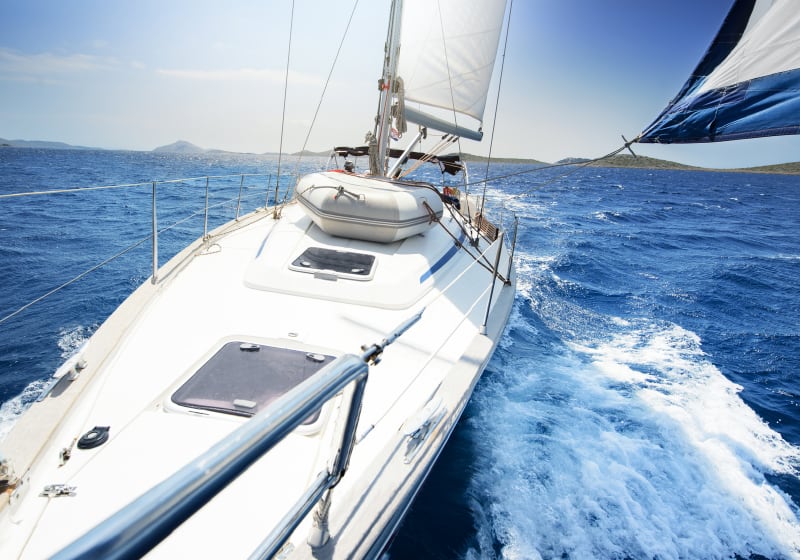
Sailing is all about freedom and love for the sea and nature. But it's also about being alert to depths and changes and interpreting winds. Electronic charts can be of great help on the water, providing information and tools that will greatly improve your sailing life.
Your passion counts for us. Create an account, and receive news on the latest features to take your time on the water to the next level.
Charts
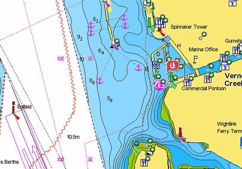
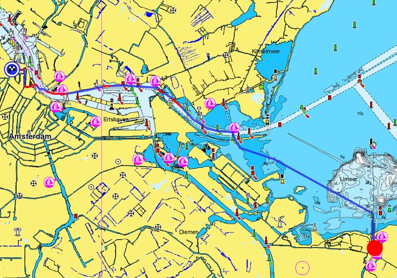
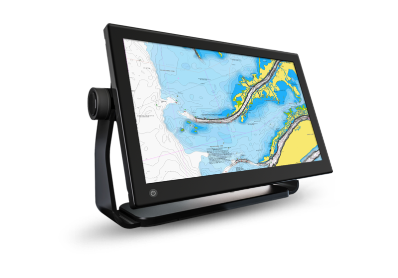
Nautical Chart
The foundation of our products, Nautical Chart is the reference for boaters around the globe with navigational aids, port plans, marine services, hazards and more. We provide worldwide coverage for short and long distances. Learn more.
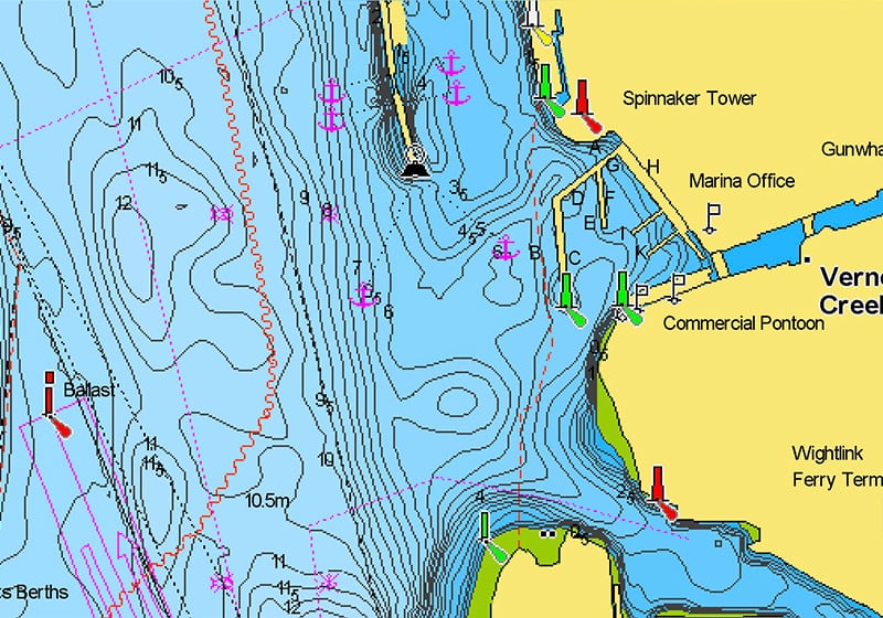
SonarChart™
SonarChart, the high-definition bathymetry chart layer, provides a thorough knowledge of sea and lakes depth for a higher level of confidence when sailing in unknown waters or areas where the bottom changes often.
Discover the "Top Five Reasons" to use SonarChart in this video by our ProStaffer.
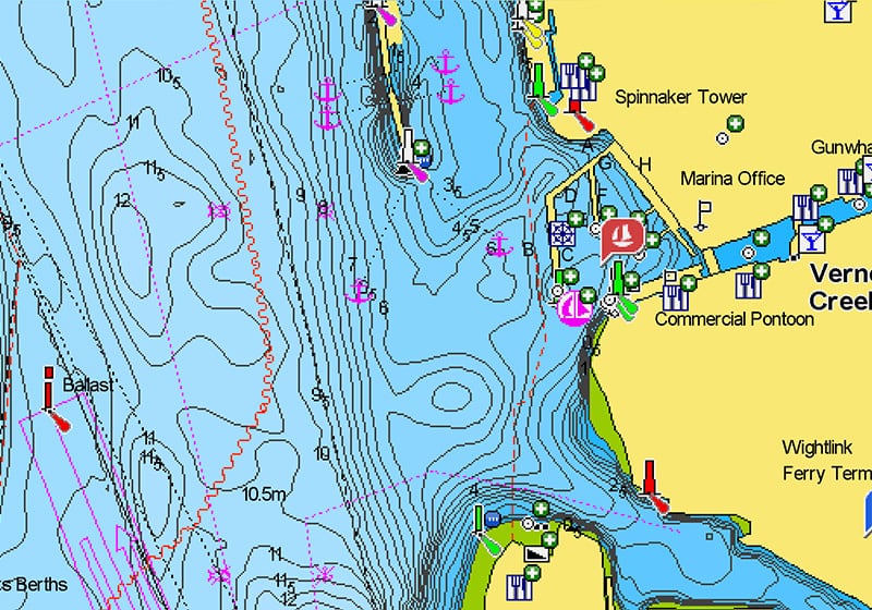
Community Edits
The additions and edits of fellow sailors improve and integrate information about anchoring locations, services on land and more. Read the tips.
Functionalities
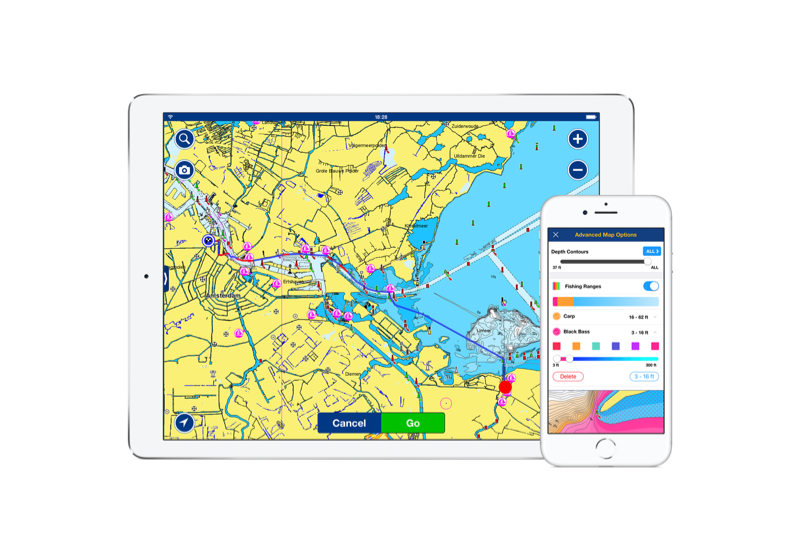
Dock-to-dock Route Guidance
Dock-to-dock Route Guidance1quickly and easily suggests a route between two points, mainly based on predefined factors such as the boat’s draft and the distance from shallow waters and land. Watch this video.
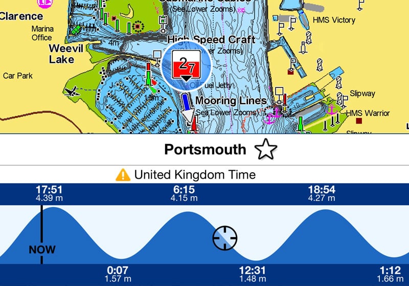
Tides and Currents
Depending on the hardware, predictions can be displayed on a graph or dynamically directly on the map. A great support when revising a dock-to-dock suggested route based on the conditions at the time of departure and along the crossing.
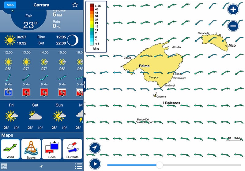
Wind Predictions
Another key factor to be considered is wind. 72-hours wind predictions represent a valuable support for decision-making and when evaluating a route.
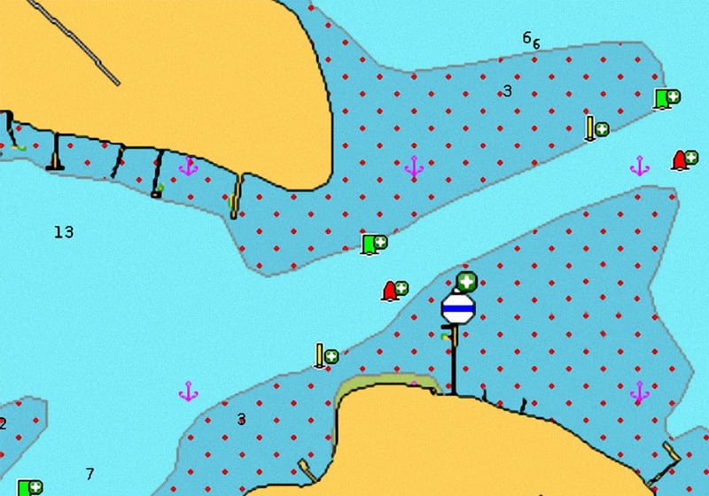
Advanced Map Options
Change the way you view Navionics charts, and focus on the details that matter most to you. You can highlight shallow areas, select a SonarChart density and more.
The Navionics Family of Products
Navionics +
Navionics+ cartography provides integrated offshore and inland marine mapping content with rivers, bays and more than 42,000 lakes around the world.
Shop Now
Platinum+
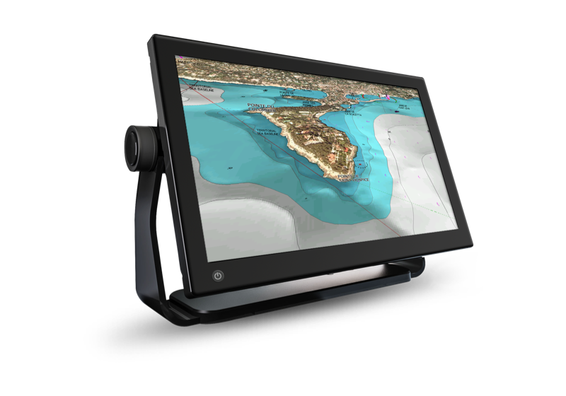
Navionics Platinum+™ charts include all the content of Navionics®+ cartography and additional viewing options for relief shading, satellite imagery with SonarChart shading and more.
Shop Now
Navionics Boating App
The same detailed charts and advanced features used on the best GPS plotters.
Shop Now