
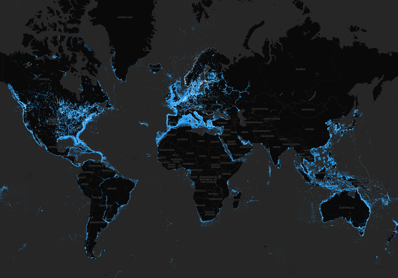
SonarChart™
HD bathymetry map
High-definition 1' Detail
SonarChart is an HD bathymetry map featuring extraordinary bottom contour detail for marine and lakes, excellent for increasing awareness of shallow waters and for locating fishing areas at any depth level.

Want better charts? Go boating!
SonarChart is constantly enhanced by sonar logs contributed by boaters such as you. Navionics accepts sonar logs recorded with the vast majority of sonar/plotter brands and mobile devices. These are integrated with existing data, updating SonarChart to reflect the ever-changing conditions of sea, lake and river bottoms.
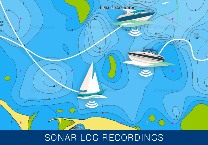
Jump on Board
Contribute sonar logs to enhance SonarChart. Use any of the options below.
Mobile
Use the Navionics Boating app to make the most of the SonarChart Live. Just connect the device to your sonar/plotter, in either of the following ways.
- Connect directly, if it has built-in Wi-Fi® connectivity.
- Or, connect through a router with Wi-Fi.
Sonar logs are automatically shared.
Wi-Fi is a registered trademark of the Wi-Fi Alliance.

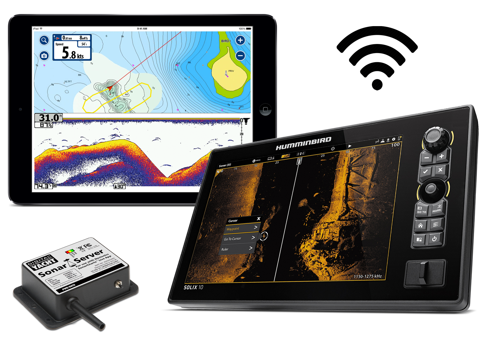
Raymarine
Use a plotter with built-in Wi-Fi connectivity, and you can:
- Create SonarChart Live right on the screen.
- Record sonar logs on the plotter, then upload via Plotter Sync or click here.
Logs recorded with older units (since 2003) that do not have Wi-Fi technology can be exported to a card (if required) and uploaded using a computer.
Lowrance, Simrad and B&G
SonarChart Live on the Navionics Boating app is the best way to automatically contribute sonar data from Lowrance, Simrad and B&G plotters. Models with built-in Wi-Fi, can connect directly to the mobile device. Other models that do not have Wi-Fi may connect to the Boating app using a router with compatible Wi-Fi, such as the Navico branded GoFree WIFI-1 Module.
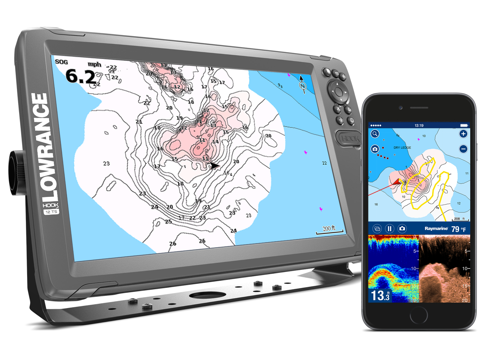
With SonarChart Live
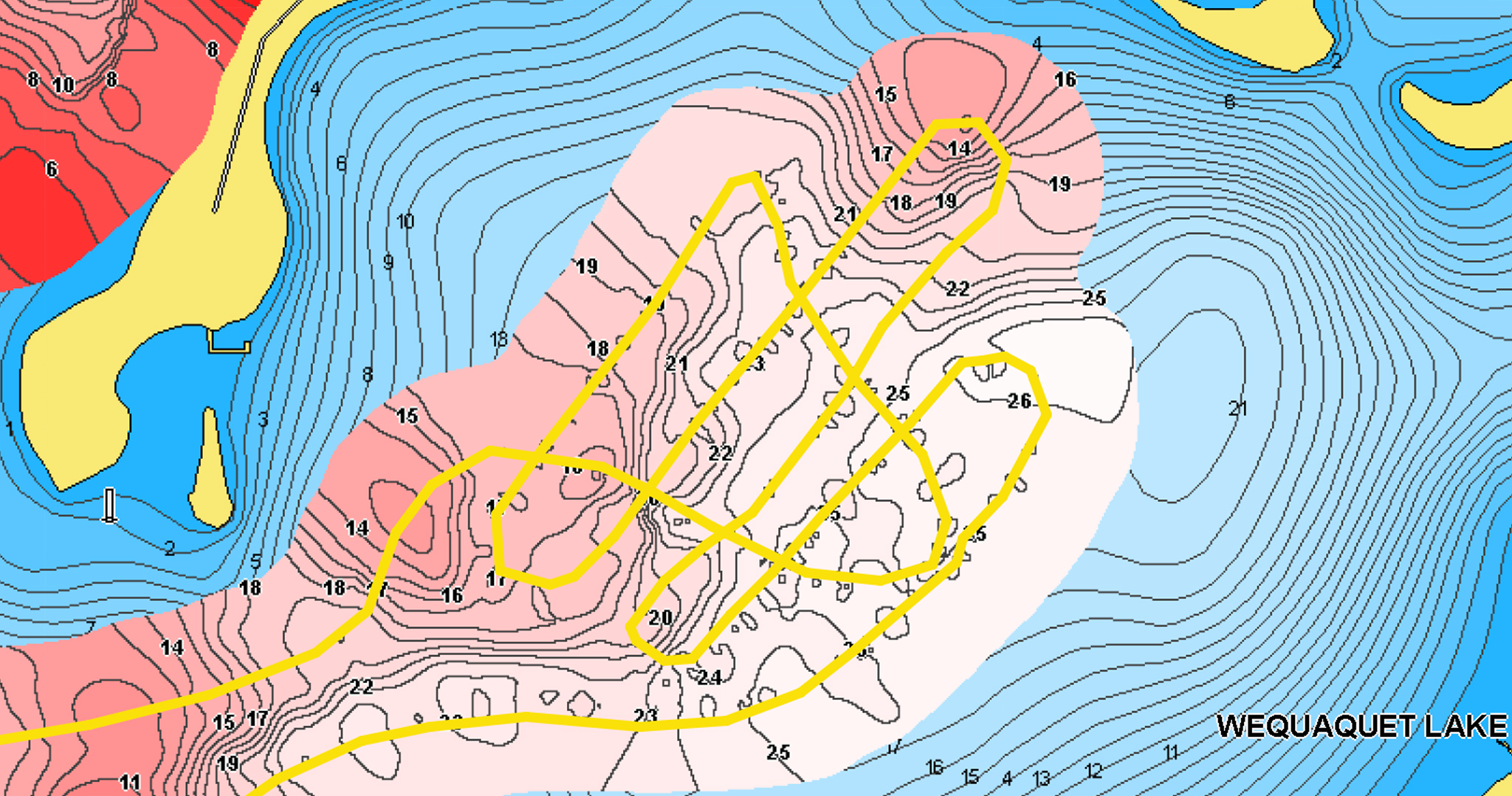
SonarChart Live allows you to create 1' (0.5 meters) personal HD bathymetry maps while navigating with the results displaying on your device in real time.
You can automatically share depth data with Navionics to improve SonarChart.
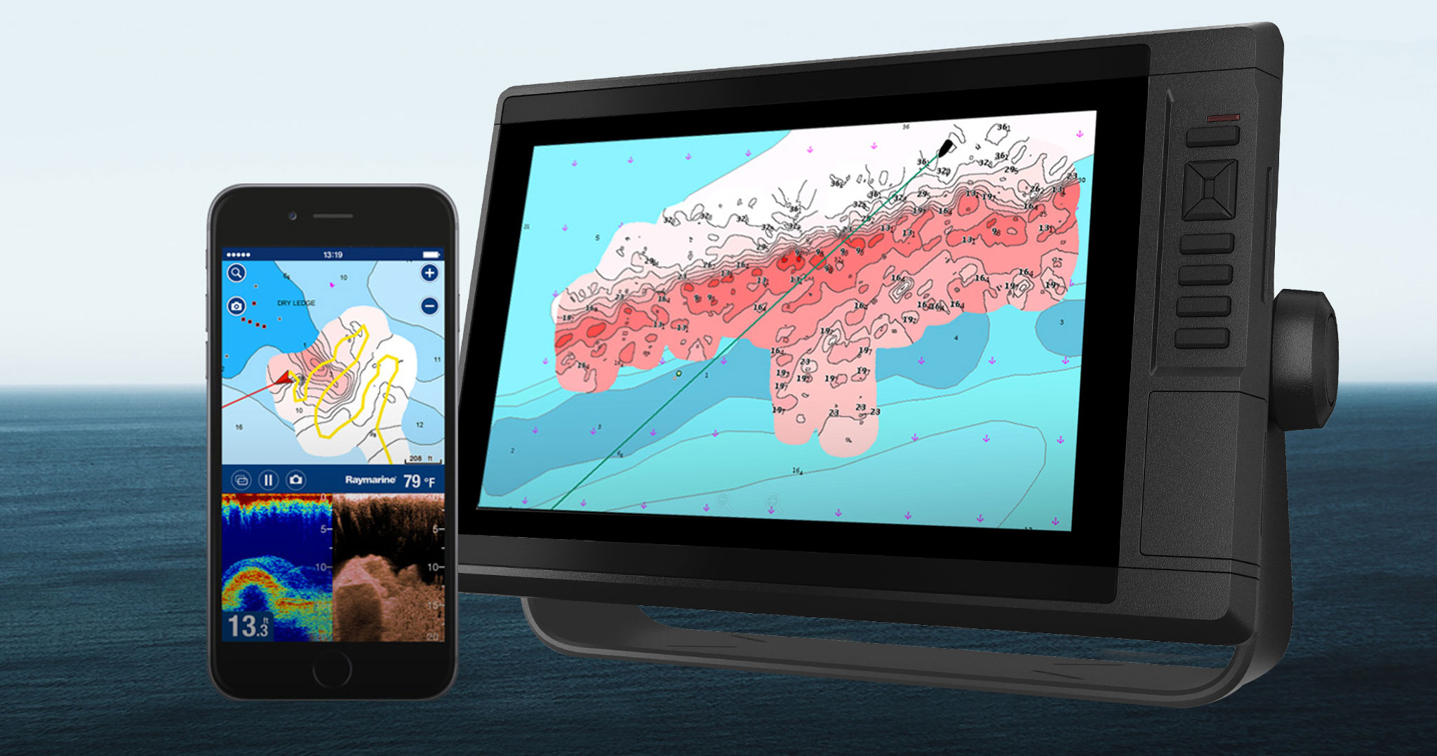
SonarChart Live is a feature available on plotters and mobile.
Processing of Data
New sonar log data normally takes about a week to be integrated but may sometimes take longer, based on data process variables.
Daily Updates
We integrate sonar log contributions using advanced integration processes to update SonarChart every day - along with Nautical Chart and Community Edits. A one-year subscription to Daily Updates and advanced features is included when you purchase any new product.
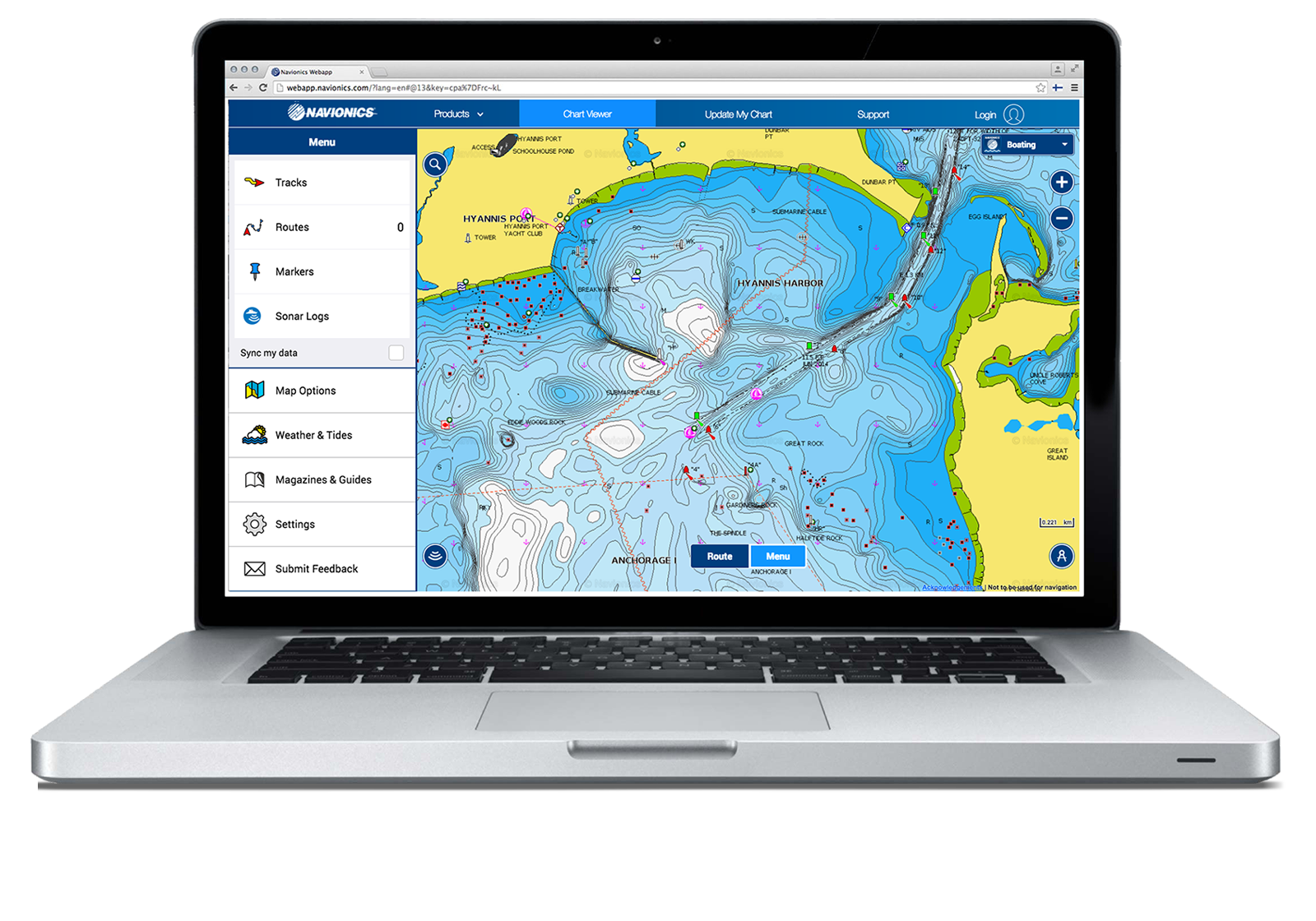
SonarChart on Every Device
Mobile
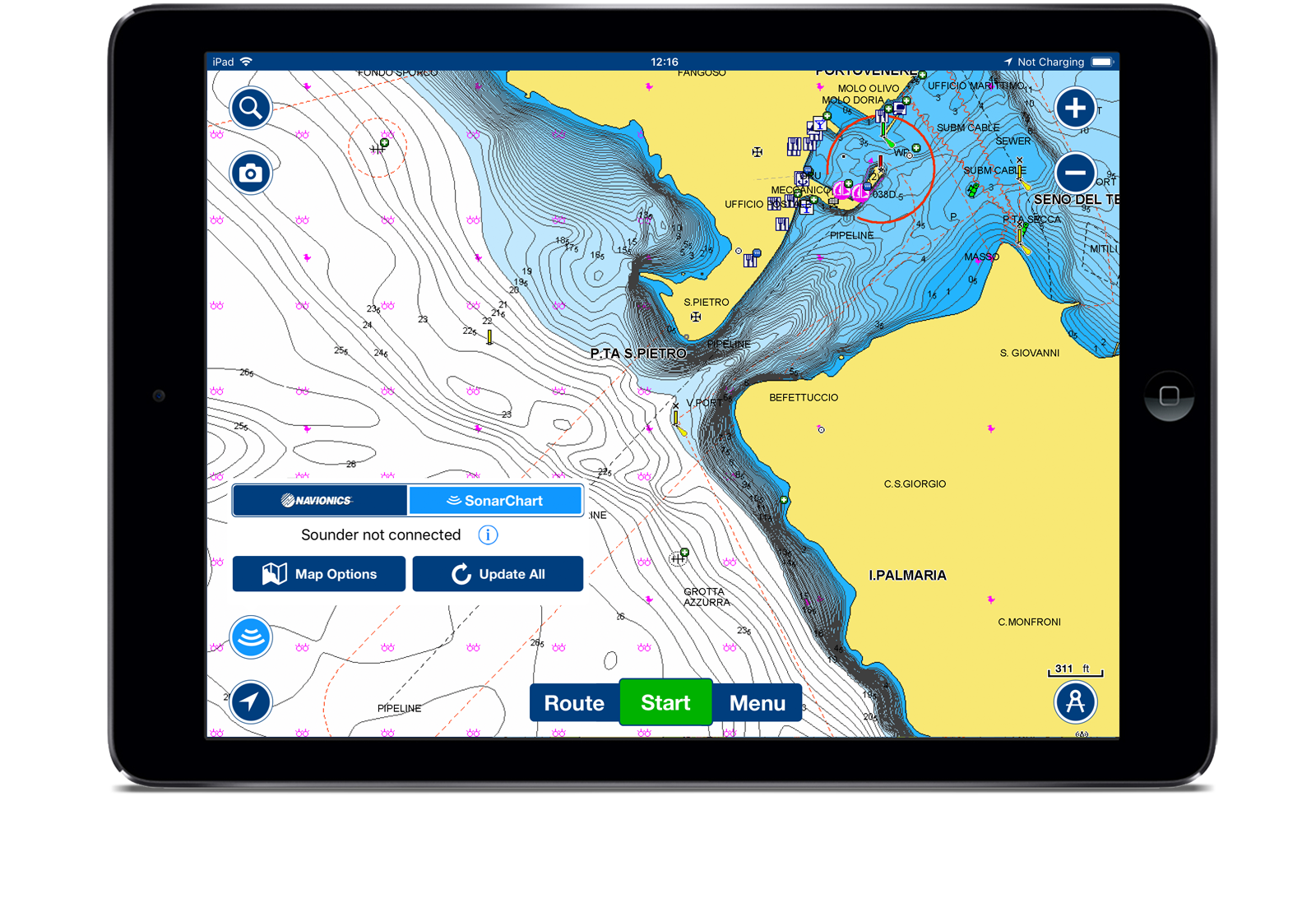
Tap the Navionics icon on the lower left-hand side of the Navionics Boating app to switch from Nautical Chart to SonarChart.
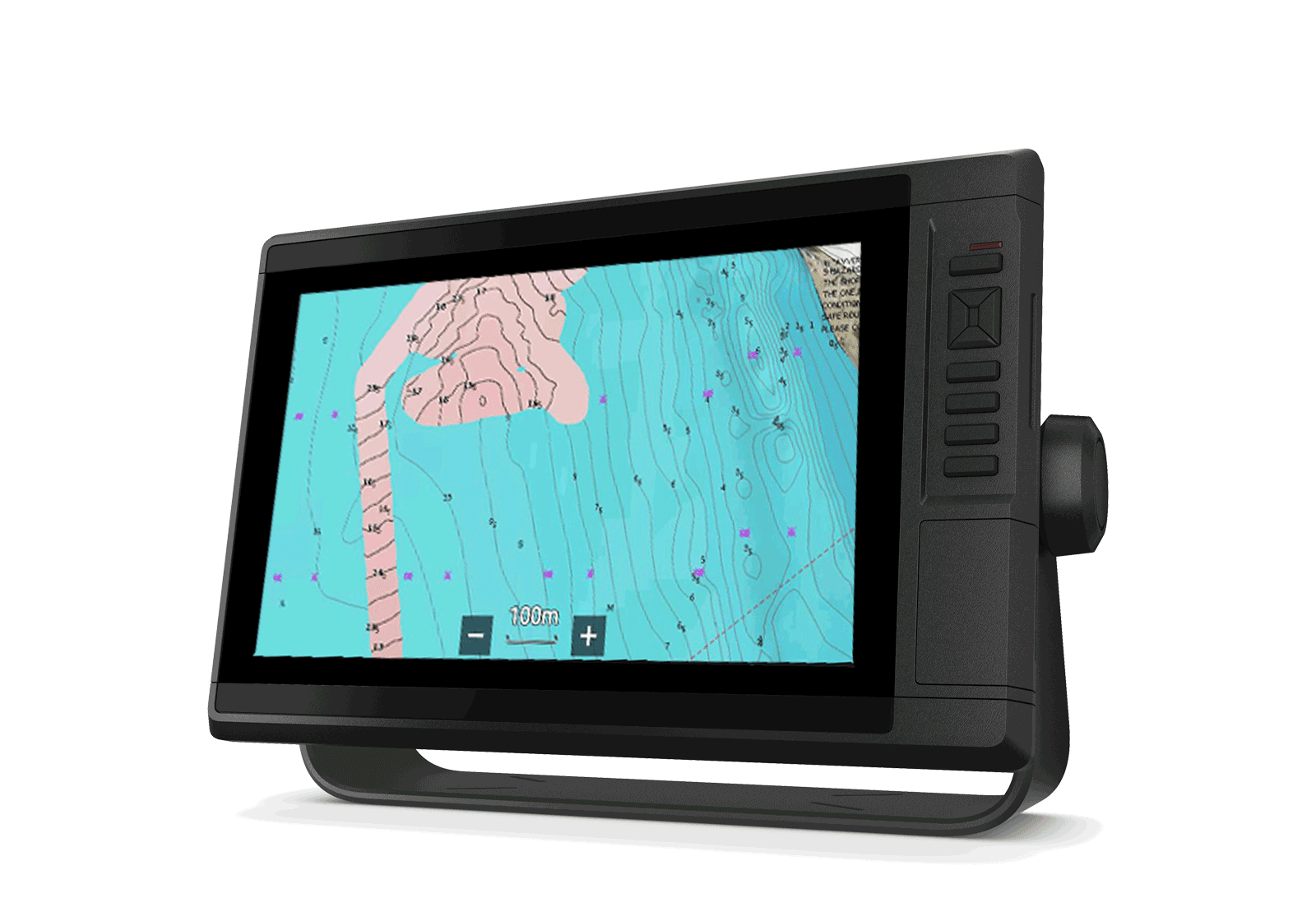
Plotter GPS
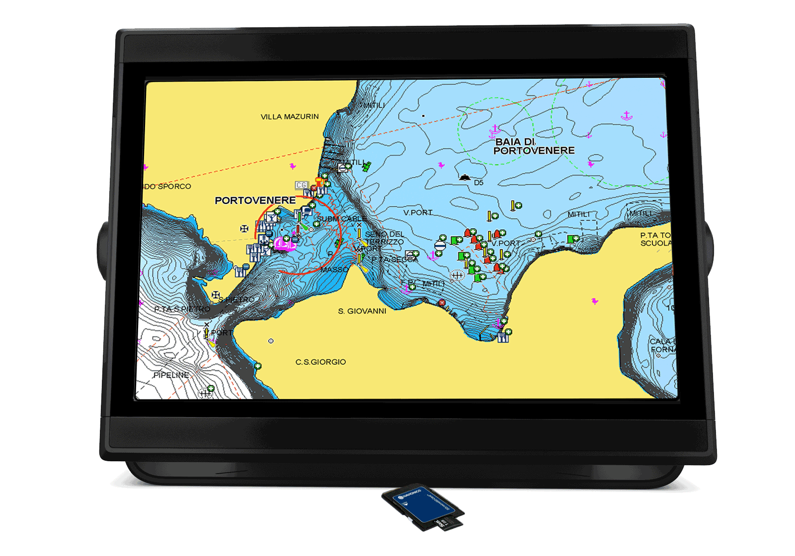
Included with Navionics+® charts, Navionics Updates , Platinum+ for compatible GPS plotters. Click here to learn how to view SonarChart.
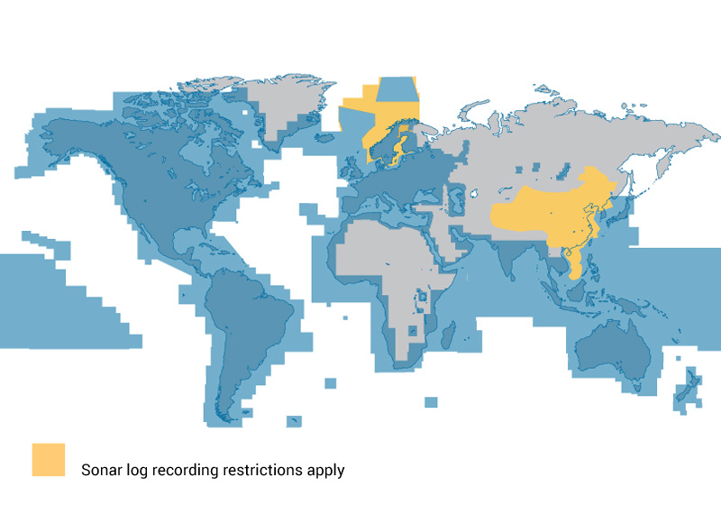
Coverage
SonarChart is available for all Navionics coverage areas.
Sweden, Norway and Finland restrict sonar logs recording at sea.
Discover Our Other Chart Layers
Nautical Chart
All essential cartographic reference detail for cruising, sailing and fishing.
Learn More
Community Edits

All kinds of valuable local information shared by millions of app users from every part of the world.
Learn More
ActiveCaptain
Information shared by the ActiveCaptain® Community for the Navionics Boating app users.
Learn More
SonarChart Academy
GPS Chartplotter
How to get the most out of SonarChart on GPS plotters.
Mobile
How to get the most out of SonarChart on mobile devices.