
Garmin Navionics+
See More When You're on the Water
Garmin Navionics+ and Garmin Navionics Vision+ cartography provides superior coverage, clarity and detail with integrated Garmin and Navionics coastal and inland content including Auto Guidance+ technology.
Check compatibility.
Features
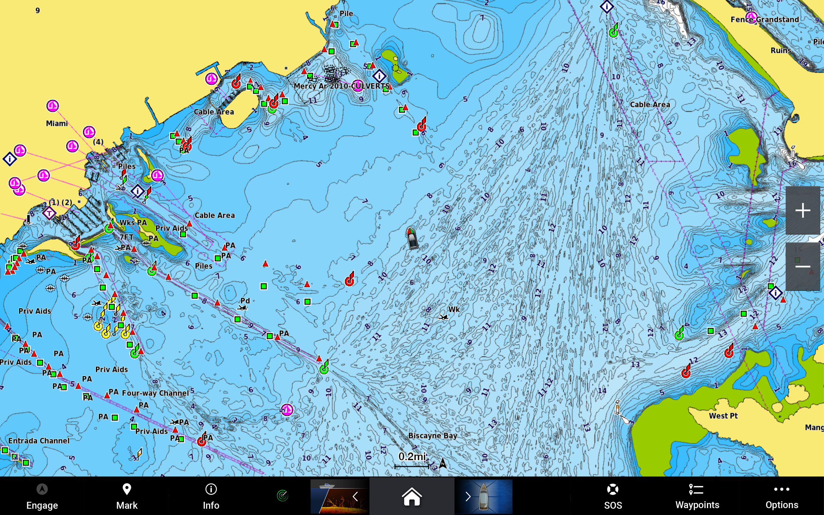
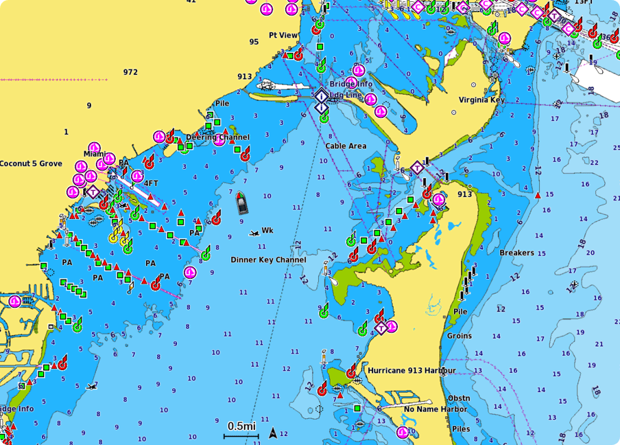
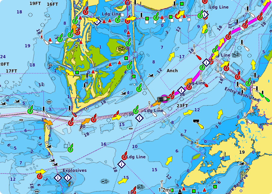
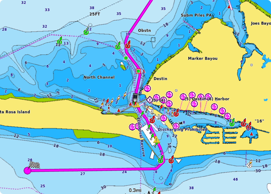
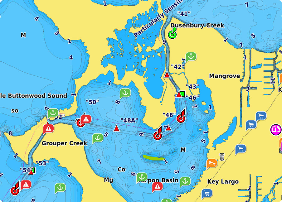
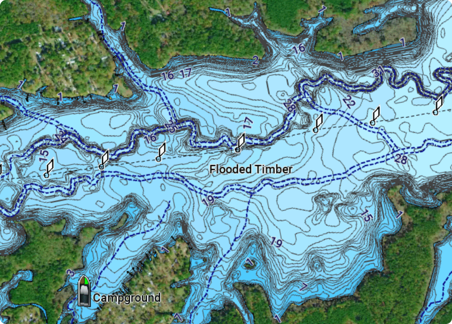
Detailed nautical charts
Navigate with our best offshore and inland lake coverage for your Garmin chartplotter with detail-rich mapping, an updated colour palette and integrated Garmin and Navionics content.
Included in Garmin Navionics+ and Garmin Navionics Vision+
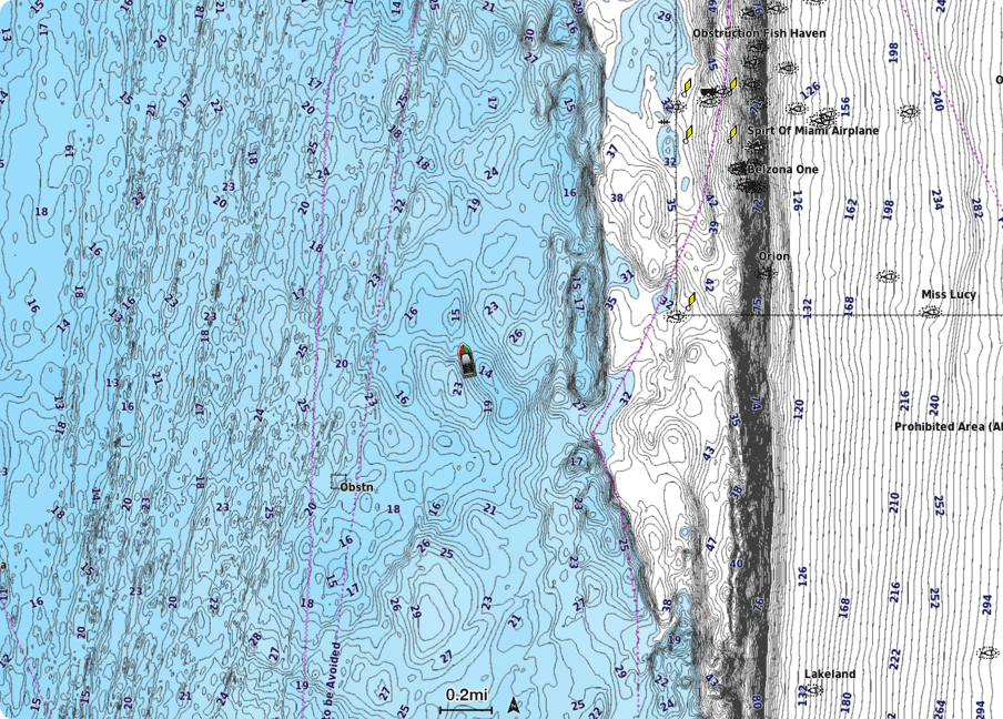
Up to 0.5 m Contours
Up to 0.5 m contours provide a detailed and clear view of bottom structure for improved fishing charts and enhanced detail in swamps, canals and port plans.
Included in Garmin Navionics+ and Garmin Navionics Vision+
Daily Updates
Easy access to daily chart updates is available via the ActiveCaptain app for the freshest chart data every time out.
One-year subscription included in Garmin Navionics+ and Garmin Navionics Vision+
Auto Guidance+ Technology
Combining the best of Garmin and Navionics automatic routing features, Auto Guidance+ technology1 gives you a suggested dock-to-dock path to follow through channels, inlets, marina entrances and more.
Included in Garmin Navionics+ and Garmin Navionics Vision+
ActiveCaptain® Community
Community-sourced content provides useful POIs, such as marinas, anchorages, hazards, businesses and more. Get recommendations from boaters with firsthand experience of the local environment.
Included in Garmin Navionics+ and Garmin Navionics Vision+
Depth Range Shading
High-resolution depth range shading lets you select up to 10 colour shade options and view your target depths at a glance.
Included in Garmin Navionics+ and Garmin Navionics Vision+
Shallow Water Shading
To give a clear picture of shallow waters to avoid, this feature allows for shading at a user-defined depth.
Included in Garmin Navionics+ and Garmin Navionics Vision+

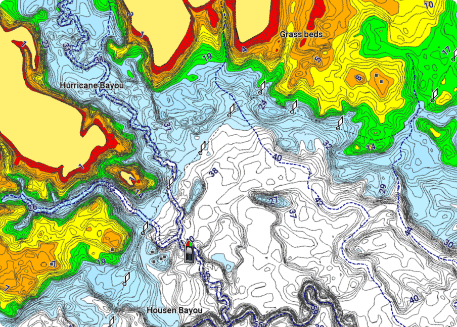
Relief Shading
Highly detailed shading combines colour and shadow to provide an easy-to-interpret, clearer view of bottom structure than contour lines alone.
One-year subscription included in Garmin Navionics Vision+ cartography
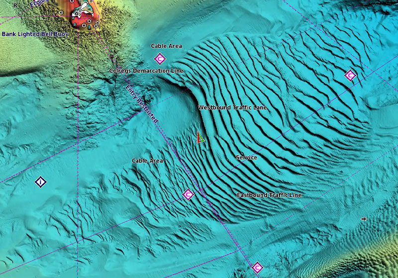
High-Resolution
Satellite Imagery
High-resolution satellite imagery provides superior situational awareness.
One-year subscription included in Garmin Navionics Vision+ cartography; requires download from the ActiveCaptain app
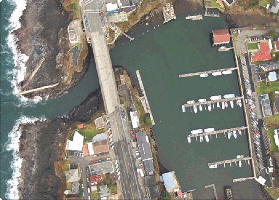
Aerial Photography
Crystal-clear aerial imagery of ports, bridges, docks, navigational landmarks and more provides a better sense of your surroundings above the waterline.
Included in Garmin Navionics Vision+ cartography
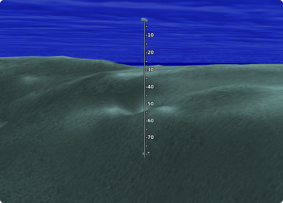
3D Fisheye View
This underwater perspective shows 3D representation of bottom and contours as seen from below the waterline. Interface with sonar data for a customised view.
Included in Garmin Navionics Vision+ cartography
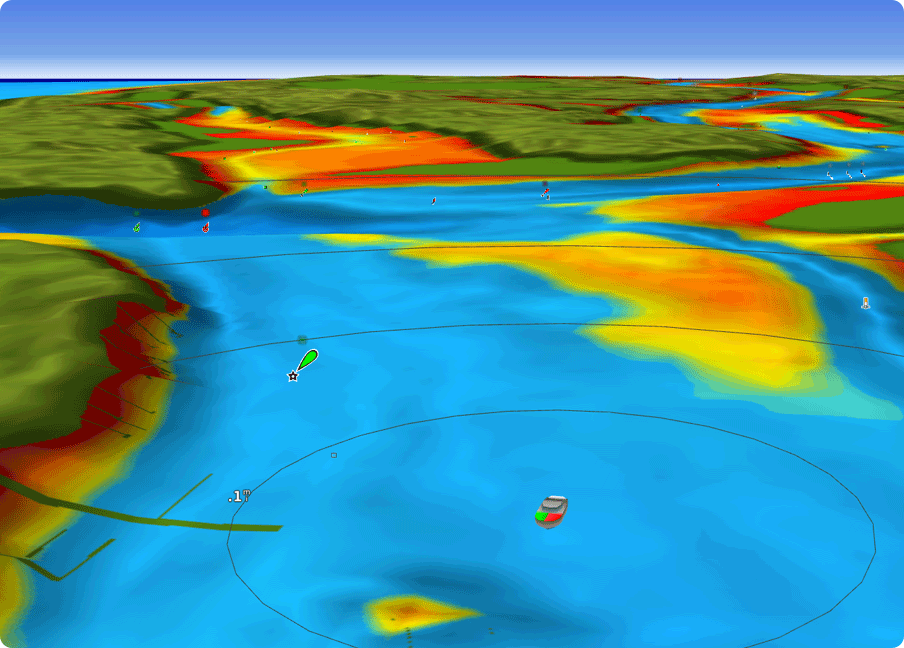
3D Marinereye View
This view provides a 3D representation of the surrounding area both above and below the waterline.
Included in Garmin Navionics Vision+ cartography
| Garmin Navionics+ | Garmin Navionics Vision+ | |
|---|---|---|
| Coastal Content | • | • |
| Inland Content | 44,000+ lakes | 44,000+ lakes |
| Detailed Nautical Charts | • | • |
| Up To 1' Contours | • | • |
| Daily Updates1 | Via ActiveCaptain App | Via ActiveCaptain App |
| Auto Guidance+ Technology2 | • | • |
| ActiveCaptain® App Support | • | • |
| ActiveCaptain Community | • | • |
| Depth Range Shading | • | • |
| Shallow Water Shading | • | • |
| Dynamic Lake Level | • | |
| Relief Shading1 | • | |
| High-Resolution Satellite Imagery1 | Via ActiveCaptain App | |
| Aerial Photography | • | |
| Side Scan Images | • | • |
| 3D Fisheye View | • | |
| 3D Marinereye View | • |
| Coastal Content | |
| Garmin Navionics+ | • |
| Garmin Navionics Vision+ | • |
| Inland Content | |
| Garmin Navionics+ | 44,000+ lakes |
| Garmin Navionics Vision+ | 44,000+ lakes |
| Detailed Nautical Charts | |
| Garmin Navionics+ | • |
| Garmin Navionics Vision+ | • |
| Up To 1' Contours | |
| Garmin Navionics+ | • |
| Garmin Navionics Vision+ | • |
| Daily Updates1 | |
| Garmin Navionics+ | Via ActiveCaptain App |
| Garmin Navionics Vision+ | Via ActiveCaptain App |
| Auto Guidance+ Technology2 | |
| Garmin Navionics+ | • |
| Garmin Navionics Vision+ | • |
| ActiveCaptain® App Support | |
| Garmin Navionics+ | • |
| Garmin Navionics Vision+ | • |
| ActiveCaptain Community | |
| Garmin Navionics+ | • |
| Garmin Navionics Vision+ | • |
| Depth Range Shading | |
| Garmin Navionics+ | |
| Garmin Navionics Vision+ | • |
| Shallow Water Shading | |
| Garmin Navionics+ | • |
| Garmin Navionics Vision+ | • |
| Dynamic Lake Level | |
| Garmin Navionics+ | |
| Garmin Navionics Vision+ | • |
| Relief Shading1 | |
| Garmin Navionics+ | |
| Garmin Navionics Vision+ | • |
| High-Resolution Satellite Imagery1 | |
| Garmin Navionics+ | |
| Garmin Navionics Vision+ | Via ActiveCaptain App |
| Aerial Photography | |
| Garmin Navionics+ | |
| Garmin Navionics Vision+ | • |
| Side Scan Images | |
| Garmin Navionics+ | • |
| Garmin Navionics Vision+ | • |
| 3D Fisheye View | |
| Garmin Navionics+ | |
| Garmin Navionics Vision+ | • |
| 3D Marinereye View | |
| Garmin Navionics+ | |
| Garmin Navionics Vision+ | • |
Quick Links


Like our products?
Create an account to receive news, tips and promotions.
Your overall experience with Navionics will greatly improve.
Create accountFor preprogrammed charts bought in-store or online, the subscription needs to be activated.
Garmin Navionics+ or Garmin Navionics Vision+ cartography requires that your compatible chartplotter software is updated to the January 2022 software release, which is conveniently preprogrammed on the cartography cards. The software is also available for download from the ActiveCaptain app or via Garmin Express™ software.