
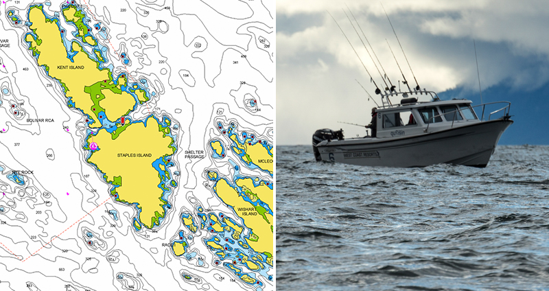
As part of our ongoing product enhancement, we recently added all 127 official Rockfish conservation areas, as designated by Canadian Fisheries and Oceans department, throughout the coast of British Columbia. From Duniria Island in the north all the way to the southern coast of Vancouver island, including the connecting waters and inlets between the Strait of Charlotte and the Strait of Georgia, these protected areas are indicated by a red dashed line within both Nautical Chart and SonarChart™. Each of them offers a detailed list of all allowed recreational and commercial fishing activities.
See the improvements now
Compare your current charts on our Chart Viewer! Boat Safer with the most detailed charts and always have up-to-date information with daily chart updates! If you are an angler, study detailed contours with SonarChart™, SonarChart™ Live and Advanced Map Options, then find your ideal fishing spots and, finally, Fish Smarter!
How to get these updates and enjoy Navionics advanced features
On plotter: choose Navionics+ or Platinum+. If you already have an active subscription, plug your card into a PC to update your charts (learn more). If you have our Boating app, you can update your plotter card wirelessly with Plotter Sync.
On mobile: download any of the paid apps or the free version that provides a 2-week free trial! If you already have an active subscription, open the app and tap Menu > Update All.
Renew your subscription
On plotter: choose one of the available options to easily renew, by simply clicking here.
On mobile: open the app, tap Menu > Charts & Upgrades.


