
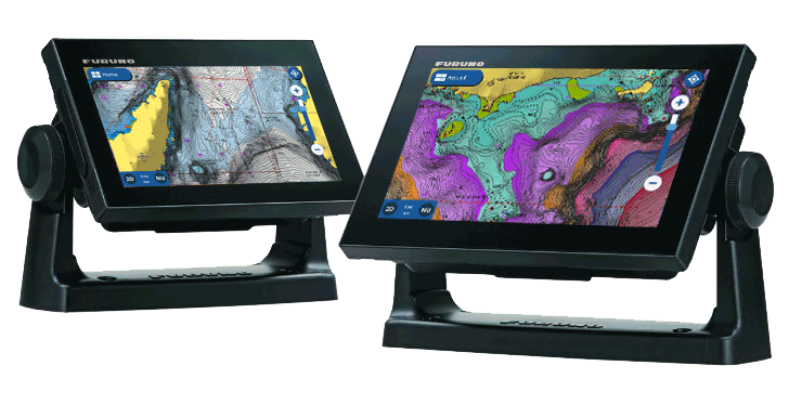
Navionics® has collaborated with Furuno on its latest software update, which makes the Furuno GP-1871F and GP-1971F chartplotters compatible with Navionics®+ and Platinum+™ cards. If you already own one of these plotters, just download the new software released by Furuno and start using Navionics maps.
By using a Navionics card in your Furuno, you can get a new world of charts and features to experience boating, sailing or fishing like never before. By using Navionics+ cartography, you can get nautical charts with all the essential cartographic data from official and private sources, and additional invaluable crowdsourced local knowledge provided by boaters like you through the Community Edits feature.
Need a hand in plotting the course? Tired of having to input multiple waypoints and waste a lot of time when you could be enjoying the day out? Let Dock-to-dock route guidance1 technology be your second officer and do the hard work for you. Just insert the start and end points and a suggested route will get automatically created. Easy, right?
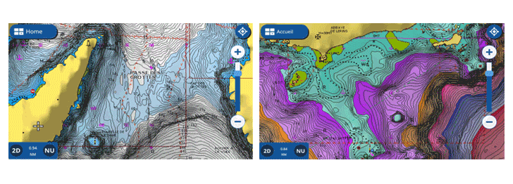
If fishing is your passion, we can’t promise to make the fish bite, but we can definitely put you in the best spot for that to happen with the SonarChart™ bathymetry layer. The 1’ HD contours help you understand depths and bottom detail to locate the best fishing areas. To make it even more powerful, combine it with fishing ranges, a feature that lets you highlight up to five different ranges with different colors to see at a glance where to cast your line. Do you want to know the bottom condition in real time? Use the SonarChart™ Live mapping and see the new contours appear on your screen while you move on the water, and no fish will be able to hide from you.
Do you need more from your charts? Then Platinum+ cartography is what you’re looking for — with all the Navionics+ content plus panoramic photos, 3D view and premium shading overlays. Take your fishing to the next level. Get a unique perspective of underwater topography with the SonarChart™ Shading and relief shading overlays to get a clearer view of bottom structure than contour lines alone. Clearly see channels, drop-offs and other structures over a wide area. Search the map for visual cues to identify fish-holding structure on inland lakes and coastal fisheries.
Oh, and one last thing, remember that we constantly enhance our charts with new and amended content from official hydrographic sources, public and private surveys, and millions of contributions from boaters. We make up to 5,000 daily updates, which affect all our chart layers, so when you go out on the water you always have the most updated information available.
Get the charts trusted by millions of boaters like you! Buy a Navionics+ or Platinum+ product online or visit your favorite dealer.
1Route guidance is for planning purposes only and does not replace safe navigation operations.


