
We are the only electronic chart manufacturer in the boating industry to provide daily updates, giving our customers confidence that they have the most current charts every time they go boating.
Because nautical charts, navigational aids and water depths change frequently we continuously seek out and acquire new data from public and private sources, and conduct proprietary surveys. Our talented cartography experts utilize our sophisticated proprietary software systems to analyze, vet and integrate this data. The result is more than 2,000 updates to our charts every day.
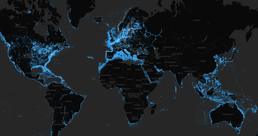
To demonstrate the size and scope of the changes we make over time, we’ve created a tool that provides our worldwide updates at a glance with three time-period filters.
The Navionics Heatmap provides a visual and interactive representation of the quantity and the position of each update brought to the map in the last two years. It is the factual demonstration of how dynamic and thorough the Navionics database is and of the amount of work we put into it.
Going forward, we expect to update the HeatMap weekly plus add new features.
TIP: To access daily updates with your GPS plotter card, activate it and download.


