
Limited-time offer. Save $30 USD on Platinum+ marine charts and HotMaps Platinum lake maps throughout the month of May when you buy from a dealer or shop our online store.
Want it all? Platinum products include the same chart content and advanced features as Navionics+ and offer additional viewing options.
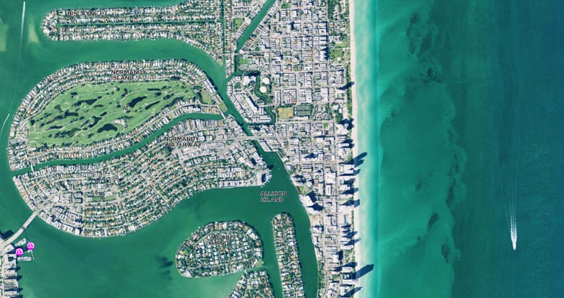
SonarChart™ Shading Coming Soon*
Embedded within the Satellite overlay content layer, SonarChart Shading provides a detailed rendering of the seafloor to deliver a unique, at-a-glance perspective of underwater topography at a glance.
Enhance your boating experience with panoramic photos, 3D View and the new, combined Satellite overlay with SonarChart Shading layer.
Platinum+ coverage areas are available worldwide, while HotMaps Platinum covers more than 24,000 lakes throughout U.S. and Canada. Check our compatibility guide for a complete list of compatible models from B&G, Humminbird, Lowrance, Raymarine, and Simrad.
Sale prices may vary. Use discount code “platinum30” when purchasing on our online store.
If you currently own a HotMaps Platinum or Platinum+ card with an expired subscription, you may be eligible to save up to 50% by either renewing online using our Chart Installer or ordering a new card. Offers cannot be combined.
*As coverage areas are released, customers who own a Platinum+ or HotMaps Platinum chart with an active subscription will be able to download the combined satellite overlay and SonarChart™ Shading layer for their region via the Chart Installer.


