
As part of our daily effort to bring you the newest and best charts available, we have updated more lakes in the U.S. with data from multibeam surveys. Now, you will have a better view of submerged structures and lake contours, including previously unmapped areas.
Toledo Bend is connected to the Sabine River and sandwiched between East Texas and Louisiana. The lake is 65 miles by 10 miles wide and is considered to be the largest lake in the South. It is also the fifth largest man-made reservoir in the U.S.
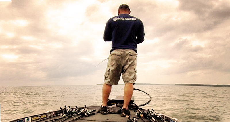
Fishing the Toledo
Toledo Bend is an important resource for the area. Not only does it produce hydroelectric power, but it is also a major water source for both Texas and Louisiana. With 1,200 miles of shoreline and 185,000 acres of lake area, Toledo Bend attracts a wide variety of recreational activities. These include swimming, boating, picnicking, fishing, camping, hunting, and sightseeing.
The lake is a popular spot for fishing and hosts a number of fishing tournaments throughout the year. The most notable professional tournament is sponsored by FLW (Fishing League Worldwide).
Toledo Bend is home to plenty of fish species. There are four species of bass including white and striped bass, Black and White Crappie, eight species of catfish, and twelve species of sunfish. Others include perch, pickerel, eel and alligator gar.
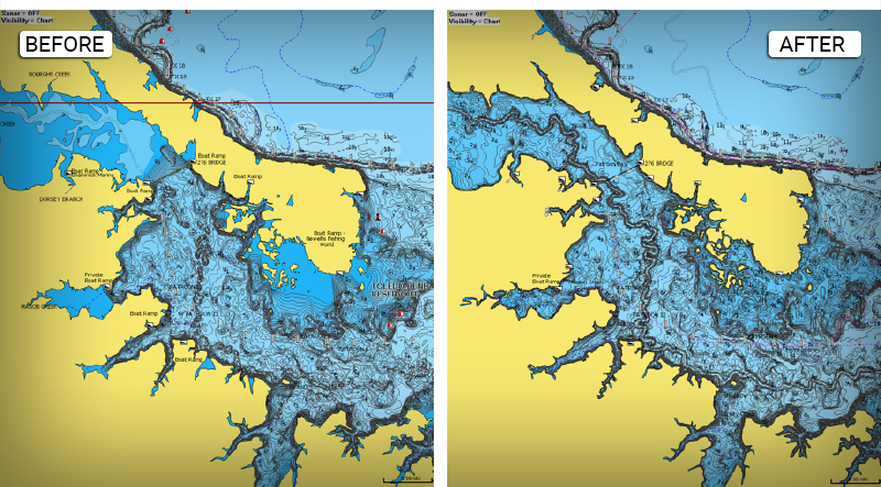
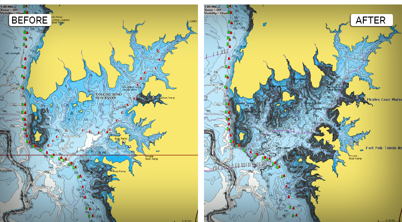
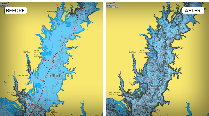
Shallow draft boats are recommended in order to get to those spots full of debris and flooded timber. With the new updates, boaters can feel more confident navigating Toledo Bend. The updated cartography clearly shows boat lanes and more accurate details marked around the shorelines and shallow areas.
Have a look at some of the updates:
NEW CHARTED AREAS ALONG THE TEXAS SIDE OF THE LAKE
SHALLOW AREAS CLEARLY DEFINED AROUND THE BRANCHES
NEW AREA CHARTED AND BOAT PATH CLEARLY DEFINED
Other lakes recently released include:
TN – Fort Loudoun
TN – Norris Lake
TN – Nickajack Lake
TN – Chickamauga
TX – Belton Lake
TX – Lewisville
TX – Palestine Lake
TX – Whitney Lake
TX – Travis
TX – Lewisville Lake
GET UPDATED CHARTS!
With an active subscription
- Have a plotter card? Plug your card into a PC and download our Chart Installer. Or, if you also have our Boating app, do it wirelessly with Plotter Sync. Download
- Have the Boating app? Open the app and tap Menu > Update All.
With an expired subscription
- Have a plotter card? Choose one of the available options to easily renew. Renew
- Have the Boating app? On this website, log in with the same account you use in the app. In the top menu select the Account icon > Subscriptions and Renew. Inside the app, tap Menu > Me > Subscription.
IF YOU DON’T HAVE NAVIONICS YET
- Have a plotter? choose Navionics+ Regions South, Navionics+ Large US & Canada or HorMaps Platinum South. Shop Now
- Have a mobile? Download the free Boating Marine & Lakes which provides a trial! Discover


