Dock-to-dock Route Guidance
Dock-to-dock Route Guidance
Let Us Be Your Guide
All autorouting existing today can find a route from A to B only if they are both in open water, while good guidance and planning is most needed in cramped complex waterways with a maze of variables.
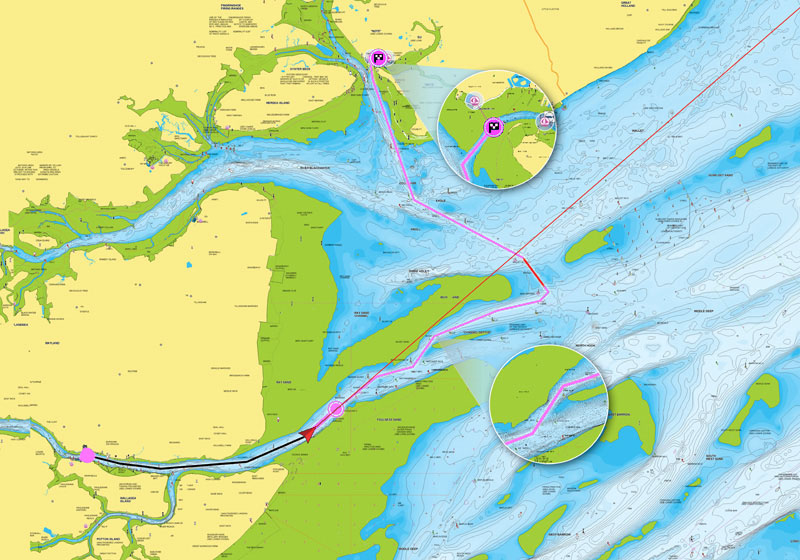
Head to the next destination with Dock-to-dock Route Guidance1. It creates a suggested route, from a real start point to a real end point, based on chart data and navigation aids.
What you can do
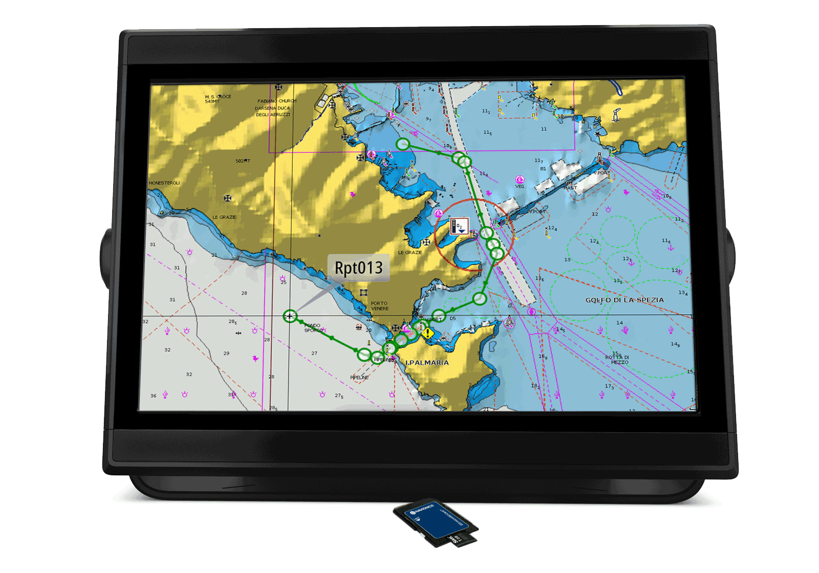
Plan your route
Choose your destination by selecting a point of interest, entering a lat/long or by tapping on the map. Dock-to-dock Route Guidance calculates a suggested route.
View details
You can see your estimated fuel consumption, distance and ETA.
Observe precautions
Suggested routes even highlight precautions along the way for shallow water and other hazards.
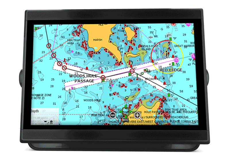
GPS Plotter
Dock-to-dock Route Guidance is possible on Humminbird, Raymarine (see video) and on Onwa, Lowrance, Simrad, and B&G models.
Dock-to-dock Route Guidance is possible on most GPS plotter models. Verify our compatibility list to see requirements.
Before using this feature, make sure to enter your boat settings into your chartplotter system. Learn more.
Discover Our Other Advanced Features
SonarChart™ Live
Create 1 ft/0.5 m HD bathymetry maps of your favorite areas in real time!
Learn more
Advanced Map Options
Highlight shallow areas, adjust SonarChart™ density, and target a fishing range!
Learn more
Plotter Sync
Connect your plotter and mobile to transfer routes & markers and update your charts wirelessly.
Learn more
The Navionics Subscription
When you purchase any new product, a one year subscription to daily updates and many advanced features is included. The subscription needs to be activated.
GPS Plotter Cards
What you get:
- Download of chart layers
- Daily Updates
- Dock-to-dock Route Guidance1
- Advanced Map Options
- Plotter Sync
- Satellite Overlay with SonarChart Shading
- Relief Shading
Check if your GPS plotter model is compatible with advanced features and make sure it is running the latest software.