
Sonar Imagery
Sonar Imagery
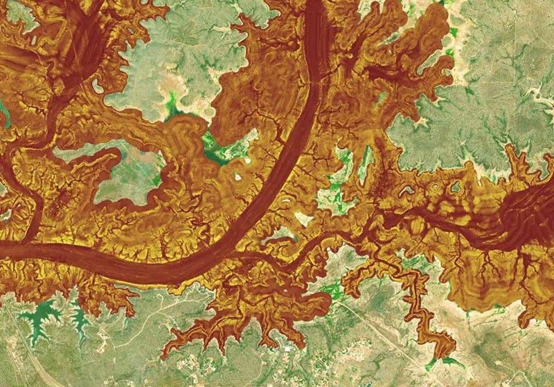
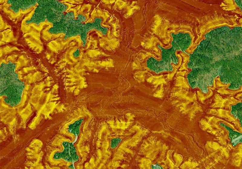
Bottom Hardness at a Glance
The sonar imagery feature reveals bottom hardness clearly and in vivid color, highlighting both subtle and dramatic transition areas.
Find the Best Fishing Spots
Sonar imagery is generated from proprietary multibeam surveys. An angler can use it as a reference to better understand the structural characteristics and bottom composition (rocky, sandy, vegetation, roadbeds, etc.) that can inform their fishing strategies.
How to Get Sonar Imagery
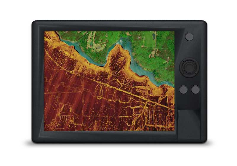
GPS Plotter
Included as a downloadable option with Platinum cards, it can be viewed with compatible models from many brands. Check compatibility
Already have a Platinum card? With an active subscription, you can download it through the Chart Installer.
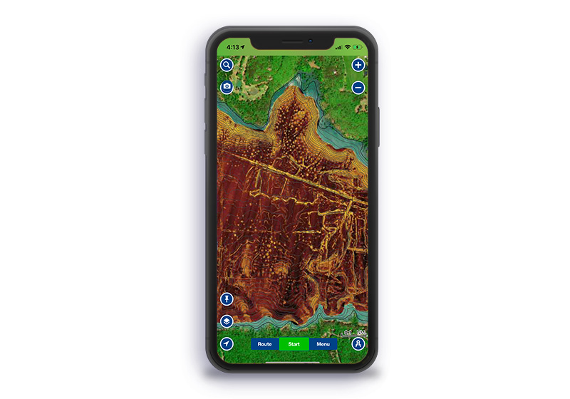
Mobile
With an active subscription, you can download the data and then, from the Map Options section, easily overlay sonar imagery on our chart layers.
Sonar Imagery Coverage
The Navionics Subscriptions
When you purchase any new product, a one year subscription to daily updates and many advanced features is included. The subscription requires activation.
GPS Plotter Cards
What you get:
- Download of chart layers
- Daily Updates
- Dock-to-dock Route Guidance1
- Advanced Map Options
- Plotter Sync
- Satellite Overlay with SonarChart Shading
- Relief Shading
- Sonar Imagery
Check if your GPS plotter model is compatible with advanced features and make sure it is running the latest software.
Subscription expired? After one year, you can purchase a renewal. If you don’t, you can still use your chart layers and download the rest of your coverage area.
The above mentioned advanced features or the download of chart updates require an active subscription.
Mobile App
With an active marine chart subscription within the Navionics Boating app, you can download detailed charts and marine data that can be used offline, plus get suggested routes using Auto Guidance+2 technology, daily updates, chart overlays, HD bathymetry, crowdsourced local information and much more. In addition to all the great chart content, the one-year renewable3 subscription offers daily updates and powerful advanced features accessible on or off the water.

Discover Our Other Overlays
Like our products?
Create an account to receive news, tips and promotions.
Your overall experience with Navionics will greatly improve.
Create account¹ Auto Guidance+ is for planning purposes only and does not replace safe navigation operations.
Charts, overlays, daily updates and advanced features are not accessible after the subscription expires.