
Home Page
How to Use Your Navionics GPS Card
What Is Your Passion?
Charts for Navionics Compatible Chartplotter Brands
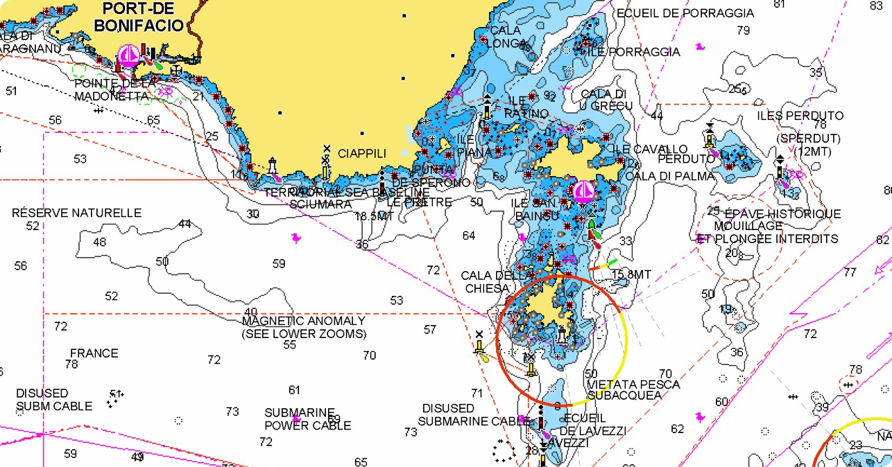
Integrated offshore and inland marine mapping content with rivers, bays and more than 44,000 lakes around the world.
Recommended products
Own a card from another brand?
Switch to Navionics and download the most up-to-date Navionics+ chart content at a great price.
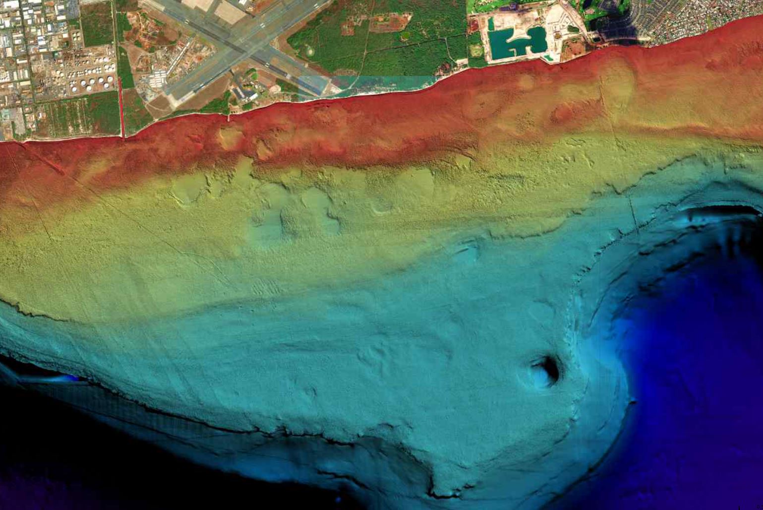
3D technologies by GeoMind – www.geomind.it