
As part of our ongoing product enhancement efforts, we have recently added hundreds of fish attractors to lakes in Alabama and Tennessee. These are in addition to approximately 2,000 fish attractors added to Kansas, South Carolina, Texas and Kentucky lakes earlier this year. The location of each is marked with a fish symbol and visible in both Nautical Chart and SonarChart™. Many of these fish habitats are constructed of brush piles, PVC cane trees and stake beds.
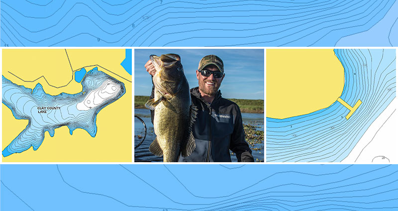
In Alabama, 260 fish attractors were added to 25 lakes: Cedar, Chambers County, Clay County, Dallas County, Dekalb County, Escambia County, Fayette County, Holt, Jordan, Lamar County, Lee County, Lewis Smith, Little Bear, Logan Martin, Madison County, Marion County, Mitchell, Martin, Neely Henry, Upper Bear, Walker County, Eufaula, Washington County, Weiss, and West Point.
In Tennessee, 216 fish attractors were added to 6 lakes: Center Hill Lake, Chickamauga, Cordell Hull, Kentucky Lake, Nickajack and Watts Bar.
See the improvements now
Compare your current charts on our Chart Viewer! Boat Safer and Fish Smarter with the most detailed charts and SonarChart™ – our 1 ft HD bathymetry map! And always have the most up-to-date information with daily chart updates!
Enjoy Navionics advanced features
Dock-to-dock Autorouting, SonarChart™ Live, Advanced Map Options and Plotter Sync on mobile and plotter.
On your plotter
Choose Navionics+, HotMaps Platinum or update your plotter card online.
On your mobile
Get the same charts with our free Boating app, that provides a 2-week trial! If you already have any of our apps, keep your charts up to date with Menu > Update All.


