
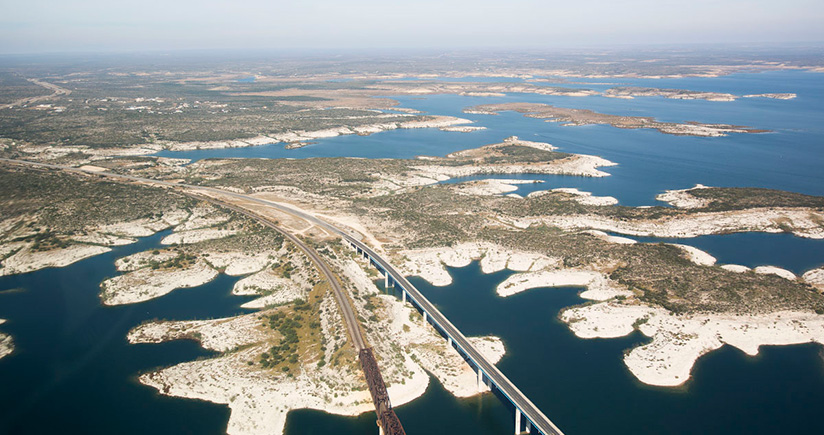
Driven by a passionate commitment to support our customers’ enjoyment on the water, we continuously enrich our chart content on popular boating and fishing areas around the world. As part of this ongoing product enhancement, we recently updated the Amistad Reservoir, also known as Lake Amistad, in southwestern Texas.
Bordered by the United States and Mexico, this large, deep reservoir was formed in 1969 on the Rio Grande at its confluence with the Devils River with the construction of the Amistad Dam. The remarkably clear and warm waters, surrounded by low, shrub-covered limestone hills, cover a wide range of complex underwater rock formations, submerged creeks and riverbeds.
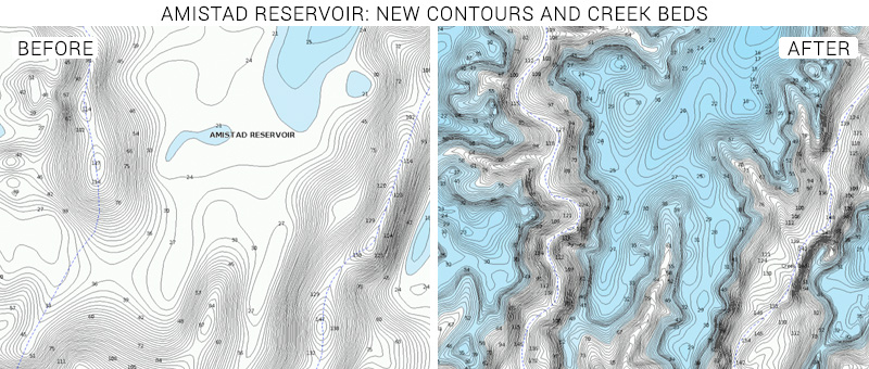
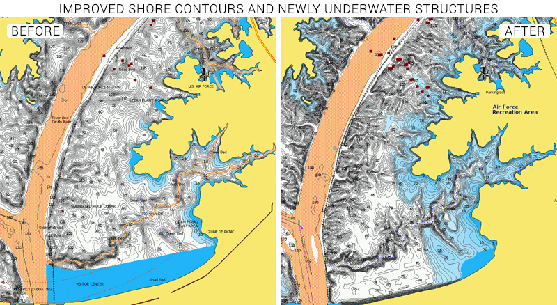
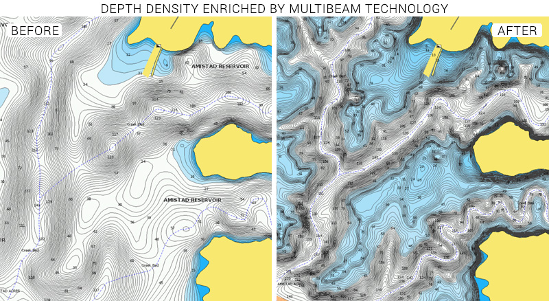
Our recently completed chart update includes more defined coastline contours and bathymetry throughout the lake improved by state-of-the art data from high-definition multibeam surveys. Shallow waters, depth levels, and submerged rivers and creeks highlighted as seabed areas are visible at first sight, and more submerged buildings are clearly marked.
Anglers can gain a better understanding of lake’s holes, humps, drop-offs and channels using SonarChart Shading, a new feature embedded within the satellite overlay content layer of HotMaps Platinum plotter charts. Varying shades of blue reveal a detailed rendering of the lake bottom to deliver a unique perspective of the underwater topography at a glance.
Amistad Reservoir is stocked with many fish species such as largemouth bass, smallmouth bass, white bass, striped bass, Guadalupe bass and catfish, making it an attractive destination for recreational fishing. Largemouth bass are the most popular and abundant sportfish in the reservoir, where nationally-televised fishing tournaments take place every year.
On the Texas side of the lake, current statewide regulations apply to all species, but recreational anglers also need a Mexican fishing license, which can be purchased at several retail shops in Del Rio.
The Amistad National Recreation Area, a park unit managed by National Park Service (NPS), offers additional opportunities as picnicking, hiking, camping, hunting, and year-round water-based opportunities such as boating, kayaking, swimming, scuba diving and water-skiing. The area is also rich in archeology and prehistoric rock arts.
Before heading to this beautiful reservoir, don’t forget to update your mobile or plotter charts to take advantage of our latest edits.
Check out some examples below and browse your areas of interest on our Chart Viewer:
Learn more about chart updates and discover our latest changes
GET UPDATED CHARTS!
With an active subscription
- Have a plotter card? Plug your card into a PC and download. Or, if you also have our Boating app, do it wirelessly with Plotter Sync. Download
- Have the Boating app? Open the app and tap Menu > Update All.
With an expired subscription
- Have a plotter card? Choose one of the available options to easily renew. Renew
- Have the Boating app? Open the app, tap Menu > Charts & Upgrades.
IF YOU DON’T HAVE NAVIONICS YET
- Have a plotter? choose Navionics+ Regions South or HotMaps Platinum South. Shop Now
- Have a mobile? Download the free Boating Marine & Lakes app that provides a trial! Discover


