
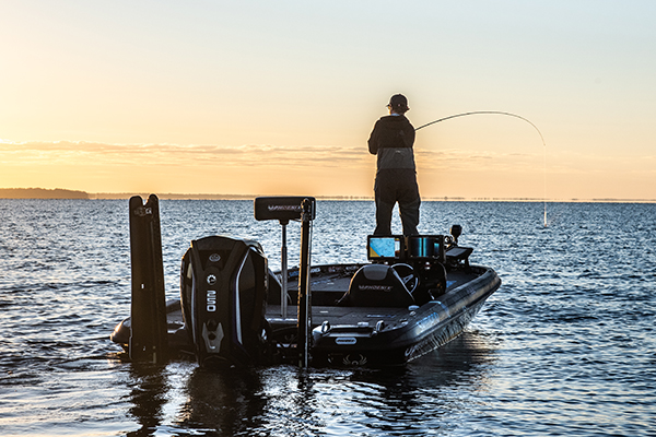
At Navionics, we continuously enhance our products and technology to provide our customers with the best possible experience, the most complete details, and relevant content. As part of our ongoing product enhancement, we recently updated Lake Greeson, a reservoir on the Little Missouri River, with hi-resolution multibeam survey data.
What’s New on Lake Greeson?
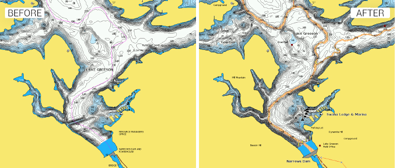
Extended coverage is noticeable on much of the lake’s shoreline. Giving anglers increased understanding of the shallow waters that are likely to hold fish during the spring spawn as well as largemouth bass in the heat of the summer!
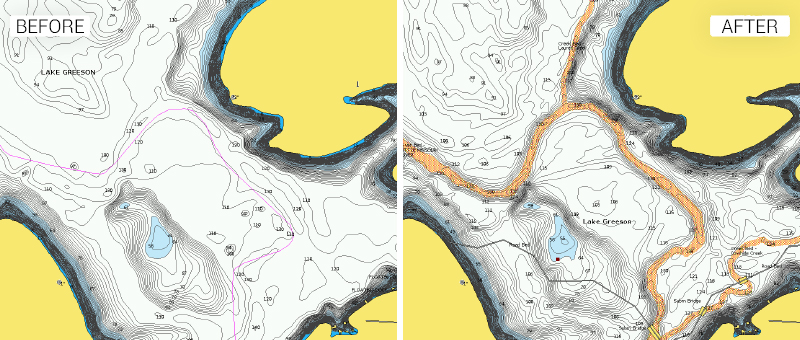
Submerged creek, river and road beds are now clearly marked on the chart. Hit these areas when you’re targeting species like spotted bass or striped bass that can typically be found lurking near rock piles ready to ambush their prey.
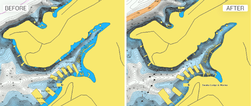
Mooring buoys are now marked in front of Kirby Landing and Marina near Daisy State Park and Swaha Lodge and Marina located next to the Narrows Dam.
Click here to see the full lake on our interactive chart viewer. If you’re an avid angler, check out this article that details recent fish attractors added to Lake Greeson in late 2017. Learn more about other chart updates and discover our latest changes!
GET UPDATED CHARTS!
With an active subscription
- Have a plotter card? Plug your card into a PC and download. Or, if you also have our Boating app, do it wirelessly with Plotter Sync. Download
- Have the Boating app? Open the app and tap Menu > Update All.
With an expired subscription
- Have a plotter card? Choose one of the available options to easily renew. Renew
- Have the Boating app? Open the app, tap Menu > Charts & Upgrades.
IF YOU DON’T HAVE NAVIONICS YET
- Have a plotter? Choose Navionics+ South, Navionics+ US & Canada or HotMaps Platinum South!
- Have a mobile? Download the free Boating Marine & Lakes app that provides a 2-week trial! Shop Now


