
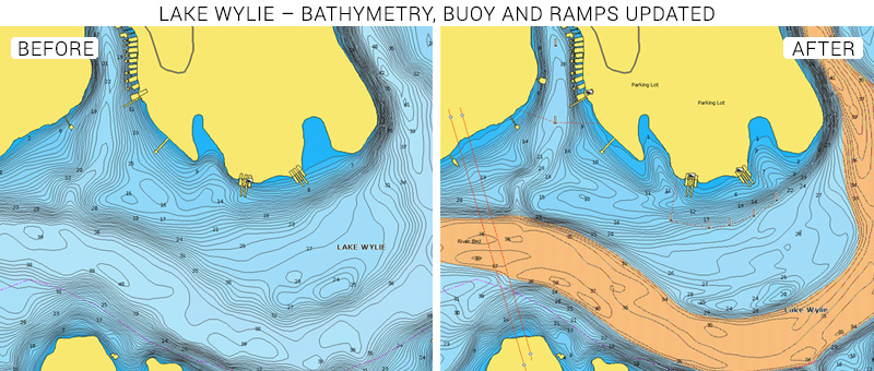
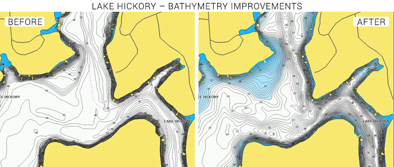
At Navionics we continuously enhance our products and technology to provide our customers with the best possible experience, the most complete details and the most relevant content. As part of our ongoing product enhancement, we recently improved Lake Hickory in North Carolina and Lake Wylie on the two Carolinas border.
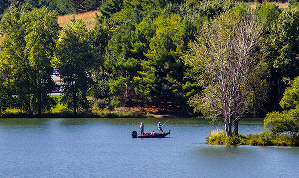
The two are among the many man-made lakes created by the inbounding of the Catawba River. They are well known recreational areas for outdoor lovers where it’s possible to enjoy a variety of water activities like boating, sailing, kayaking and fishing. Bonus point for all the diving enthusiasts: you can scuba diving in Lake Hickory thanks to clear waters that characterize it.
The amazing shores of Hickory and Wylie are populated with various ramps, where you can access the lake with your own boat, and marinas where you can rent different craft and canoes to explore the area.
With our latest release, we added some ramps, introduced new buoys and updated the positions of current ones.
But the big news is that we have done an extensive bathymetry update providing you more data than ever before. Now you will be able to spot at a glance the best anchorage places, the perfect spot to scuba dive or the areas where your sailboat can easily pass. Plus, if you are an angler, this update will help you bring out your fishing A-game, by pinpointing the right places to cast your line, like ledges, drop-offs, holes and underwater rivers. Just remember to switch from Nautical Chart to SonarChart™ to see 1ft contours.
Oh, and if you have never been to Lake Hickory or Wylie, know that both have a wide variety of fish , such as largemouth bass, channel catfish, blue catfish, black crappie, white crappie, white bass and white perch.
Tip: Do you want to take your fishing to a Pros level? Then SonarChart Shading is the tool you are looking for. Created from the high-definition contour data within SonarChart, SonarChart Shading presents a detailed rendering of lake bottoms delivering a unique perspective of underwater topography at a glance.
See the improvements now
Browse your areas of interest on our Chart Viewer, check out some examples below:
Learn more about chart updates and discover our latest changes
GET UPDATED CHARTS!
With an active subscription
- Have a plotter card? Plug your card into a PC and download. Or, if you also have our Boating app, do it wirelessly with Plotter Sync. Download
- Have the Boating app? Open the app and tap Menu > Update All.
With an expired subscription
- Have a plotter card? Choose one of the available options to easily renew. Renew
- Have the Boating app? Log in on the website with the same account you use in the app. In the menu select Subscriptions and renew. (Open the app, tap Menu > Charts & Upgrades.)
IF YOU DON’T HAVE NAVIONICS YET
- Have a plotter? choose Navionics+ East or HorMaps Platinum East. Shop Now
- Have a mobile? Download the free Boating Marine & Lakes app that provides a trial! Discover


