A new tool for anglers to quickly and easily locate fishing spots! In our Boating Marine & Lakes app is now possible to customize the chart view with multiple depth ranges simultaneously, for bottom understanding at a glance!
Customize your map
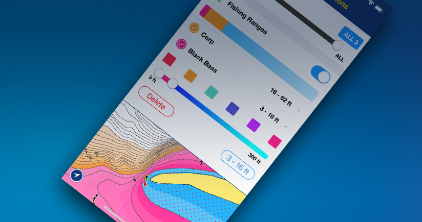
The Fishing Ranges feature allows to customize and display on our SonarChart™ map layer up to 5 depth ranges at the same time! The app interface makes it really intuitive to set: choose a color, select the depth values and name your range: the map will show depth gradients with different color shadings.
Easily plan your fishing trip and target the best place to cast the lure
Have a clear view of bottom depths and choose your fishing area depending on the fish you want to catch. Then move quickly on the water telling with a glimpse holes, submerged islands, steep ledges and drop-offs.
Go fishing in multicolor!
- If you have our Boating app, go to Menu > Map Options and start customizing your maps! To use the new feature, you need an active Navionics+ subscription.
- To renew your subscription go to Menu > Me.
- If you haven’t our Boating app yet, download it for FREE and have a 2-weeks trial. Then, subscribe to the 1-year Navionics+ subscription to continue using Fishing Ranges and many other features!
Download the Boating app now!
Select your device