
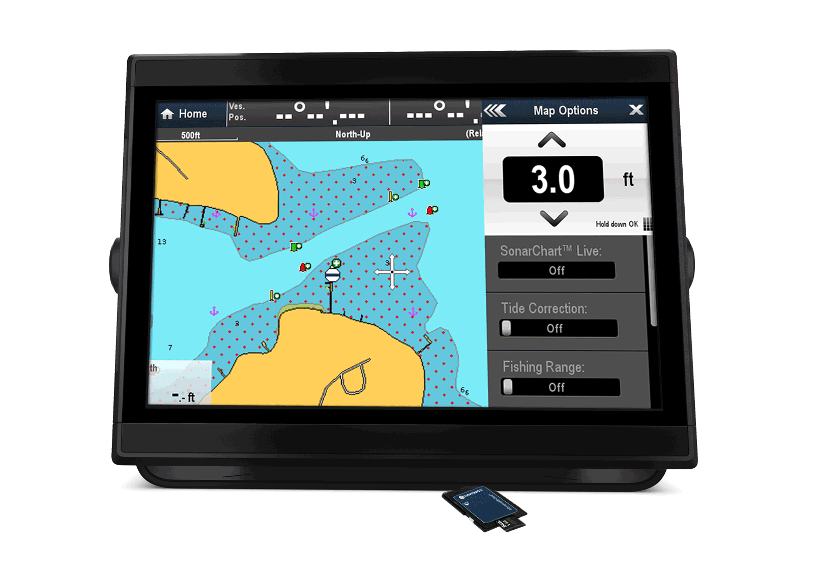
Advanced Map Options
Advanced Map Options
Customize your view
Change the way you view Navionics charts and focus on the details that matter most to you (see video).
What you can do
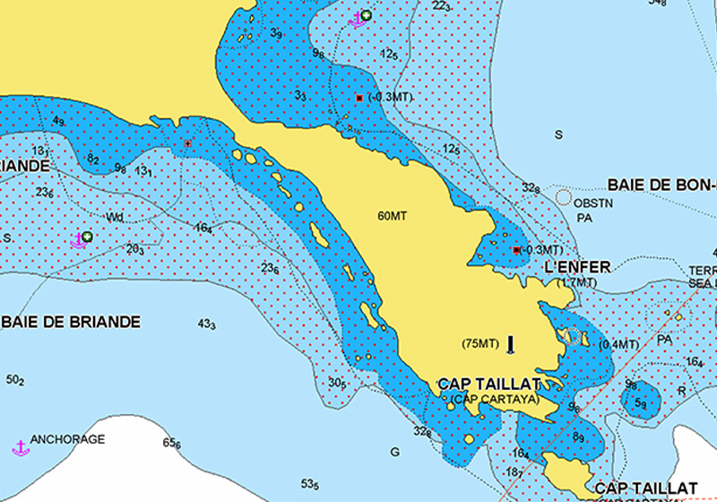
Highlight shallow areas
Whether you want to target shallow areas for sight fishing or avoid damaging your prop, recognize them at a glance by shading up to your preferred depth.
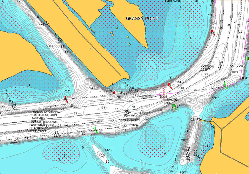
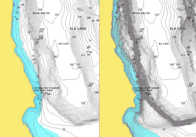
Adjust contour density
Sometimes less is more. Very steep drop-offs can result in overlapping contour lines. Now you can see more clearly by lowering the density level for SonarChart™.
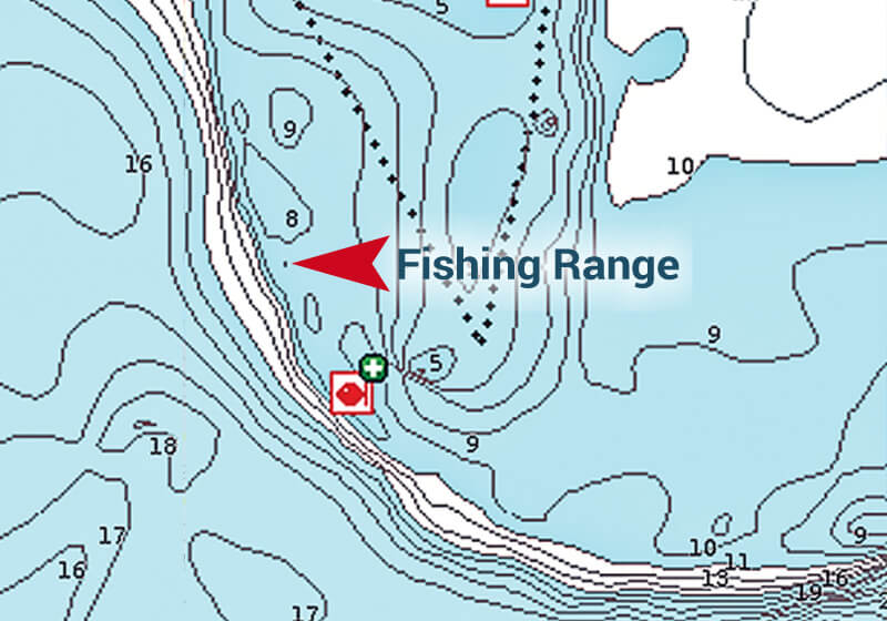
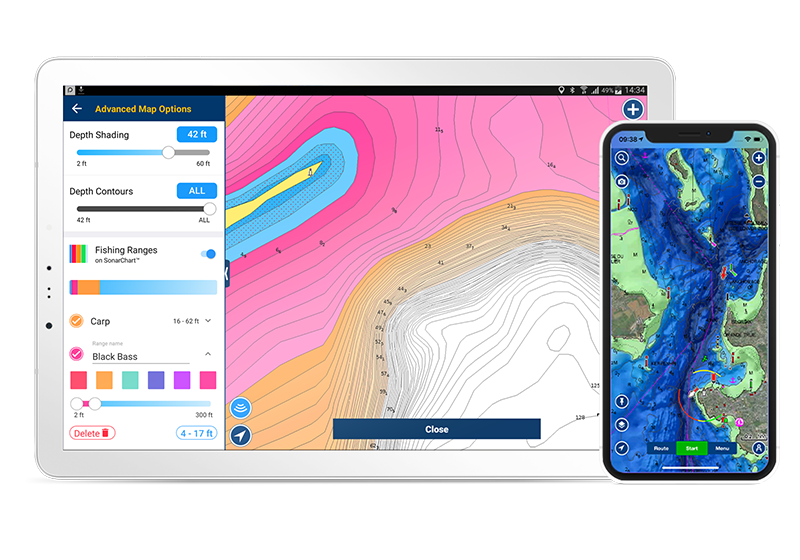
Select a fishing range
When you know the fish are suspended over certain depths, highlight the range so you can quickly identify more places to check out.
Get Advanced Map Options
GPS Plotter
Check the list of compatible chartplotters, and learn how to set up your model from our support area
Be sure to update your chartplotter's operating software and use a Navionics card that has an active subscription.
Mobile
Advanced Map Options on mobile allow to easily and intuitively choose among different combinations of chart layers-overlays. Use Fishing Ranges, to customize the map with multiple depth ranges simultaneously. Learn more
Discover Our Other Advanced Features
Dock-to-dock Route Guidance1
Create a suggested route, from a real start point to a real end point, based on chart data and navigation aids.
Learn more
SonarChart™ Live
Create 1 ft/0.5 m HD bathymetry maps of your favorite areas in real time!
Learn more
Plotter Sync
Connect your plotter and mobile to transfer routes & markers and update your charts wirelessly.
Learn more
The Navionics Subscriptions
When you purchase any new product, a one year subscription to daily updates and many advanced features is included. The subscription requires activation.
GPS Plotter Cards
What you get:
- Download of chart layers
- Daily Updates
- Dock-to-dock Route Guidance1
- Advanced Map Options
- Plotter Sync
- Satellite Overlay with SonarChart Shading
- Relief Shading
- Sonar Imagery
Check if your GPS plotter model is compatible with advanced features and make sure it is running the latest software.
Mobile App
With an active marine chart subscription within the Navionics Boating app, you can download detailed charts and marine data that can be used offline, plus get suggested routes using Auto Guidance+2 technology, daily updates, chart overlays, HD bathymetry, crowdsourced local information and much more. In addition to all the great chart content, the one-year renewable3 subscription offers daily updates and powerful advanced features accessible on or off the water.
Like our features?
Create an account to receive news, tips and promotions.
Your overall experience with Navionics will greatly improve.
Create accountCharts, overlays, daily updates and advanced features are not accessible after the subscription expires.