
Daily Updates
Update Any Time You Want
Daily Updates
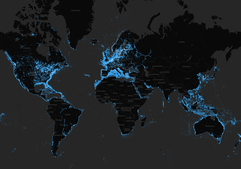
We constantly enhance our charts with new and amended content from official hydrographic sources, public and private surveys, and millions of contributions from boaters.
We make up to 5,000 updates every day affecting all our chart layers. See recent examples.
View our latest charts on the Chart Viewer.
See our worldwide updates instantly, and locate them on our Heatmap.
The Navionics Subscriptions
When you purchase any new product, a one year subscription to daily updates and many advanced features is included. The subscription requires activation.
GPS Plotter Cards
What you get:
- Download of chart layers
- Daily Updates
- Dock-to-dock Route Guidance1
- Advanced Map Options
- Plotter Sync
- Satellite Overlay with SonarChart Shading
- Relief Shading
- Sonar Imagery
Check if your GPS plotter model is compatible with advanced features and make sure it is running the latest software.
Mobile App
With an active marine chart subscription within the Navionics Boating app, you can download detailed charts and marine data that can be used offline, plus get suggested routes using Auto Guidance+2 technology, daily updates, chart overlays, HD bathymetry, crowdsourced local information and much more. In addition to all the great chart content, the one-year renewable3 subscription offers daily updates and powerful advanced features accessible on or off the water.
Don't miss important changes to
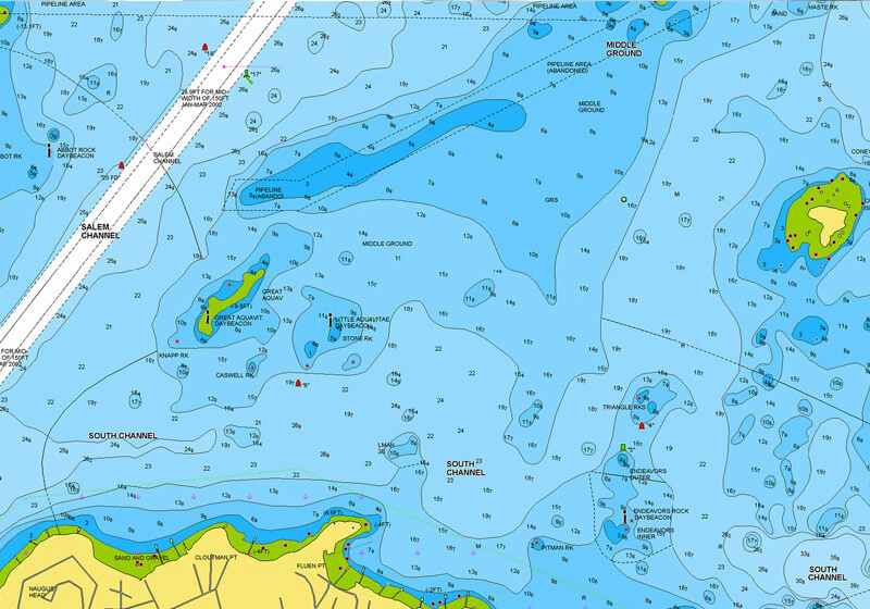
Nautical Chart
SonarChart™
Community Edits
Update Any Time You Want
GPS Plotter Charts
With an active subscription you can keep your charts up to date by inserting your card into a PC, directly or using a card reader. You can also do it from your boat using Plotter Sync.
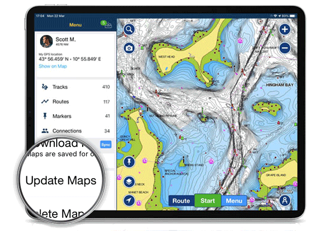
Navionics Boating App
Within the one year subscription, open the app, go to the Menu and tap on Update All Maps.
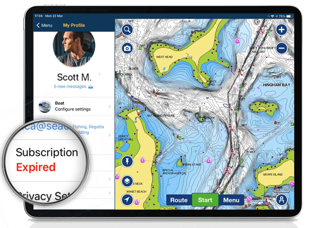
Subscription Expired?
Navionics Boating App
- From navionics.com: go to the Subscriptions section of your account and click on Renew.
- Within the app: Open the app menu and tap on Subscriptions.
Like our features?
Create an account to receive news, tips and promotions.
Your overall experience with Navionics will greatly improve.
Create accountCharts, overlays, daily updates and advanced features are not accessible after the subscription expires.