
Relief Shading
Relief Shading
Easily Interpret Bottom Structure
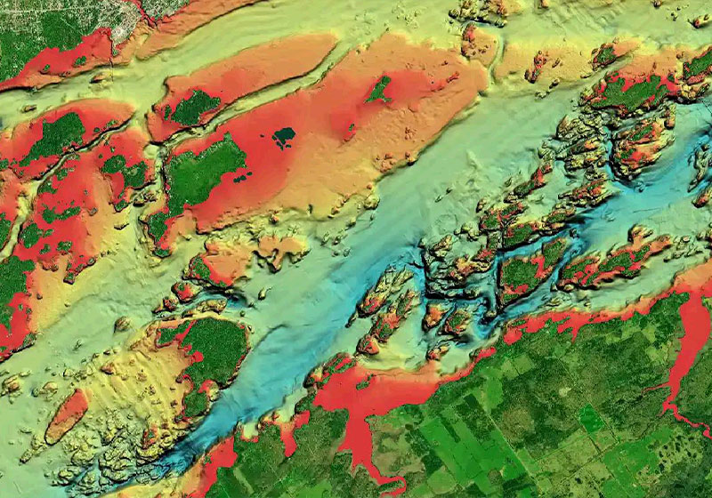
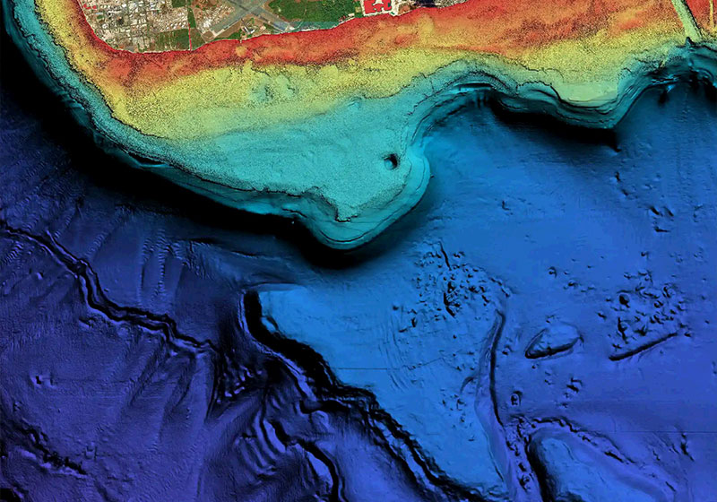
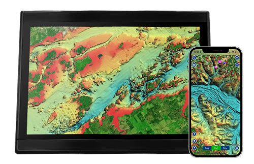
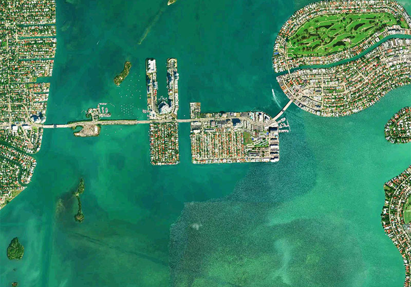
Relief shading delivers highly detailed shading that combines color and shadow to provide an easy-to-interpret, clearer view of bottom structure than contour lines alone.
Identify Topography Quickly
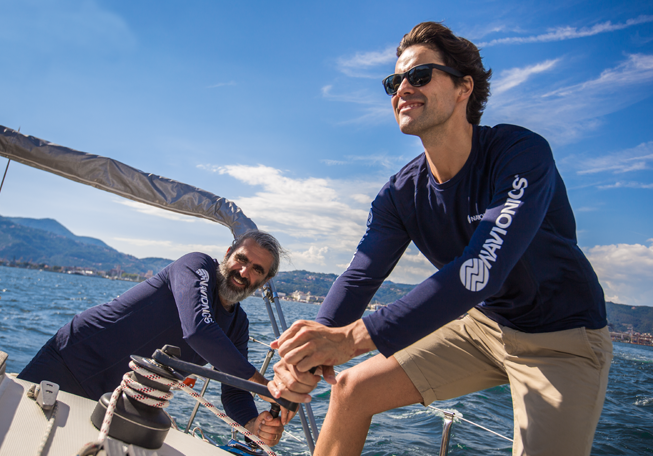
For coastal and inland boat owners who need to know as much as possible about sea and lakes beds, relief shading offers a better understanding of bottom detail for improved fishing and diving.
We use the best data available from our sources.
In some cases, high-resolution data is mixed with low-resolution data to produce a more complete image. The most convenient way to preview relief shading in your area of interest is on the Navionics Boating app.
How to Get Relief Shading
GPS Plotter
Included as a downloadable option with Platinum cards, it can be viewed with compatible models from many brands.
Check compatibility
Already have a Platinum card? With an active subscription, you can download it through the Chart Installer.
Check "How to Display" Tutorials.
Mobile
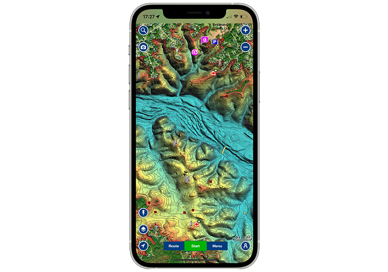
With an active subscription, from the Map Options section of the app you can easily overlay relief shading on our chart layers.
How to download Relief Shading
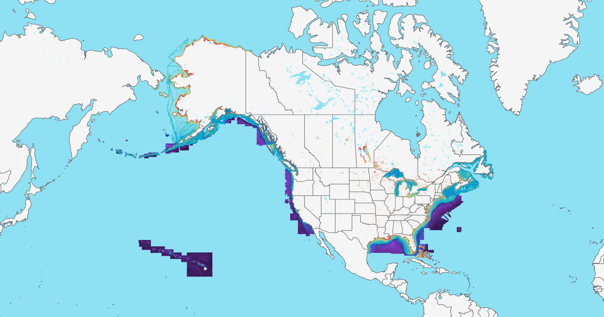
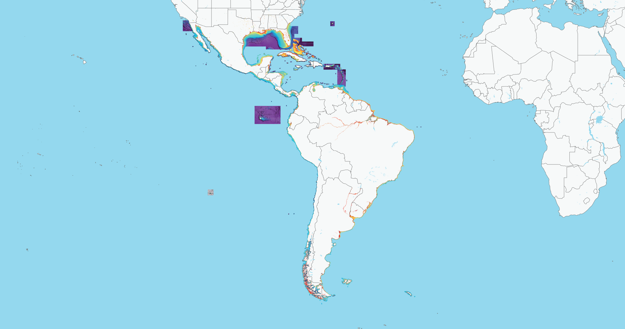
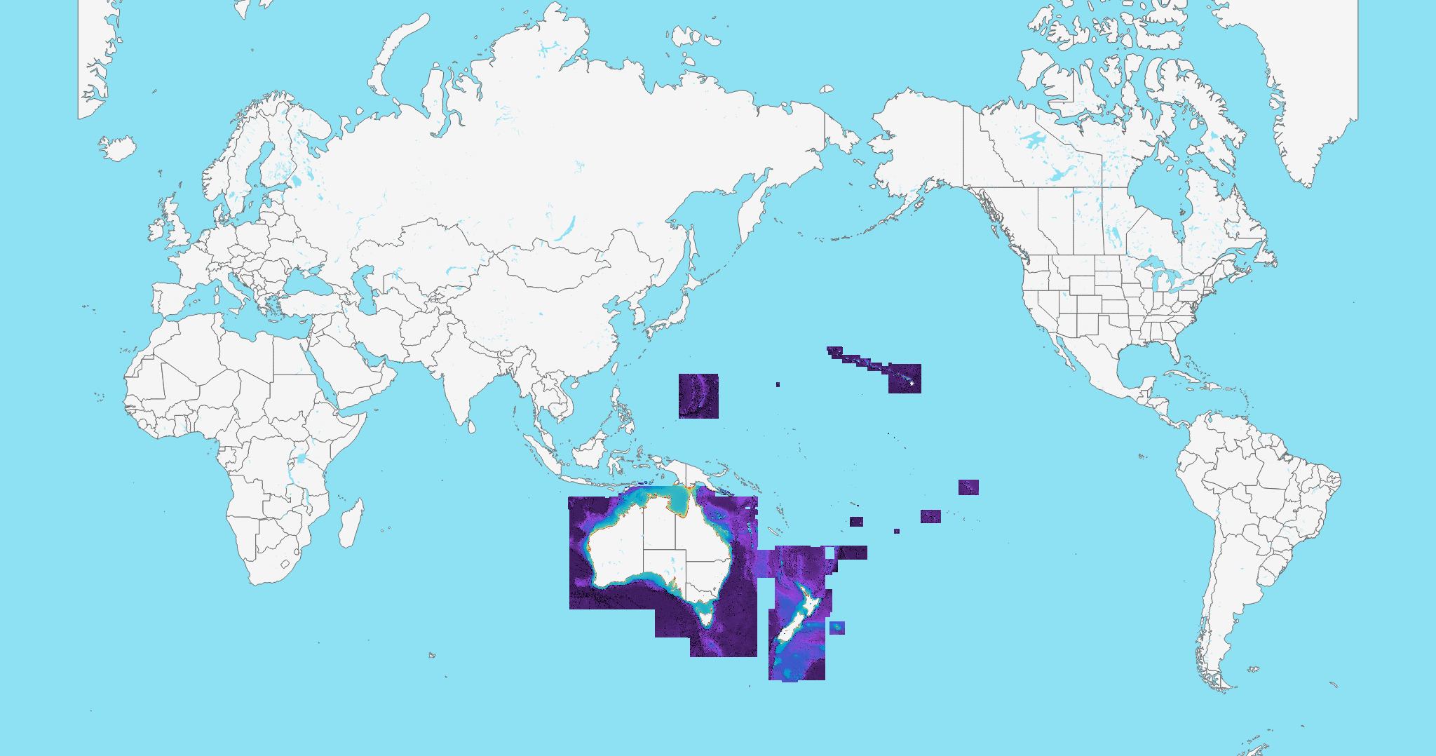
Relief Shading Coverage

Find answers to your relief shading questions here
The Navionics Subscriptions
When you purchase any new product, a one year subscription to daily updates and many advanced features is included. The subscription requires activation.
GPS Plotter Cards
What you get:
- Download of chart layers
- Daily Updates
- Dock-to-dock Route Guidance1
- Advanced Map Options
- Plotter Sync
- Satellite Overlay with SonarChart Shading
- Relief Shading
Check if your GPS plotter model is compatible with advanced features and make sure it is running the latest software.
Mobile App
With an active marine chart subscription within the Navionics Boating app, you can download detailed charts and marine data that can be used offline, plus get suggested routes using Auto Guidance+2 technology, daily updates, chart overlays, HD bathymetry, crowdsourced local information and much more. In addition to all the great chart content, the one-year renewable3 subscription offers daily updates and powerful advanced features accessible on or off the water.
Discover Our Other Overlays
Like our products?
Create an account to receive news, tips and promotions.
Your overall experience with Navionics will greatly improve.
Create accountCharts, overlays, daily updates and advanced features are not accessible after the subscription expires.