
Two new Navionics+ coverage areas are now available for Central and South America.
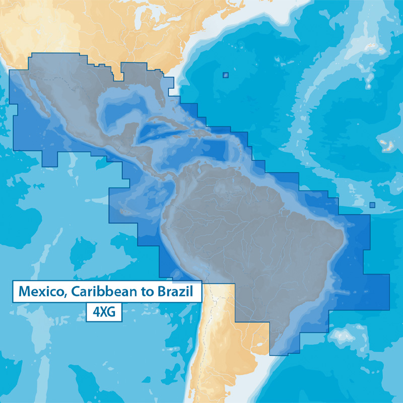
NAV+4XG: Mexico, Caribbean to Brazil
This covers the Atlantic coastal waters from Savannah, Georgia through Brazil, including Bermuda, the Caribbean, the Bahamas and the entire Gulf of Mexico. Coverage continues through the Atlantic coast of South America including the coast of Brazil, Uruguay and stops at the northern border of Argentina. From the Pacific side, coverage starts from Oceanside California and ends at Chile’s northern border. This also includes the Galapagos Islands and U.S. lakes in AL, AZ, FL, GA, southern LA, NM, MS and TX.
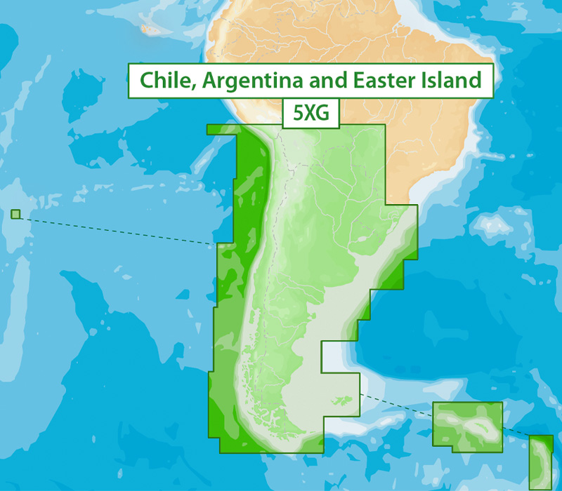
NAV+5XG: Chile, Argentina and Easter Island
This covers the Atlantic coastal waters from southern Brazil around Cape Horn to northern Chile. Includes the Easter, Falkland, South Georgia and South Sandwich Islands.
Navionics+ 4XG and 5XG replace 3XG coverage, which is now discontinued. Customers who own a Navionics+ 3XG chart with an active subscription can still update data for the entire region. Upon renewal however, they will need to select one of the regions.