
When talking about fishing, pinpointing your location is key and this is even more true for ice fishing. So be sure to follow the first rule: start with a plan.
Plan Like a Pro
Before you run to the lake with all your fishing equipment, take a breath, sit down and start planning your day so you’ll have more chances to catch fish.
Crappie, pike, perch and all the other fish, behave differently, so you need to study their habits during the winter period to understand where you might find them.
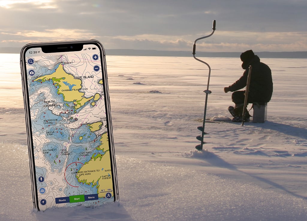
Once you know their habits, the most important thing you can do is to study the lake or river where you plan to go fishing. Pros know lakes better than the back of their hands. Gain the same knowledge studying SonarChart™, the layer where you can see 1 ft contour maps that we have developed to help anglers make the big catch. Follow the contours to read the lake bottom and find the best places to fish, like ledges, humps, steep drop-offs, holes and underwater structure.
If you only own a flasher with no mapping, don’t worry. You can use the Boating app as your cartographic tool.
The Navionics app enables you to analyze a lake foot by foot, study depth ranges and accurately pinpoint fishing spots. It is a powerful tool, because it provides features that will improve your technique, making you more focused and motivated once you get on the ice.
After you’ve identified the best places by studying the map from the comfort of your home, try to divide the area of the lake so that you can drill holes at different depths to find the most productive area. Then focus your effort only where it matters.
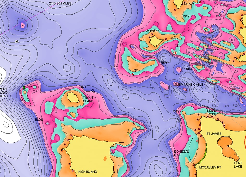
If you want to understand at a glance the different depths, on the app you can customize SonarChart™ using the Fishing Ranges feature highlight up to 5 depth ranges at the same time with different colors. Just choose a color, select the depth values and name your range: the map will show depth gradients with different color shadings.
Ice fishing has a strong social aspect which contributes to its uniqueness. Meeting up with your buddies is now easier with the new GPX import/export feature. Share markers and tracks directly from your phone.
Fish Like a Pro
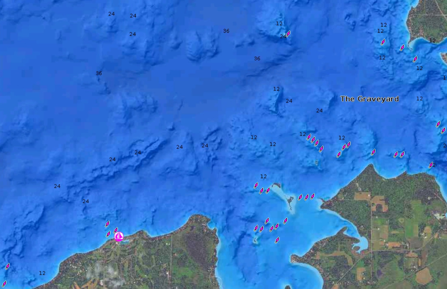
If you want more, try SonarChart Shading on your plotter. This chart layer has been created from the high-definition contours within SonarChart and presents a detailed rendering of the lake bottoms in varying shades of blue. This feature will enable you to visually identify fish-holding structure at a glance and modify the transparency to show the SonarChart contours under it to get the best result.
Map in Fall, Fish in Winter
Gain an edge over your fellow anglers, summer and fall are great times for you to go out on your boat and map the waters. Go boating and use the SonarChart Live advanced feature to easily create your maps in real time while the boat moves. You can use this feature also to create charts for smaller uncharted lakes. Easily do it on your plotter or mobile, learn how here.


