
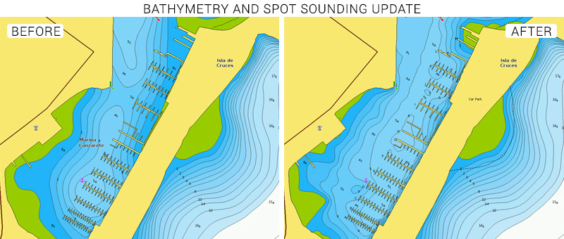
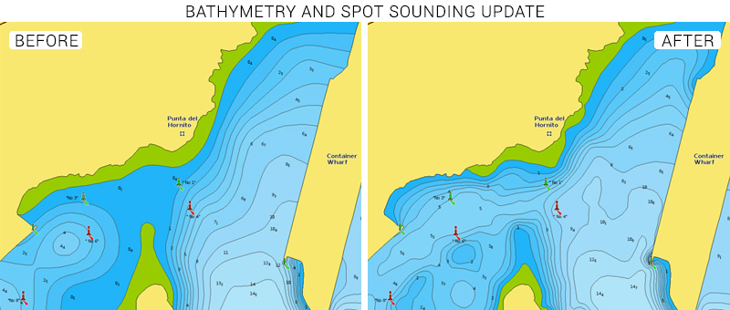
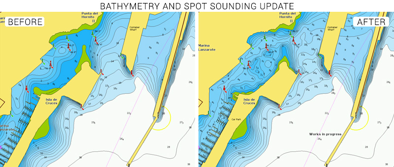
At Navionics we continuously enhance our products and technology to provide our customers with the best possible experience, the most complete details and the most relevant content. As part of our ongoing product enhancement, we recently updated the bathymetry data of the Lanzarote Marina in the Canary Islands.
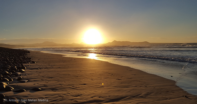
Lanzarote is the northernmost island in the Canaries and has 213 kilometers of coastline with incredibly beautiful sandy and rocky beaches. The island is often referred to as the “Island of Eternal Spring” due to its amazing climate with long hot summers and moderately warm winters that create a small paradise for boaters, sailors, anglers, kayakers and divers.
The volcanic island is a great place to relax. The tranquility and silence invite you to disconnect from your daily routine and recharge your batteries. Sailing or cruising around Lanzarote allows you to see some incredible scenery created by the astonishingly beautiful beaches and mountains. Out on the sea you’ll have good odds of encountering different species of whales and possibly to be escorted on your route by dolphins swimming alongside your boat.
Divers will enjoy the beauty of the underwater sea life, have the chance to swim with marine turtles and see a wide variety of marine flora and fauna.
If you’re an angler remember to request a fishing license. You’ll have a great variety of fish to try to target like swordfish, marlin, tuna, amberjack, wahoo, bonito, barracuda, sole, sea trout and more.
The Lanzarote Marina, located in the island capital city Arrecife, is one of the biggest and fully serviced marinas you’ll encounter in the Canaries. Located in the center of the island’s traditional maritime quarter with many bars and shops, it’s an attractive and peaceful area to stroll through.
In order to make access to the marina piers and facilities easier, especially for sailing boats, we’ve updated our charts with new bathymetry information and numerous spot soundings. Now when approaching the area, you’ll now have a better awareness of the sea bottom and the water depths as you set your route to approach and exit the port.
See the improvements now
Browse your areas of interest on our Chart Viewer, check out some examples below:
Learn more about chart updates and discover our latest changes
GET UPDATED CHARTS!
With an active subscription
- Have a plotter card? Plug your card into a PC and download. Or, if you also have our Boating app, do it wirelessly with Plotter Sync. Download
- Have the Boating app? Open the app and tap Menu > Update All.
With an expired subscription
- Have a plotter card? Choose one of the available options to easily renew. Renew
- Have the Boating app? Open the app, tap Menu > Charts & Upgrades.
IF YOU DON’T HAVE NAVIONICS YET
- Have a plotter? choose Navionics+ 5G551S2 or 43XG or Platinum+ 5P159XL or 31P+. Shop Now
- Have a mobile? Download the free Boating Marine & Lakes app that provides a trial! Discover


