Cartography Subscription Solutions for Navionics-compatible Chartplotter Brands

Cartography Subscription Solutions for Navionics-compatible Chartplotter Brands
| Navionics+ | Platinum+ | |
|---|---|---|
| Coastal Content | • | • |
| Inland Content | 44,000+ lakes |
44,000+ lakes |
| Detailed Nautical Charts | • | • |
| Daily Updates1 | • | • |
| Dock-to-dock Route Guidance 1,2 | • | • |
| Plotter Sync1 | • | • |
| Community Edits | • | • |
| Advanced Map Options1 | • | • |
| SonarChartTM Live Mapping3 | • | • |
| Relief Shading1 | Via Chart Installer | |
| Satellite Imagery1 | Via Chart Installer | |
| Aerial Photography | • | |
| 3D View | • |
| Coastal Content | |
| Navionics+ | • |
| Platinum+ | • |
| Inland Content | |
| Navionics+ | 44,000+ lakes |
| Platinum+ | 44,000+ lakes |
| Detailed Nautical Charts | |
| Navionics+ | • |
| Platinum+ | • |
| SonarChartTM HD Bathymetry | |
| Navionics+ | • |
| Platinum+ | • |
| Daily Updates1 | |
| Navionics+ | • |
| Platinum+ | • |
| Dock-to-dock Route Guidance1,2 | |
| Navionics+ | • |
| Platinum+ | • |
| Plotter Sync¹ | |
| Navionics+ | • |
| Platinum+ | • |
| Community Edits | |
| Navionics+ | • |
| Platinum+ | • |
| Advanced Map Options1 | |
| Navionics+ | • |
| Platinum+ | • |
| SonarChartTM Live Mapping3 | |
| Navionics+ | • |
| Platinum+ | • |
| Relief Shading1 | |
| Navionics+ | |
| Platinum+ | Via Chart Installer |
| Satellite Imagery | |
| Navionics+ | |
| Platinum+ | Via Chart Installer |
| Sonar Imagery1 | |
| Navionics+ | |
| Platinum+ | • |
| Aerial Photography | |
| Navionics+ | |
| Platinum+ | • |
| 3D View | |
| Navionics+ | |
| Platinum+ | • |
Coverage
Card type
We will take care of shipping it to the address you indicate.
 SD/MSD
This product is NOT compatible with GARMIN GPS chartplotters
| Navionics+ | Platinum+ | |
|---|---|---|
| Coastal Content | • | • |
| Inland Content | 44,000+ lakes |
44,000+ lakes |
| Detailed Nautical Charts | • | • |
| Daily Updates1 | • | • |
| Dock-to-dock Route Guidance 1,2 | • | • |
| Plotter Sync1 | • | • |
| Community Edits | • | • |
| Advanced Map Options1 | • | • |
| SonarChartTM Live Mapping3 | • | • |
| Relief Shading1 | Via Chart Installer | |
| Satellite Imagery1 | Via Chart Installer | |
| Aerial Photography | • | |
| 3D View | • |
| Coastal Content | |
| Navionics+ | • |
| Platinum+ | • |
| Inland Content | |
| Navionics+ | 44,000+ lakes |
| Platinum+ | 44,000+ lakes |
| Detailed Nautical Charts | |
| Navionics+ | • |
| Platinum+ | • |
| SonarChartTM HD Bathymetry | |
| Navionics+ | • |
| Platinum+ | • |
| Daily Updates1 | |
| Navionics+ | • |
| Platinum+ | • |
| Dock-to-dock Route Guidance1,2 | |
| Navionics+ | • |
| Platinum+ | • |
| Plotter Sync¹ | |
| Navionics+ | • |
| Platinum+ | • |
| Community Edits | |
| Navionics+ | • |
| Platinum+ | • |
| Advanced Map Options1 | |
| Navionics+ | • |
| Platinum+ | • |
| SonarChartTM Live Mapping3 | |
| Navionics+ | • |
| Platinum+ | • |
| Relief Shading1 | |
| Navionics+ | |
| Platinum+ | Via Chart Installer |
| Satellite Imagery | |
| Navionics+ | |
| Platinum+ | Via Chart Installer |
| Sonar Imagery1 | |
| Navionics+ | |
| Platinum+ | • |
| Aerial Photography | |
| Navionics+ | |
| Platinum+ | • |
| 3D View | |
| Navionics+ | |
| Platinum+ | • |
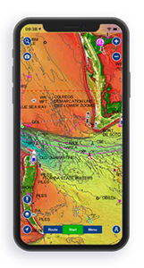
PLATINUM+ CARTOGRAPHY
Navionics Platinum+™ charts include all the content of Navionics®+ cartography, with integrated offshore and inland mapping, 44,000+ lakes and additional viewing options for relief shading, satellite imagery with SonarChart shading overlay, 3D perspective view, aerial photos and more.
______________________________________________________________________________________________________________________________________________________________ THE NAVIONICS SUBSCRIPTION A one-year subscription to Daily Updates and advanced features is included when you purchase any new Navionics Platinum+ mapping solution. The subscription needs to be activated. Subscription renewals cost up to 50% less than a new chart. CHARTS AND UPDATES ADVANCED FEATURES OVERLAYS PLATINUM+ ADDITIONAL VIEWING OPTIONS COVERAGE AREAS COMPATIBILITY
Nautical Chart – Comprehensive charts are derived from multiple official, government and private sources, displayed in a familiar look and feel
SonarChart HD Bathymetry – Innovative 1' (0.5 m) bathymetry charts are created by using Navionics proprietary systems that augment existing content with sonar data contributed by the boating community
Community Edits – Get useful local knowledge from edits made by users of the Navionics Boating app on your compatible smart device.
Daily Updates – Up to 5,000 daily updates to our charts give you the most accurate, most current Navionics data available.
Dock-to-dock Route Guidance – Start your trip with a suggested path.
SonarChart Live Mapping Feature – Watch new HD depth maps develop in real time as your boat moves through the water.
Advanced Map Options – Customize your view to focus on the details that matter most
Plotter Sync – Transfer routes and markers, update chart layers and more — between your compatible chartplotter and the Navionics Boating app.
Relief Shading – Get an easy-to-interpret, clearer view of bottom structure. Check coverage.
Satellite Imagery – A top-down view of inland and coastal areas. Check coverage.
3D View – Adjust the perspective of your chart view to highlight key features and enhance awareness
Aerial Photos – Get a better sense of your surroundings.
Worldwide map coverage is available, with integrated content making it easier to select the navigation features and map regions you want. Choose from large coverage areas (Large) to more localized chart cuts (Regular).
Check compatibility of Platinum+ content and features with your GPS chartplotter.