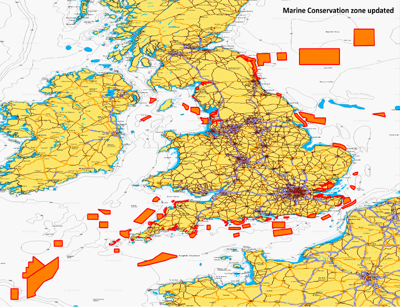
Do you care about the environment? We do, too. And we are in a unique position to share information that helps protect the waters you enjoy. You can now find 96 Marine Conservation Zones (MCZ) clearly marked in the waters surrounding the U.K., alerting you to sensitive natural areas and any related boating restrictions.
What are MCZs and why they are important?
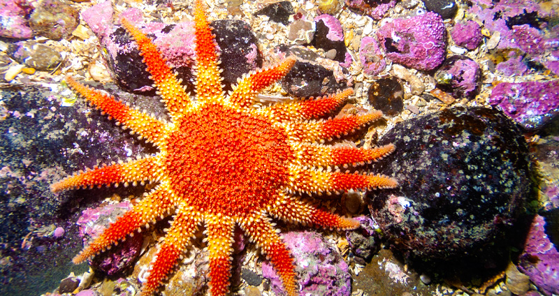
A Marine Conservation Zone is an official area where certain activities are restricted so that seascapes, natural habitats and threatened plants and animal species can recover, survive and thrive. These protected areas are created to give a break to the marine environment, allowing plants to grow back, reefs to restore themselves and marine animals, such as seahorses, to breed and maintain healthy populations.
Marine protection doesn’t just help the environment. The oceans essentially function as one of the Earth’s lungs. The phytoplankton that lives in them create half the oxygen for the planet. Plus, by absorbing carbon dioxide, they help reduce climate change. When marine areas are left alone, they will produce more fish, so that anglers still have a reason to cast their lines and divers can enjoy a diverse and lively marine habitat. For example, the Southbourne Rough MCZ is ecologically important for the nesting of black seabream, since this species tend to return to the same nesting site every year.
What activity can I do in MCZs?
Each MCZ or marine protected area has its own rules and regulations, and the range of activities allowed vary from area to area. In some cases, you might be allowed to fish with a permit, while in others it will be absolutely forbidden. Before venturing into a protected area, be sure to look up all the necessary information from the local authorities.
Where are the new MCZs located?
The network of MCZ surrounding the U.K. is wide and vast. Most of the protected areas are in the English Channel, the Bristol Channel and out by Great Sole Bank. Many are relatively close to the coast, while some large areas off the east coast out into the North Sea are also protected.
How are MPAs shown on my maps?
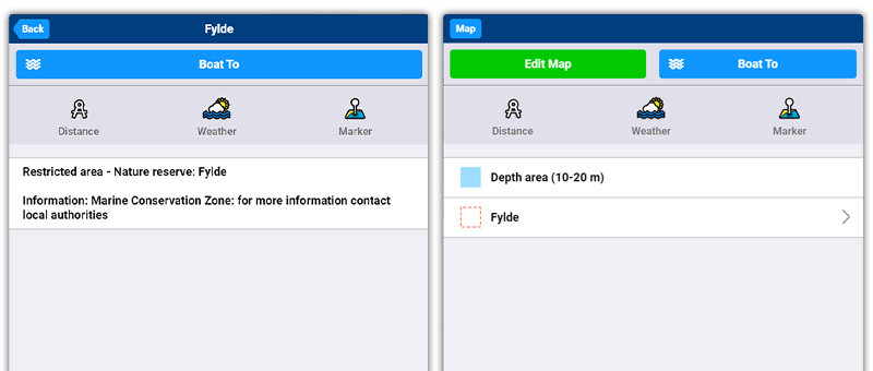
If it is true that a picture is worth a thousand words, here’s an example of the Fylde MPA near Blackpool:
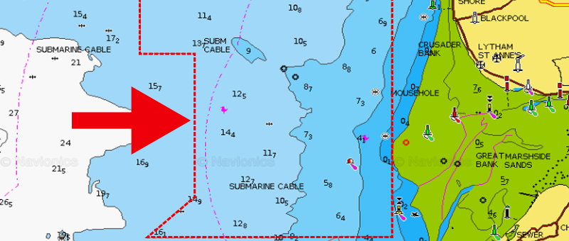
As you can see, red lines delimit the protected area. These symbols are used to show many different restricted areas. To learn the nature of the area, you will need to investigate the chart details, as you can see in the images below (Learn how).
GET UPDATED CHARTS!
With an active subscription
- Have a plotter card? Plug your card into a PC and download. using our Chart Installer. Or, if you also have our Boating app, do it wirelessly with Plotter Sync. Download
- Have the Boating app? Open the app and tap Menu > Update All.
With an expired subscription
- Have a plotter card? Choose one of the available options to easily renew. Renew
- Have the Boating app? Open the app, tap Menu > Charts & Upgrades.
IF YOU DON’T HAVE NAVIONICS YET
- Have a plotter? choose Navionics+ Small or Large. Or Platinum+ Small or Large. Shop Now
- Have a mobile? Download the free Boating Marine & Lakes app that provides a trial! Discover