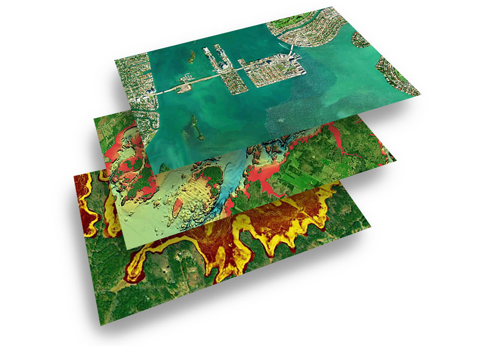
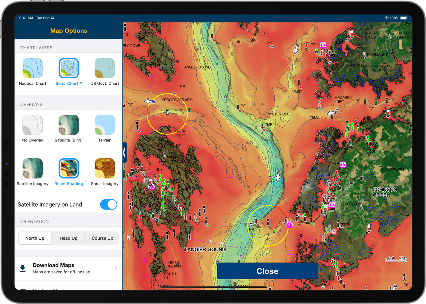
Marine charts are an essential tool for any on-the-water activity, but did you know there are more types of mapping presentations that add interesting information and context for your adventure? The Navionics Boating app provides you with additional content to use along with charts. In the app, you can superimpose five different overlays on your charts: relief shading, satellite imagery, sonar imagery (only on select lakes in the U.S.), satellite imagery by Bing and terrain maps. The latest app release (v.19.0) offers improved relief shading detail and extended coverage by 120%, including many new coastal and inland waters and more than 40,000 additional lakes.
These additional overlays can help you better understand your surroundings — below and above the water. Let’s discover how.
Get Your Bearings
While out on the water, it is always good to know what surrounds you. Sometimes it can be tricky to get your bearings, especially if you are a new boater or in an unfamiliar area. The terrain and satellite imagery overlays can help you recognize landmarks such as water or bell towers, seawalls, lighthouses, bridges, buildings and more. Also, if you need to launch your kayak or canoe, you can look for a route to beaches or ramps and find a place to take a break from paddling.
Find Anchoring Spots
Finding the perfect anchoring spot is one of the great satisfactions of a boating day, whether you plan to fish, swim, or simply relax and enjoy the carefree day. Overlaying relief shading on your charts can help you spot the right places to anchor. At a glance, you can see the bottom structure and identify holes and other places you might want to drop your anchor. Also, the vibrant colors can quickly inform you about the depth.
Avoid Shallow Waters
Shallow waters can be tricky and dangerous. Luckily the SonarChart™ bathymetry maps are a great tool to identify them, and you can even highlight them using the dedicated map option setting; but overlay relief shading offers even more information. You will be able to quickly identify the shallow waters through the color palette. If you need to get more information, you can switch to satellite imagery or satellite (Bing). With these overlays, you could be able to spot things that might not be visible on charts such as shallow reefs, shoals or channels in marshy areas. Do you need to extend the satellite images on more water? All it takes is the adjustment of your map options. Learn how in our support article.
Locate Diving Spots
Preparation is essential for diving, and familiarizing yourself with the area you’re going to explore is always a great advantage. Relief shading, with high detail and a clear representation of the bottom, can help make it easier to identify underwater cliffs, wrecks, submerged channels and other interesting areas. Start here to find your next great diving destination — from wherever you are.
Target Fishing Areas
Anglers can optimize their fishing time with the overlays. Relief shading helps make it easier to interpret the bottom structure. As soon as you look at the map, you will start to identify drop-offs, submerged channels and other features that make great fishing spots.
With satellite imagery over water, you can check for marsh areas or shallow water, and where the water is super clear, you can look for sandbars, shoals and other information.
If that is not enough, more than 150 U.S. lakes also contain a feature called sonar imagery, which can display the bottom hardness, highlighting subtle and dramatic transition areas. You can quickly understand the bottom composition (rocky, sandy, vegetation, roadbeds, etc.) and determine your fishing strategies.
With all these tools at hand, the fish will have no place to hide.
Consider Wind Effects
Love to sail? If you have been sailing for a while, you know that the coast conformation can affect winds and their direction. To know beforehand what situation you might find, especially if you are not familiar with the area where you’re going to sail, just use the terrain overlay — it will show bathymetry on land. A plain coast or high cliff can make a substantial difference on the winds (or the lack of) that can influence your sailing. Also check wind direction and intensity overlayed on the charts with the weather feature. An informed decision to take a route right along the coast or to maintain some distance can make your sailing more effective.
Haven’t tried the Navionics Boating app yet? No time like the present. Download the app and try it for free for a limited time.