Driven by a passionate commitment to support our customer experience on the water, Navionics continues to enrich its chart coverage to include popular boating and fishing areas around the globe.
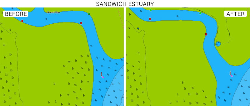
Our charts cover the shallow and very changeable waters of Kent’s River Stour at Sandwich and Pegwell Bay. We have recently updated new depth contours, obstructions and navigational aids marking the channel entrance to the river.
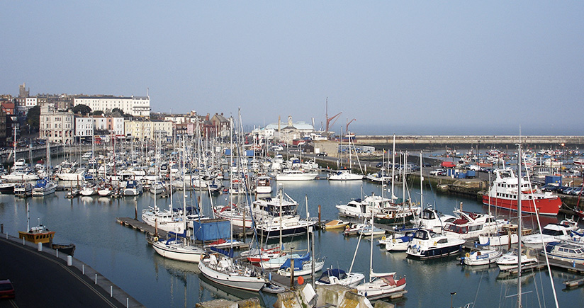
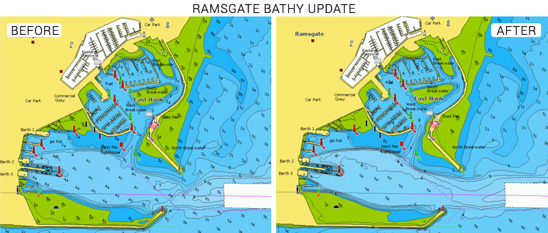
Furthermore, recent updates have been made to the Port of Ramsgate thanks to new data received from the Sandwich Harbour Master. This seaside town is well known for its large harbour and excellent marina facilities.
The Kent coastline and rivers offer some of the finest fishing areas for both sea and freshwater. Fish that are common to this coastline include flounder, bass, silver eel, codling, dab, grey mullet and plaice. The area includes a nature reserve with tidal flats and salt marshes. Many anglers that fish there choose to surf-cast from shore.
The currents are strong in this region which has an ever-changing effect on the nature of the seabed. This is why it’s important to keep your charts accurate and up to date. As a Navionics user, you are able to clearly identify depth contours, submerged structures and even wrecks. Whether you are sailing, motorboating, fishing or kayaking, updated charts are important to your experience.
See the improvements now - browse your areas of interest on our Chart Viewer, check out some examples below:
Learn more about chart updates and discover our latest changes
GET UPDATED CHARTS!
With an active subscription
- Have a plotter card? Plug your card into a PC and download. Or, if you also have our Boating app, do it wirelessly with Plotter Sync. Download
- Have the Boating app? Open the app and tap Menu > Update All.
With an expired subscription
- Have a plotter card? Choose one of the available options to easily renew. Renew
- Have the Boating app? Open the app, tap Menu > Charts & Upgrades.
IF YOU DON’T HAVE NAVIONICS YET
- Have a plotter? choose Navionics+ Small or Large. Shop Now
- Have a mobile? Download the free Boating Marine & Lakes app that provides a trial! Discover