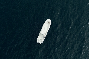
The Boating app offers a wide range of solutions for all anglers, including saltwater and freshwater enthusiasts, people fishing from a boat, the ones casting from shore, the rookies and the pros. So, let’s pack our tackle, take out our rods and discover the Boating app’s best tools for fishing.
SonarChart™ - Master the water depths
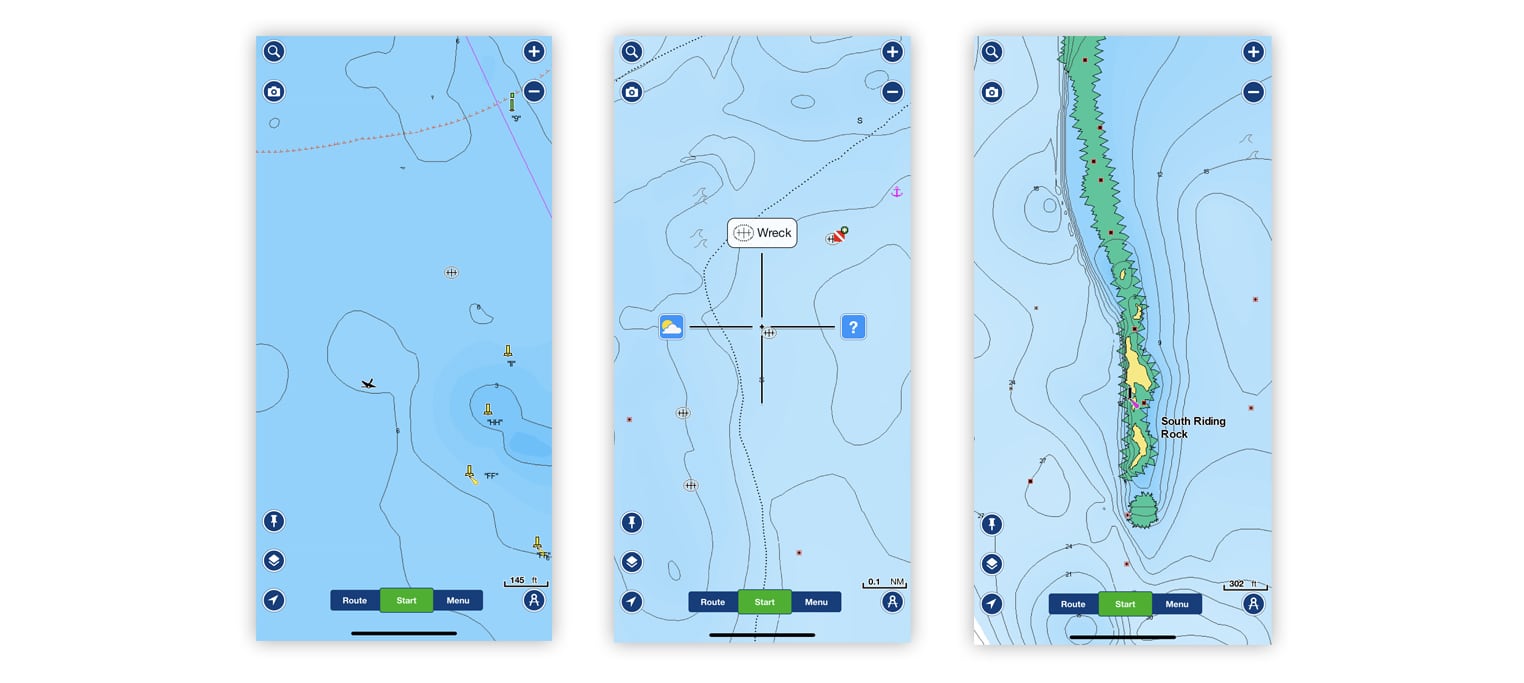
Being in the right place at the right time is part of what makes a fishing expedition successful. To gain a better understanding of water depths and sea, river and lake bottom structure, refer to the SonarChart map layer. The 1 ft/0.5 m HD bathymetry map will help you locate the very best fishing spots. By looking carefully at the map, you will be able to identify drop-offs, holes, ledges and underwater rivers where fish are likely to be. We can’t make them bite for you, but we can lead you to the right places.
How to: activate the layer by tapping on the Map Options button on the lower left corner, then select SonarChart.
Overlays – Find the best fishing spots at a glance.
The app provides some additional content to use along with charts, superimpose the overlays to know more about what’s below the water.
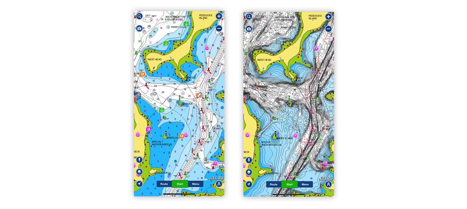
- Relief Shading: this overlay helps make it easier to interpret the bottom structure. As soon as you look at the map, you will start to identify drop-offs, submerged channels, and other features that make great fishing spots.
- Satellite Imagery: Locate underwater grass, mangrove trees, potholes in sea grass flats, oyster bars and other places where your prey is hiding by checking the satellite images.
- Sonar Imagery (only selected US lakes): reveals bottom hardness clearly and in vivid color, highlighting both subtle and dramatic transition areas. You can use the overlay as a reference to better understand the structural characteristics and bottom composition (rocky, sandy, vegetation, roadbeds, etc.) so you can choose the best fishing strategies.
SonarChart Live – Create your own bathymetric map
Do you want to increase your awareness of the bottom situation in real time? Do you need bathymetric information in areas not yet mapped? You can use SonarChart Live. Watch new 1 ft/0.5 m HD bathymetry maps develop in real time as your boat moves along the water! It appears as an additional layer over your map while it also gets stored on your device for future use. Mobile devices can generate SonarChart Live if connected via Wi-Fi to a compatible plotter or sonar.
How to: go to Menu > Paired Device and follow the instruction.
Map Options – Catch more with customized maps
Sometimes the standard chart view may not be enough, and you want to accentuate details that will help you to make the big catch you’ve always dreamt about. You can customize the map display in the Map Options section. Here are the best options:
- Fishing Ranges: See the best places to cast your line at a glance by color coding up to 5 different depth ranges. Designed especially for anglers.
- SonarChart Density: Customize the amount of contour detail you want to see in the SonarChart layer when the contours are too dense and you need a clearer view.
How to: tap on the Map Options button on the lower left corner and then start customizing. If you want to bring back the maps to the default view, press the Reset default values button at the bottom of menu.
Weather & Tides – Winds, currents, tides detailed info and more
Fish movement patterns are often influenced by weather, water levels and other climatic factors, so knowledge of winds, tides and currents plays a major factor in your ability to catch something. With the Boating app, you have access to a 7-day weather forecast and hourly conditions within the coverage area you own. A special section dedicated to winds, tides and currents lets you check actual tidal and current flow graphs.
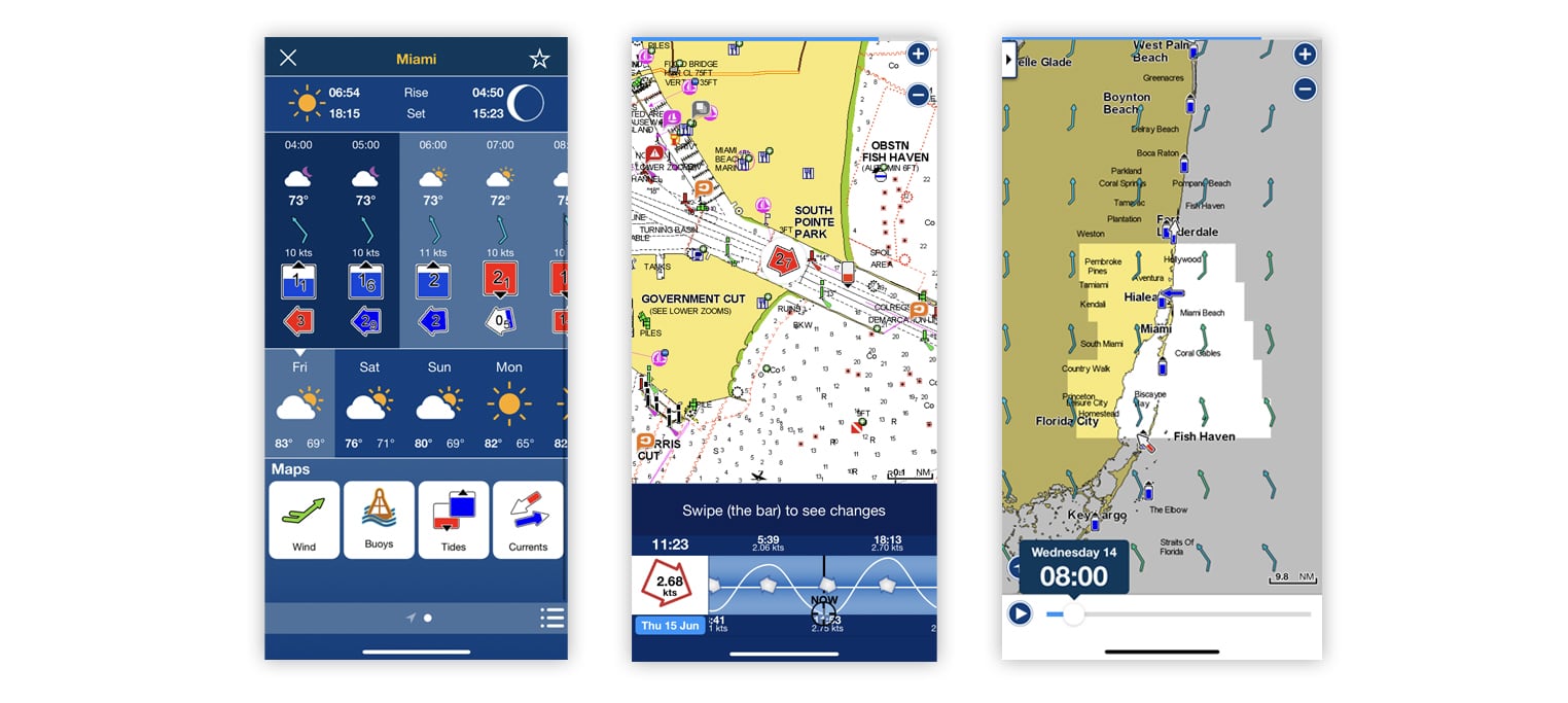
How to: tap on the map to activate the crosshair, then select the weather icon. Swipe left to check the daily and hourly weather. Tap on the wind, buoy, tides or currents buttons to show details for each category.
Auto Guidance+TM- plan with a suggested dock-to-dock path
Creating a manual route from one point to another can take quite some time, especially if you need to go through narrow passages or channels. With Auto Guidance+1, you can start heading to your next fishing destination in no time. All you need to do is to enter start and end points, and the app will automatically create a suggested route based on chart data, navigation aids and your boat settings.
How to: on the map, tap the Route button, then select Automatic. Now just add start and end points and the app will create a suggested route. Remember to set your boat parameters (Menu > Name > Boat), so if the route passes through areas where waters are too shallow for your boat, a red leg will appear. If you want to edit the route, just add some waypoints.
Update Maps – A world of reasons to update your charts
Cartographic details of the world’s oceans, seas, rivers and lakes need to be updated frequently because of both natural and artificial influences. We release more then 5,000 updates every day so you can always be on top of the changes and keep an edge over other anglers. See where changes have been made on our Heatmap, or view the latest content on our Chart Viewer.
How to: with an active subscription, press Menu > Update All. With an expired subscription, go to Menu > Name > Subscription to renew.
Want to stay updated on product improvements, get tips related to your interests, and more? Create an account.