
Harness the power of modern technology to help all boaters!
Turn every minute you spend on the water into an opportunity to enhance the detail of marine and inland charts for your GPS plotter, including unmapped areas and those subject to frequent changes.
Generate new depth contours of your local area!
Create 1 ft/0.5 m HD maps in real time with SonarChart™ Live using our Navionics Boating app. The sonar logs you collect will be shared with Navionics and integrated with existing chart data to produce a more detailed, accurate, and up-to-date SonarChart™ for your GPS plotter!
Here’s how:
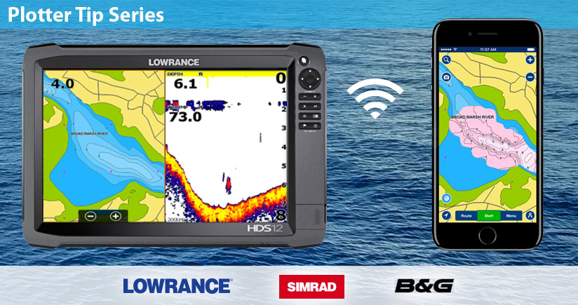
Connect your GPS plotter with your mobile device via Wi-Fi. While you navigate, SonarChart™ Live will begin displaying new contours within the Boating app. Select the higher value for Depth Shading (Menu>Map Options), to make sure you can see the maps you create. The SonarChart™ Live map is stored for your continued private use.
When you connect your mobile device to the internet again, your sonar logs can be automatically uploaded to Navionics. You will be able to check the processing status of your logs in your Account dashboard on the Navionics website, and view them on the map. The new SonarChart™ will be available after about one week for the whole community.
Update your Navionics card to see the new, unprecedented contour detail of SonarChart™ on your GPS plotter.
SonarChart™ Live is an embedded, free feature of the Navionics Boating app, available for Apple and Android devices.


