
Driven by a passionate commitment to support our customers’ enjoyment on the water, Navionics continues enriching its chart coverage to include popular boating and fishing areas around the world.
Much attention has been given to the Swedish lake system in the past years, and Navionics now provides more than 3,400 lakes throughout the country.
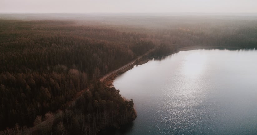
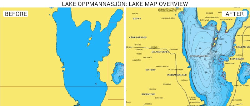
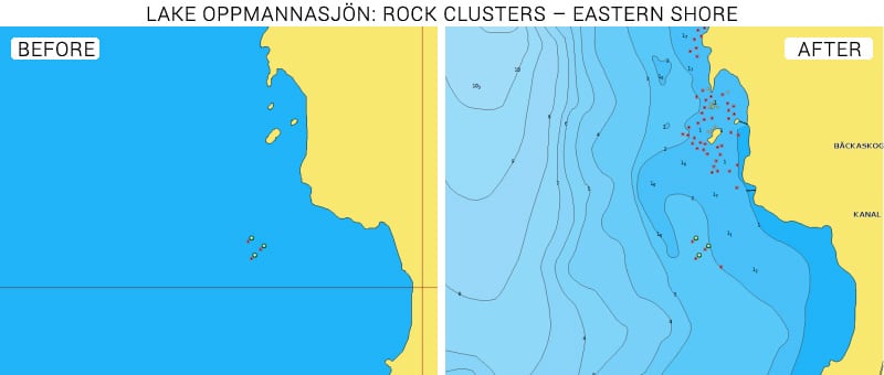
In the southernmost county of Skåne, we have been able to source detailed data for Oppmannasjön Lake. Previously, the map only offered a basic coastline of the lake, and now useful information such as depth contours and areas, spot soundings, rocks and geographic names are available.
Fishing has been practiced in this area for centuries by the Swedish monarch and clergy. This lake, along with others in the area, including the neighboring Ivösjön Lake, are known for pike, zander and perch. The new data used together with other Navionics fishing-oriented features such as SonarChart Live and Fishing Ranges on the Boating App will certainly represent an advantage for anglers.
See the improvements now
Browse your areas of interest on our Chart Viewer, check out some examples below and judge for yourself:

Learn more about chart updates and discover our latest changes
GET UPDATED CHARTS!
With an active subscription:
- Have a plotter card? Plug your card into a PC and download. Or, if you also have our Boating app, do it wirelessly with Plotter Sync. Download
- Have the Boating app? Open the app and tap Menu > Update All
With an expired subscription:
- Have a plotter card? Choose one of the available options to easily renew. Renew
- Have the Boating app? Open the app, tap Menu > Charts & Upgrades
IF YOU DON’T HAVE NAVIONICS YET
- Have a plotter? Choose Navionics+ 44XG, 45XG or Platinum+ 13P+,17P+,15P+ Shop Now
- Have a mobile? Download the free Boating Marine & Lakes app that provides a trial! Discover


