
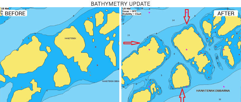
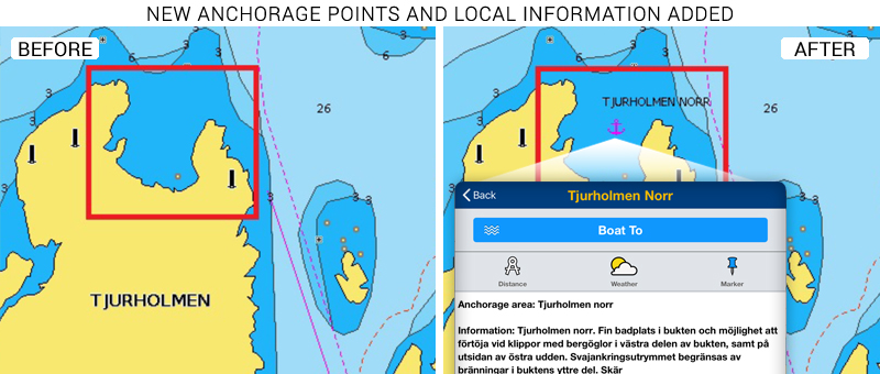
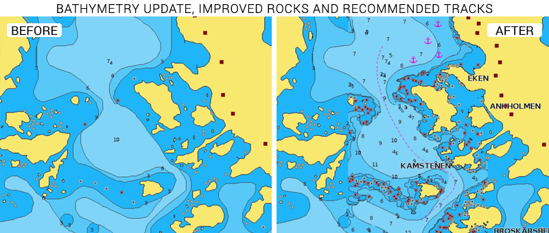
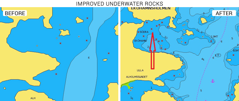
At Navionics, we continuously enhance our products and technology to provide our customers with the best possible experience, the most complete details, and relevant content. As part of our ongoing product enhancement, we recently updated our charts in Sweden adding new cartographic data released by Hydrographica. Whether you are navigating in the coastal waters of Kalmar, Östergötland, Södermanland or in the Stockholm Archipelago, you will get the latest details just published. Updated content includes, but is not limited to, anchorage points, underwater rocks, bathymetry, submarine cables and wrecks.
After the integration of Hydrographica's Hamnguiden 8 in 2017, our most recent update to Sweden charts include data from the recently published Hamnguiden 7 with about 300 harbour chartlets from Landsort to Påskallavik - for more information, services, safety and fun!
See the improvements now
Browse your areas of interest on our Chart Viewer and check out some examples here below and judge for yourself:
Learn more about chart updates and discover our latest changes!
GET UPDATED CHARTS!
With an active subscription
- Have a plotter card? Plug your card into a PC and download. Or, if you also have our Boating app, do it wirelessly with Plotter Sync. Download
- Have the Boating app? Open the app and tap Menu > Update All.
With an expired subscription
- Have a plotter card? Choose one of the available options to easily renew. Renew
- Have the Boating app? Open the app, tap Menu > Charts & Upgrades.
IF YOU DON’T HAVE NAVIONICS YET
- Have a plotter? Choose Navionics+ 44XG, 45XG, 5G602S2, 5G601S2 , or Platinum+ 13P+ 17P+, 5P400XL Shop Now
- Have a mobile? Download the free Boating Marine & Lakes app that provides a 2-week free trial or the paid apps for Europe! Shop Now


