
Owners of compatible Alphatron, MPS, Polar, Si-Tex, Seiwa, Lorenz and JMC plotters now have new features available to make their boating and fishing time more enjoyable. With a simple software update from your plotter manufacturer, you can access Fishing Ranges and Plotter Sync on Navionics+ and Platinum+ charts.
Plan on Mobile, Go on Plotter
Pair your compatible GPS plotter with the Boating app using Plotter Sync and save time. Easily plan your next trip at home with the app. Then, when at your boat simply transfer routes and markers to your plotter. You’ll quickly be ready to leave the dock to enjoy your day out. Also, use it to activate your Navionics+ or Platinum+ card, easily handle your yearly subscription and seamlessly update your maps with up to 5,000 daily updates for peace of mind when you’re on the water.
Locate the Best Fishing Spots at a Glance
Your fishing trips will no longer be the same with Fishing Ranges - a feature designed specifically for anglers. Customize and display up to 5 depth ranges simultaneously on the SonarChart™ layer to have a clear view of bottom depths and choose your fishing area depending on the fish you want to catch. Move quickly on the water, finding holes, submerged islands, steep ledges, and drop-offs at a glance. Cast your line where it matters and be ready to hook and reel in your prey.
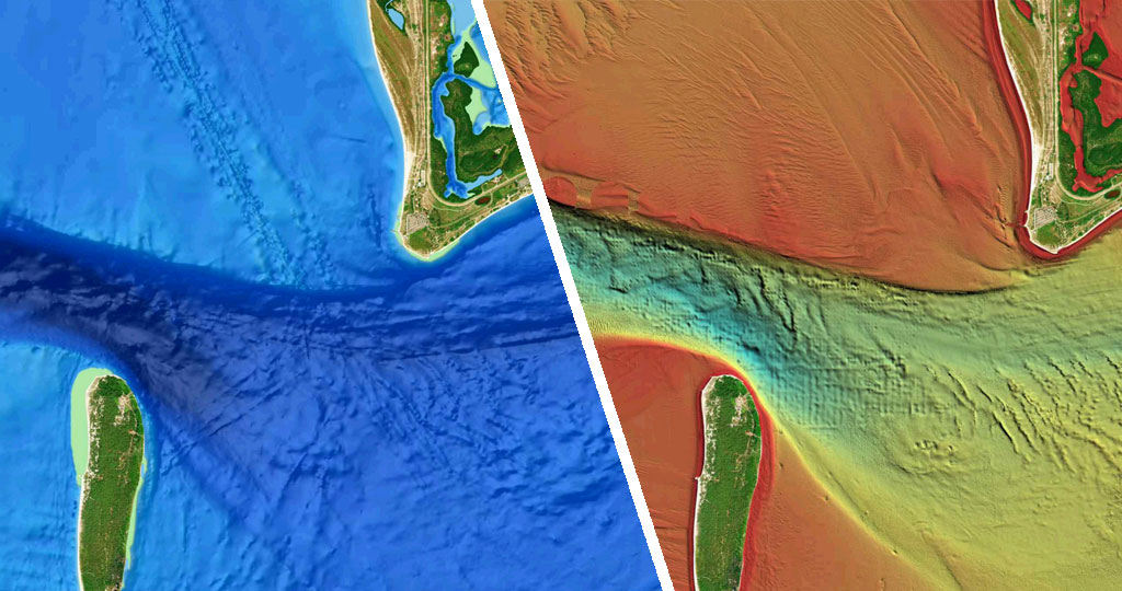
If you want to always be at the top of your fishing game remember you can use the SonarChart Shading and relief shading overlays present in the Platinum+ cards. Get a unique perspective of underwater topography with an easy-to-interpret, clearer view of bottom structure than contour lines alone. Clearly see channels, drop-offs and other structures over a wide area. Search the map for visual cues to identify fish-holding structure on inland lakes and coastal fisheries.


